Curated OER
The Election of 1840
Entertaining political cartoons, campaign songs, and slogans are sprinkled throughout this presentation, which details the Presidential Election of 1840. Teachers can bring their own discussion topics to the slideshow with references to...
Curated OER
The Persian Wars: Greece's Finest Hours
Maps and photographs help contextualize the Persian Wars in this straightforward presentation. These slides detail the motives and major events of the war between Persia and Greece, making it ideal for a lecture on ancient Greek politics...
Curated OER
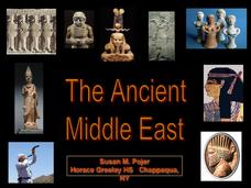
The Ancient Middle East
Good for a quick look at the Roman and Byzantine Empires, this presentation would serve as a strong supplement to a lesson on the politics and culture of ancient Middle Eastern territories. Enjoy the photographs of the Hagia Sophia, as...
Constitutional Rights Foundation
Refugees From Vietnam and Cambodia
The United States may have pulled its troops from the Vietnam War in 1973, but the conflict was far from over for the citizens living in Asia at the time. An informative resource lets learners know about the wave of over 220,000...
Constitutional Rights Foundation
Refugees from the Caribbean: Cuban and Haitian “Boat People”
Should refugees fleeing poverty be allowed the same entrance into the United States as those fleeing persecution? High schoolers read about US foreign policy in the late 20th century regarding refugees from Cuba and Haiti, and engage in...
Curated OER
Any Town, USA
Students launch an investigation of their home town by creating a mental map and examining the livability factors from their perspective. After completing their map, students write a brief description of their town
Curated OER
Population Diversity in Southeast Asia
Students explore diversity in ethnic, lingual, religious, and political systems of the people of Southeast Asia. The activity's focus is designed to foster an understanding of the complexity of the region.
Curated OER
Social Studies: African Folklore and Geography
Students discover the connection between geography and folklore in several African nations. In groups, they record information from maps of their assigned countries. Students observe the pictures in books and match the geographic...
Curated OER
Campaign 2004: Classroom Electorate
Learners role play as political analysts first forecasting the electoral college vote in a presidential election and then, following the results of the actual count. They study the role of swing states, and why political participation is...
Curated OER
Help! I Am Lost at Fox Chapel
Sixth graders create a map to locate places on campus and share the map with another student. The other students use the map to locate certain places and validate for accuracy via a checklist. The parents use the completed map at open...
Curated OER
Lincoln Home National Historic Site
Students investigate the community in which Lincoln and his family lived and explore how the citizens felt about him. The national issues that inspired Lincoln to act decisively in politics and that propelled him to the White House are...
Curated OER
United Kingdom
Students investigate the geographical features of the United Kingdom. They create a clay, playdoh, or salt and flour map of the region. The maps should be labeled with landmarks and bodies of water. They can also draw maps on paper for...
Curated OER
Harry S Truman National Historic Site
Students examine the early years of Harry Truman to determine how his upbringing influenced his character. His political career from county judge to president is explored and some of the decisions made as a politician, evaluated.
Curated OER
China - the Geography of European Imperialism - Spheres of Influence in China
Ninth graders create a map of China. They identify the various spheres of influence carved out by the Imperialist powers of Europe as well as locating geographical features of china and major cities. They explain the global impact of...
Curated OER
U.S. And Global Deforestation
Students analyze graph showing global deforestation, view photograph of deforestation in Brazil's interior rain forest and examine three maps showing deforestation within the United States, describe political, economic, and social...
Curated OER
The Battle Over Reconstruction: The Aftermath of War
Students explore public sentiment regarding Reconstruction. In this Reconstruction lesson, students analyze primary sources for evidence of the political, social and economic stability of the U.S. following the Civil War. Students...
Curated OER
Colonial America and Roots of Government
Students identify 50 States and the major geographic features, regions, and political representation of each. In connection, they investigate the causes and effects of European colonization on North America. They identify the formation...
Curated OER
GEOGRAPHY: SPACE CENTERS
Young scholars examine the descriptive science dealing with the surface of Earth, its division into continents and countries, climate, natural resources, inhabitants and industries of the various divisions and analyze the political...
Curated OER
Book: Spain
Students, after reading Chapter One in the book, "Spain," design and re-create the political boundaries as well as the physical features of nation of Spain. They utilize play-doh or salt dough to illustrate and create their three...
Curated OER
The First North Americans
Students identify and interpret the different North American Indian groups, by region, and the type and impact of their interaction with Europeans.
Then they complete an overview of one main Native American group during the age of...
Curated OER
Global Intelligence
Students discuss the war in Afghanistan and the conditions surrounding the hunt for Osama bin Laden after reading the article "Bin Laden and Omar: Far Harder to Find" from The New York Times. After the class discussion, students...
Curated OER
Geography And The Revolutionary War
Students gain a deeper understanding of both geography and the Revolutionary War. They practice using on line research in examining historical events and using political, physical, and topographic maps.
Curated OER
Countries of South America
Students focus on the geography of the countries of South America. Using a map, they identify the European countries who claimed the South American countries and research the influences they had on South America. To end the lesson,...
Curated OER
The Path of the Black Death
Students are able to show on a map how the Black Death moved through Europe. They summarize the direct effects of the Black Death in Europe. Students cite evidence from firsthand accounts in developing an argument that connections can,...
Other popular searches
- Wwi Political Map
- Maps of Europe Political
- Physical and Political Maps
- Canada Political Map
- Americas Political Map
- Blank Political Maps
- Political Map of Africa
- United Kingdom Political Map
- Europe Political Map
- Physical & Political Maps
- Mexico Political Map
- State Political Maps


