Curated OER
Central American Map
In this Central American political map worksheet, students examine the boundaries of this region of the world. The map may be used in a variety of classroom activities.
Curated OER
Central America: Unlabeled Map
In this Central American political map learning exercise, students examine the boundaries of the countries and capital cities located in this region of the world.
Curated OER
Central America Map
In this Central American political map worksheet, students make note of national boundaries and capitals in this region of the world.
Curated OER
States: United States Map
In this United States political map worksheet, students examine state boundaries. The map is labeled with the names of each of the 50 states.
Curated OER
United States Map
In this United States political map worksheet, students examine national and state boundaries. The map also highlights the location of each of the state capitals and the national capital.
Curated OER
USA Capitals Map
In this United States political map worksheet, students examine state boundaries and locations of each of the state capitals.
Curated OER
South America Map
In this South American political map worksheet, students examine both national boundaries and national capitals.
Beverly Hills High School
Mapping Napoleon's Empire at Its Height (1812)
The complicated political history of Europe becomes apparent as young historians create a map of the borders of France when Napoleon's Empire was a its height in 1812.
Curated OER
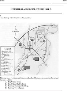
Fourth Grade Social Studies
For this social studies worksheet, 4th graders answer multiple choice questions on state maps, city maps, road maps, political maps, and more. Students complete 25 multiple choice questions.
Curated OER
Politics and Religion in 17th Century Dutch Art
Seventh graders examine different pieces of Dutch Art. They identify its social and political meanings by using cultural and historical information. They examine maps of the time period as well.
Curated OER
Using Different Kinds of Maps
Third graders explore the landforms and population diversity. They read maps and examine geographic terms. Students create their own map of the United States and answer questions about the location of people. After exploring the map, 3rd...
Eastconn
Learning to Analyze Political Cartoons with Lincoln as a Case Study
Discover the five main elements political cartoonists use—symbolism, captioning and labels, analogy, irony, and exaggeration—to convey their point of view.
Curated OER
What Do Maps Show?: Lesson 1 Introduction to Maps
Young scholars brainstorm a list of the different types of maps they have seen or used. Using the activity sheet, they look through a social studies book to find all the maps and to determine what they are used for. Using a poster, they...
Curated OER
Geographic Regions and Backyard Geology with the USGS Tapestry Map
A beautiful tapestry map of North America is examined by geology masters. The map incorporates the topography and geology of different regions. You can purchase printed copies or a large poster of the map, or if you have a computer lab...
Curated OER
Maps and the Pictures in Our Heads
Geographers of all ages examine different types of maps. They draw maps of their environment, utilizing both three-dimensional and picture maps. They interpret map information, noting how it can sometimes be misleading. Some good...
Curated OER
California Map
In this California blank outline map worksheet, students examine the political boundaries of the state and then mark the state capital, other cities, and other state attractions on the map.
Curated OER
Tennessee Map
In this Tennessee outline map, students examine the political boundaries of the state. Students mark the state capital, major cities, and other state attractions.
Curated OER
Canada: Outline Map
In this Canadian political map activity, students examine Canada's province boundaries. The map also highlights each of the province's capitals with a star.
Curated OER
Blank Europe Map
Simple blank map, limitless possibilities! Here is a single-page resource of a blank map of Europe, without any country boundaries or text.
Curated OER
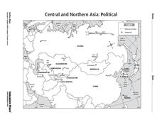
Central and Northern Asia: Political
In this Central and Northern Asia map worksheet, students examine national political boundaries and national capitals in this region of the world. The map is labeled.
Curated OER
Central and Northern Asia: Political
For this Central and Northern Asia outline map, students examine the political boundaries of the nations in this region and note the location of their capital cities. This unlabeled map may be used in a variety of classroom activities.
Curated OER
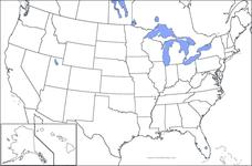
United States Map
In this United States outline map worksheet, students make note of the political divisions of 50 states of the nation. This map may be used in a variety of classroom activities.
Curated OER
United States Map: Capitals
In this United States outline map instructional activity, students make note of the political divisions of 50 states of the nation. This map is labeled with the 50 state capitals.
Curated OER
Australia Map: Labeled
In this Australia outline map worksheet, students make note of the political divisions of the 5 provinces and territories of the nation. This map is labeled.
Other popular searches
- Wwi Political Map
- Maps of Europe Political
- Physical and Political Maps
- Canada Political Map
- Americas Political Map
- Blank Political Maps
- Political Map of Africa
- United Kingdom Political Map
- Europe Political Map
- Physical & Political Maps
- Mexico Political Map
- State Political Maps


