Curated OER
Stepping Inside the Flowchart: How Does a Bill Become a Law?
Students explore the steps a bill must pass through to become a law and create a flow chart that maps the complexities of the process. They research the committees that are involved in a bill that relates to energy policy and the...
Curated OER
Trade in the Silk Road Cities
Pupils use Google Earth to map cities along the Silk Road trade route. In this Silk Road trading lesson, students complete a worksheet examining production, transportation, and value of goods and research trade items. Pupils create a...
Curated OER
"Ancora Imparo" (Still I Am Learning)
Students study the Italian Renaissance, its impact, and origin. In this Italian Renaissance lesson, students study the Renaissance via the ancient civilizations and political geography of various countries. Students study the art prior...
Curated OER
America's Wars
Students classify information regarding American involvement in wars. In this classification lesson, students examine the causes of the war in which the United States has been involved, and classify them as mainly political, social,...
Howard Hughes Medical Institute
BiomeViewer
Which holds more influence, the environment over humans or humans over the environment? Young scientists explore an online interactive that addresses this discussion. They observe changes in the natural world over time and see which...
New York State Education Department
Global History and Geography Examination: August 2012
Let's test global history knowledge. The standardized test, designed for high schooler scholars, assesses world history and geography. The assessment is divided into five different sections, including essay items and multiple choice. It...
Curated OER
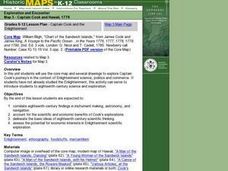
Captain Cook and the Enlightenment
Students use a core map and several drawings to explore Captain Cook's journey's in the context of Enlightenment science, politics and commerce. They are introduced to eighteenth-century science and exploration.
Curated OER
African Art is Alive: Drum, Dance, Storytelling....
Pupils investigate and experience African culture through various art forms. Students explore the physical and political geographies of Africa through mapping activities. Pupils, in groups, prepare presentations about different aspects...
Curated OER
The Russian Revolution
Students complete a matching game based on geographic features of Russia and label a map with these features. In this geography and politics lesson, students identify resources and populations in Russia and complete a T-Chart on a video...
Curated OER
Some Like It Cold
Sixth graders study Canada's northern territories and four settlements above the Arctic Circle. In this northern Canada lesson, 6th graders maps and timelines to locate physical, political, and economic features of northern Canada....
Curated OER
Geography Grid
Fourth graders search a database to find images and scan and affix them on an 8-foot long map of the state of Illinois. They then use it as a basis for discussion.
Curated OER
Latin America: Places and Regions
Seventh graders create a Latin American portfolio in the form of a country presentation using PowerPoint software. They use their knowledge of geographic concepts to interpret maps, globes, charts, diagrams, and timelines.
Curated OER
Our State Road Trip
Students take a virtual tour of the country of China instead of a state. Using the Internet, they examine the differences between a political and physical map and use latitude and longitude to locate specific places. They also research...
Curated OER
Early Growth and Expansion: Russia and Japan
Fifth graders examine the role of geography in both the political expansion of Russia and the isolation of Japan. They evaluate the costs and benefits of Russia's expansion. They complete a worksheet exploring Japanese feudalism and...
Curated OER
Friends of the Desert
Middle schoolers examine the climate map of Africa with emphasis on the desert regions. They work together in groups to play the role of different delegations preparing for a conference. They present their information to the class.
Curated OER
The Geography of Maine Tourism
Students study topographical maps of Maine to identify the important physical features. They work in groups to create tourism pamphlet highlighting a region of the state.
Curated OER
Ticket to Ride
Students research a place they would like to visit. They write a report about that location that includes a map, the climate and other features that explain their desire to visit.
Curated OER
Where Did That Come From?
Fourth graders participate in a scavenger hunt. They locate specified items, finding the country origin. Students collect and organize the data, marking each country on a map. After researching the results, 4th graders write an analysis...
Curated OER
Island Countries
Students define the meaning of an island. In this island mapping lesson, students identify islands on the map. Students discuss the sizes of various islands.
Curated OER
Regions of the United States
Students research maps in order to propose geographic reasons for geographic patterns such as state boundaries, interstates and elevations.
Curated OER
The Romans: Roman Place Names
In this Roman place names worksheet, students find a map of Great Britain and write down as many city names that end with the Roman endings "--caster" or "--chester".
Curated OER
Effects of Urban Growth
Learners explore population growth in the United States and the impact it has had on society. First, they brainstorm the reasons for population growth and the results of these increases. Then, they design surveys, record results, and...
Curated OER
It's Happening, Where? Find the Absolute and Relative Location of News Articles
Students read newspaper articles. In this social studies lesson, students locate the latitude and longitude of the location where the news article takes place. Students write a summary of the news article.
Curated OER
Asia Crossword
In this geography worksheet, students complete a crossword puzzle on the continent of Asia. They answer 21 questions related to the type of government systems found, capital cities, deepest lake, and lowest population density.
Other popular searches
- Wwi Political Map
- Maps of Europe Political
- Physical and Political Maps
- Canada Political Map
- Americas Political Map
- Blank Political Maps
- Political Map of Africa
- United Kingdom Political Map
- Europe Political Map
- Physical & Political Maps
- Mexico Political Map
- State Political Maps


