Curated OER
Waldseemüller’s Map: World 1507
Students take a closer look at historical maps. In this primary source analysis lesson, students examine the first world map produced by Martin Waldseemuller. Students complete the included map analysis worksheet and then write letters...
Curated OER
Map It With Pixie
Fourth graders use the computer program 'Pixie' to create a topographic, detailed map for the state they live in. In this mapping skills lesson, 4th graders use Pixie to make a map of their state that includes topographic features, state...
Curated OER
The Sands of Arabia
Sixth graders apply geographic information to the study of World History. In this Geography lesson, 6th graders create a political/physical map of the Middle East, develop questions and answers about the culture of the Middle East,...
Curated OER
Summertime Travel
Third graders write about a summer event they participated in. In this paragraph writing instructional activity, the teacher models how to write about a place they have visited. Students then write their own paragraphs. Students...
Curated OER
United States Map - Lesson 4: States
Learners use a United States Map to locate their state and use map symbols to determine the boundaries of a state. In this states lesson plan, students learn the definition of a state and identify their own on a map.
Curated OER
Canada Outline Map
In this blank outline map worksheet, students study the political boundaries of the North American country Canada as well as those of the provinces located there. The capital cities of the provinces are listed.
Curated OER
What Do Maps Show?
Young scholars discover the uses for various types of maps. In this geography skills lesson, students discuss the type of maps that exist and what their individual features are. Young scholars then practice using different types of maps.
Curated OER
Introduction to Maps
Students develop their map skills. In this geography lesson, students participate in an activity that requires them to survey their social studies book in order to find different types of maps and purposes for their uses.
Curated OER
Worksheet for Analysis of a Map
In this primary source analysis worksheet, students respond to 6 short answer questions that require them to analyze the maps of their choice.
Curated OER
Canada Outline Map: Labeled
In this blank outline map learning exercise, students study the political boundaries of the North American country of Canada as well as those of the provinces located there. This map is labeled.
Curated OER
Mexico Map
In this blank outline map worksheet, students study the political boundaries of the North American country of Mexico. This map may be used in a variety of classroom activities.
Curated OER
Mexico and Central America Map
In this outline map worksheet, learners study the political boundaries of Mexico and the Central American countries. This map is labeled with the country names.
Curated OER
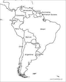
South America Outline Map
In this blank outline map learning exercise, learners explore the political boundaries of South America and the nations there. This map may be used in a variety of classroom activities. The map is labeled with the country names.
Curated OER
South America Outline Map
In this blank outline map worksheet, students explore the political boundaries of South America and the nations there. This map may be used in a variety of classroom activities. The location of the capital cities are denoted with...
Curated OER
South east Asia and the South Pacific: Political: Labeled Map
For this Asia and the South Pacific map worksheet, learners examine the boundaries of the nations in this region of the world. Students also note the location of capital cities as they are denoted by stars. This map is labeled.
Curated OER
United States Map - Lesson 7: Four Main Directions
Students locate the North and South Poles, and learn the definitions of the four directions by using a United States Map and a globe. For this directions lesson plan, students define north, south, east, and west on a map and a globe.
Curated OER
Canada Outline Map
In this blank outline map activity, students study the political boundaries of the North American country of Canada as well as those of the provinces located there.
Curated OER
Canada Outline Map
In this Canada outline map worksheet, learners make note of the political divisions of the provinces and territories of the nation.
Curated OER
Canada Outline Map
In this blank outline map instructional activity, students study the political boundaries of the North American country of Canada as well as those of the provinces located there.
Curated OER
Canada Outline Map
In this blank outline map worksheet, students study the political boundaries of the North American country of Canada as well as those of the provinces located there.
Curated OER
United States Outline Map
In this United States outline map worksheet, students note the political boundaries of the states that are labeled with state capitals.
Curated OER
Mexico Map
In this blank outline map worksheet, students study the political boundaries of the North American country of Mexico. The capital cities of each state are denoted with stars.
Curated OER
Mexico and Central America Map
In this blank outline map activity, students study the political boundaries of Mexico and Central America. Each of the counties is labeled and the capital cities are starred.
Curated OER
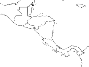
Central America Map wtih Country Borders
In this blank outline map activity, students explore the political boundaries of Central America and the nations there. This map may be used in a variety of classroom activities.
Other popular searches
- Wwi Political Map
- Maps of Europe Political
- Physical and Political Maps
- Canada Political Map
- Americas Political Map
- Blank Political Maps
- Political Map of Africa
- United Kingdom Political Map
- Europe Political Map
- Physical & Political Maps
- Mexico Political Map
- State Political Maps


