Curated OER
Matching the Globe with the Map
Students examine how to use a globe. In this globe and map comparison lesson, students discuss how the globe and map are alike when looking at Africa and Antarctica. Students investigate shapes and sizes of globes versus maps.
Curated OER
Traveling aroud Our Town
Students are asked to describe to a partner how he or she walks to school or the bus stop. They are shown on the overhead an one-inch grid paper, and at the intersection of two lines on the grid paper, students are shown a house and...
PBS
Working with Coordinate Planes: Activities and Supplemental Materials
Seven activities make up a collection of supplemental materials to reinforce graphing on a coordinate plane. Worksheet objectives include plotting coordinates within single and four quadrants, measuring straight and...
Curated OER
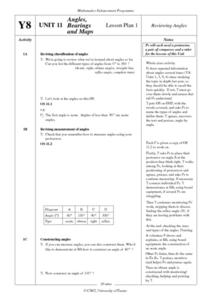
Angles, Bearings and Maps
Young scholars review what they comprehend about angles. They name the differnt types of angles and define them. Students use their protractors to answer questions, the teacher walks around to look at the positioning of the...
Curated OER
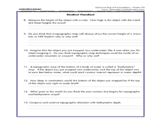
A Watered-Down Topographic Map
Eighth graders explore the ocean floor. In this topography lesson, 8th graders compare topographical maps to bathymetric charts. They will create a topographic map and note landmarks and other land features.
Curated OER
Learning to Use Map Legends
Fifth graders comprehend the purpose of and use map legends. They identify and use symbols and lines from legends on a general-purpose map and four topical maps to completely and accurately answer eight questions on a geography worksheet.
Curated OER
West Virginia Quarter Reverse: Over, Under, In, and Out
Students examine the images on the West Virginia quarter reverse. Using the quarter design as a model, the discover the meaning of directional terms. They play a game where they have to listen to and follow directions and complete a...
Curated OER
Nonfiction Genre Mini-Unit: Persuasive Writing
Should primary graders have their own computers? Should animals be kept in captivity? Young writers learn how to develop and support a claim in this short unit on persuasive writing.
Positively Autism
Pirate Vocabulary
Pirate ships and parrots, cannons and coins. Introduce learners with autism to pirate vocabulary with these pages that include an image and the printed vocabulary word.
Teaching Tolerance
Community Mural / Poster Campaign
Every piece matters. A creative lesson provides an opportunity for scholars to create murals or posters that represent their views on social justice. Academics work on smaller posters or pieces of a mural that will ultimately be...
Concord Consortium
Other Road
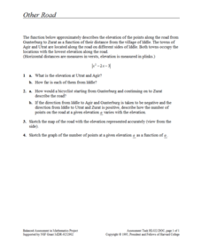
Take the road to a greater knowledge of functions. Young mathematicians graph an absolute value function representing a road connecting several towns. Given a description, they identify the locations of the towns on the graph.
Curated OER
United States Map
Students compare the United States on a globe and on a map. In this map lesson, students relate the sizes of the continents and locate the United States. Students identify the location of the continental US as well as Alaska and Hawaii.
Curated OER
Maps
First graders look at their classroom or school setting. They use positional word to describe where things are located in the school. Students discuss a map and why they are important. They read the story "Taylor's New School" and...
Curated OER
Introduction to the United States Map
Students identify the United States of America and it's states on a map. In this mapping lesson, students examine a globe and find the United States as well as a few land marks (Florida and the Great Lakes). Students then look at a...
Curated OER
Country Capitals
Students locate country capitals on a world map. For this map skills lesson, students review the definition of the word country and discuss what a capital is. Students locate and label capital cities on a world map using a map marker.
Curated OER
Reporting on a Battle
Students report on battles of the Civil War. In this American Civil War lesson, students conduct research that allows them to report on selected battles of the war. Student's newspapers should include eyewitness statements, photographs,...
Curated OER
The Driveway Case
Young scholars discover how courts determine property possession using evidence. In this critical analysis lesson, students use provided case studies and evidence to determine legal possession. This lesson would be suitable for group...
Curated OER
GPS Treasure Hunt
Learners explore geography by participating in a treasure hunt activity. In this Global Positioning System lesson, students define the terms latitude and longitude while utilizing an electronic GPS device. Learners view a PowerPoint...
Curated OER
Relative Location
First graders use landmarks to describe relative locations of a place. In this geography and mapping lesson plan, 1st graders draw picture maps of their bedrooms to show an object's location in relation to other objects. As an...
Curated OER
Electric Field Mapping / Equipotential Lines
Students determine the equipotential lines surrounding a charged object. In this physics lesson, students draw lines to identify areas. They relate the spacing of the field lines to the strength of the charge.
Curated OER
Graphing Ordered Pairs On A Coordinate Plane
Sinking ships, construction paper, coordinate planes, sounds like fun day in math class. Play the game Battleship with your class and reinforce the concept of graphing ordered pairs.
Discovery Education
Sonar & Echolocation
A well-designed, comprehensive, and attractive slide show supports direct instruction on how sonar and echolocation work. Contained within the slides are links to interactive websites and instructions for using apps on a mobile device to...
Curated OER
Global Studies I: Rise of Civilizations
Providing a list of presentations on a variety of topics focused on the development of civilizations throughout the world, this resource could be used in both an upper elementary or high school class. A few important topics covered are...


