National WWII Museum
On Leave in Paris: Maps as Primary Sources
Primary sources—even those that seem mundane—offer a window into those who experienced history. Using a Red Cross map offered to soldiers stationed in Paris after World War II alongside worksheet questions, scholars consider what life...
DocsTeach
Analyzing a Map of the Louisiana Purchase
With the stroke of a pen, Thomas Jefferson roughly doubled the size of the United States. The Louisiana Purchase not only grew the new country, but also it gave rise to the legends surrounding westward expansion and accelerated the...
National Endowment for the Humanities
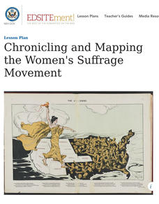
Chronicling and Mapping the Women's Suffrage Movement
While women's suffrage is often believed to be the result of a single constitutional amendment, the effort of women to secure the vote spanned decades and continents. Using primary sources in online archives, class members explore the...
Curated OER
John Smith’s Map of the Chesapeake Bay
Young geographers travel back through time with primary source and map analysis and envision Captain John Smith's arrival at the Chesapeake Bay.
National Endowment for the Humanities
On This Day With Lewis and Clark
Walk in the footsteps of Lewis and Clark as they discover the wonders, beauty, and dangers of the American frontier. After gaining background knowledge about Thomas Jefferson and the Louisiana Purchase, young explorers use primary...
DocsTeach
Red Record of Lynching Map Analysis
Long before the civil rights movement, leaders were working to secure equal rights. An informative activity explains the 1922 anti-lynching campaign with a map. Scholars analyze the map, complete a worksheet, and participate in group...
Curated OER
Mapping the Brain
A virtual 3-D tour leads students to developing icons representing the function of various parts of the brain. These icons are then used to label hand-drawn maps of the brain. A worksheet, assessment, and detailed procedures are included.
DocsTeach
From Dred Scott to the Civil Rights Act of 1875: Eighteen Years of Change
What do a photo of Abraham Lincoln, a map for the Battle of Antietam, and the Dred Scott decision all have in common? Learners consider the broader question as they examine documents related to civil rights during the Civil War and...
Institute for Geophysics
Understanding Maps of Earth
Here is your go-to student resource on primary geography concepts, including facts about the surface of the earth and its hemispheres, latitude and longitude, globes, types of maps, and identifying continents and oceans.
PBS
Arthur Compass Rose
Keep your class headed in the right direction with this printable compass rose. Large and easy to read with a smiling picture of Arthur in the middle, this resource would make a fun addition to the desk of any primary grade student.
A&E Television
The World Wars
Contemporaneously known as The Great War, World War I had never seen its match on the global stage—until World War II. An engaging set of resources designed to extend a viewing of the History Channel's The World Wars features discussion...
Curated OER
Size It Up: Map Skills
Compare information from a US population cartogram and a standard US map. Learners draw conclusions about population density by analyzing census data a population distribution. They discover that census data is used to apportion seats in...
Roy Rosenzweig Center for History and New Media
Continental Differences
Students break into groups and closely investigate primary sources associated with the seven different continents. After deciding which continent their primary sources relate to, representatives from each group present their findings to...
Roy Rosenzweig Center for History and New Media
Differences Among Colonial Regions
Classes look at and analyze primary source images to explore the differences between the colonial regions during the Revolutionary era. They break into groups to tackle each region and then present their findings to the class. A final...
National Endowment for the Humanities
Empire and Identity in the American Colonies
The American Revolution was born out of a European conflict that spilled over into North America—and the documents prove it! Using primary sources from the era of the French and Indian War, including British plans to try to unite its...
Bright Hub Education
Teaching "Gone with the Wind" in High School: Ideas & Activities
Plan on using Gone with the Wind as a reading selection? Here's a packet of prompts for activities and assessments.
Tennessee State Museum
An Emancipation Proclamation Map Lesson
Did the Emancipation Proclamation free all slaves during the Civil War? Why was it written, and what were its immediate and long-term effects? After reading primary source materials, constructing political maps representing information...
DocsTeach
The Settlement of the American West
What do Abraham Lincoln and the Transcontinental Railroad have in common? Using a set of primary source documents, including pictures, maps, and treaties, class members link together the common themes of expansion into the American West....
DocsTeach
Exploring America's Diversity: Rosalia Fundaro (Beginner)
Elementary scholars learn about the life of Rosalia Fundaro, an Italian immigrant, using primary sources. They analyze documents, complete written prompts, and participate in group discussion to understand Rosalia's life in the United...
Digital Public Library of America
The Underground Railroad and the Fugitive Slave Act of 1850
Escaping Enslaved people attempting to escape didn't need a ticket to ride on the Underground Railroad. Here is a packet of primary sources that reveal the kind of courage and determination they did need to face the challenges to gain...
Illustrative Mathematics
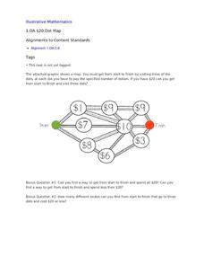
$20 Dot Map
Challenge the addition skills of young learners with this open-ended math problem. The task is simple, get from start to finish by connecting a series of three numbers. The trick is that the sum of the numbers must be less than or equal...
Curated OER
Teaching With Documents: U.S. Constitution Workshop
What does it mean to be American? Explore the constitution and what it really means to be a citizen here. First, learners of all ages will investigate different primary source documents. Then, they establish each document's...
Curated OER
Put Your Face on the Map
Learners investigate topography and contour lines by examining a human face. In this mapping lesson, students create a plaster cast of a face and create a map of the contours of the face one centimeter at a time. Learners examine the...
Library of Congress
Investigating the Building Blocks of Our Community’s Past, Present, and Future
As Ken Jennings said, "There's just something hypnotic about maps." Certainly, the longer you look at them the more you can learn. In this project-based learning lesson, individuals study both historic and present-day maps of their area...


