Rainforest Alliance
Protecting the Critical Habitat of the Manatee and Loggerhead Turtle
Explore ocean habitats with a lesson that showcases the home of manatees and loggerhead turtles in Belize. Here, pupils compare and contrast the homes of ocean animals to those of humans, listen to an original short story about...
Wind Wise Education
Where is it Windy?
How is the wind up there? The class builds a topography model using materials available in the classroom, then place wind flags in different locations on the landscape. Using a fan as a wind source, pupils collect data about how wind...
Curated OER
Middle Ages Cross Curriculum Project
Middle schoolers complete several projects on the Middle Ages. In this world history lesson, students complete language arts, social studies, math, and science projects. Some of these include: comparing a teenager's life now to that in...
Environmental Education in Wisconsin
Biome Travel Guide
In a perfect marriage of social studies and science, groups work together to research and create a travel guide presentation to share with the class. Not only do kids learn about the climate and geography of a biome, but also the...
Columbus City Schools
Totally Tides
Surf's up, big kahunas! How do surfers know when the big waves will appear? They use science! Over the course of five days, dive in to the inner workings of tidal waves and learn to predict sea levels with the moon as your guide.
National Research Center for Career and Technical Education
Health Science: Back to Basics
This lesson focuses on unit conversion, proportions, ratios, exponents, and the metric system. Discuss measurement with your math class and demonstrate how to solve several health-science word problems. Give learners a chance to visit an...
Curated OER
The World's Last Great Wilderness (Antarctica)
It's a shame that there are no photographs in this presentation because the information is fascinating! Each identically fashioned slide contains bullet points of information about Antarctica that will enhance an earth science...
Curated OER
Mapping Community Values
Pupils discuss the origin of various maps focusing on the values behind them. Students also explore how human needs and geography influence community settlement patterns. Pupils extend learning by creating and mapping their own ideal...
Curated OER
Reading Maps of the East Pacific Rise
Pupils make qualitative and quantitative observations and use various maps to investigate the features of the East Pacific Rise The study actual bathymetric maps of the EPR region. They identify key features of the ridge and explore the...
Curated OER
Weather, Data, Graphs and Maps
Students collect data on the weather, graph and analyze it. In this algebra instructional activity, students interpret maps and are able to better plan their days based on the weather reading. They make predictions based on the type of...
Curated OER
TE Lesson: Habitat Mapping
Students examine the current technologies used in mapping resources in the marine environment. They look at remote sensing, sounding, and underwater vehicles. They examine image from the benthic habitat produced by the GIS in order to...
Teach Engineering
Projections and Coordinates: Turning a 3D Earth into Flatlands
Introduce your class to map projections and coordinates, the basics for the work done in a GIS, with an activity that uses Google Earth to challenge learners to think about the earth's shape.
Curated OER
Organization of a Territory, Map Elements
Third graders compare printed and online maps and use proper geographic terminology to answer questions.
Curated OER
The Crash Scene
Fifth graders explore geography by participating in a mapping activity. In this engineering instructional activity, 5th graders identify the differences between latitude and longitude and practice locating precise points on a globe or...
Curated OER
Where Has It Been? Tracking the Ivory-Billed Woodpecker
By studying the assumed extinction, and subsequent rediscovery of the Ivory-billed Woodpecker, learners use maps and come up with a scenario for the rediscovery of the bird. This incredibly thorough lesson plan is chock-full of...
Center Science Education
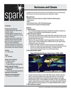
Hurricanes and Climate
Feeling under the weather? This instructional activity on hurricanes can whip things up! With professionally designed maps and handouts, teach your future weathermen (or women) where, when, and how hurricanes occur. They identify...
Curated OER
Determining Cutting Site Locations
Learners explore DNA restriction mapping. They cut pieces of paper into lengths representing those produced when specific enzymes are used to cut a strand of DNA.
Curated OER
Fossils and Lithologic Units
Practicing paleontologists map the geologic time scale, simulate the formation of sedimentary rock, and analyze fossil data. Instructions for four activities and five assessment choices are provided for the teacher. This comprehensive...
Curated OER
Settlement Exploration: Then and Now
NASA has crafted an imaginative and memorable series of lessons, "NASA and Jamestown Education Module." This lesson is one of the five components. In it, middle schoolers connect history and science by comparing the settlement of...
Curated OER
An Internet Exploration: Flying into the Eye
Take a virtual field trip into the eye of a hurricane. Through a series of websites, mini-meteorologists discover the anatomy of a hurricane and how one is formed. Add some excitement to your atmosphere curriculum by exploring this form...
Teach Engineering
Stormy Skies
Young meteorologists examine the four main types of weather fronts and how they appear on a weather map. Participants learn about the difference between the types of weather fronts along with their distinguishing features. A...
Curated OER
Locate Key Information in Nonfiction Text
Interpret nonfiction text with your class. Readers use key information found in nonfiction text to answer questions and problem solve. They utilize the chapter headings, diagrams, glossary, maps, and captions as well as the table of...
Curated OER
Applications of GIS
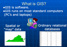
Don't be concerned that the title slide of this presentation mentions Virginia's Geospatial Extension Program; this slide show is very informative for any technology-focused curriculum when considering global information systems. It...
Curated OER
What's the Matter? (Grade 3)
Third graders organize information about the three types of matter and to reinforce concepts learned in the matter unit of the science curriculum. They use Inspiration software to create a concept map of the three types of matter.


