Curated OER
Science Excursion: Cover Mapping Land
Students study remotely sensed images and topographic maps to classify land cover types in their watershed area. They take samples in the watershed area to interpret the images.
Curated OER
Volcano Contour Models Activity
Students experiment with water levels and plastic topographic volcano models to determine the contour lines that would be used to create a topograpohic map of a volcano. They use the traced lines to actually develop the map.
Curated OER
You Are Here
Students map local places and learn to use scale and distance. In this mapping instructional activity, students map their school and a favorite place. Students recreate their maps showing distance and scale sizes. Students...
Curated OER
Continents and Oceans on the Move
Students create an awareness of the vast percentage of water covering the earth. They relate similarities/differences between topographical maps and other maps of various time periods. Students examine how to use a topographical map.
Curated OER
River Study
Pupils explore a stream in their area and show the class the topographic map of the stream. They locate the topographic map and name the streams, lakes and ponds in their watershed. They write a paragraph about their stream and complete...
Curated OER
Mapping the Sea Floor
Students review their prior knowledge on topographical maps. Using a map, they examine the sea floor off the coast of San Diego, California. With a partner, they chart the sea floor of an area and use cutouts to create a visual...
Curated OER
Topo Triangulation
Students investigate how to read a topographical map and triangulate with just a map. They convert a compass measurement to a protractor measurement, reverse a bearing direction, and using a worksheet take a bearing of certain landmarks...
Curated OER
Tracking Pollution - A Hazardous Whodunit
Students read a story problem about the issue of hazardous waste and pollution in a fictional town. In groups, they create a topographical map and predict how the water might flow and determine the place of contamination. To end the...
Curated OER
Siting Wind Power
Young scholars analyze a variety of curves that describe the power extracted from the wind by a variety of commercially produced wind turbines. They utilize site specific topographic maps and political boundary data to evaluate and make...
Curated OER
Common Themes
Tenth graders test usefulness of a model Earth by comparing its predictions to observations in the real world. In this landforms lesson students construct an island from a contour map using model clay then analyze the landscape...
Curated OER
Lesson 4 Activity 1: Mapping the Third Dimension
Learners work in pairs to construct a simple stereoscope.
Curated OER
Build a Model Watershed
Collaborative earth science groups create a working model of a watershed. Once it has been developed, you come along and introduce a change in land use, impacting the quality of water throughout their watershed. Model making is an...
Curated OER
Three Dimensional Geology
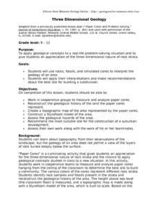
Here is a fine lesson plan on geology designed for high schoolers. Learners use rocks, fossils, and other geological clues to determine the geology of an area. Then, they make recommendations to a fictitious city council about the...
Curated OER
Design an Island
Students make a map of an imaginary island using the topographic symbols provided from a worksheet. Students place lakes, dwellins, reefs, etc. in areas where they would logically be located from understanding how the topography of an...
Curated OER
Running Water/Rivers-Life Cycle
Young scholars explore the parts of a river system and use topographical maps to determine the stage of the river.
Curated OER
Watershed Delineation
Students use topographic maps to delineate a watershed.In this ecology lesson, students draw the boundaries of a watershed onto a map using contour lines as a guide. Their resulting maps are used to evaluate their understanding.
Curated OER
Mapping Your Watershed
Students examine student created maps to locate geographical features such as hills, cliffs, flat meadows, stream beds, etc. They use watershed topo maps to identify landmarks, water flow, and elevation of several features. In addition,...
Curated OER
A Shuttle's Eye View
Students explore the goals of the Shuttle Radar Topography Mission as a springboard to exploring the topographical features of their own state or region. They synthesize their understanding of landforms and topography by mapping their...
Curated OER
Virtual Geologic Field Trip to Griffith Park
Students explore the geological processes and research methodology involved in the evolution and development of Griffith Park. They justify the selection of a geologic hypothesis based on observations.
Curated OER
The Marsh Land as a Changing Environment
Sixth graders continue their examination of the state of Connecticut. After taking a field trip, they identify the types of birds, plants, invertebrates and vertebrates who make their home in the salt marshes. In groups, they identify...
Curated OER
From Maps to Models
Fourth graders study topography maps and learn the importance of their contour lines. In this map lesson students create their own topography map.
Curated OER
Take Me to the River! Using the Black River for Earth Science Review
Ninth graders use maps to identify landscape regions and drainage patterns producing the Black River. They create PowerPoint presentations pertaining to the Black River watershed, its geologic history and highlighting safe rafting...
Curated OER
Gallery Walk Questions on Weathering and Mass Wasting
A set of questions on weathering and erosion are found in this resource. Some of them can be used as discussion topics or lecture guides. There are also suggested activities such as the examination of topographic quadrangles and the...
Science Matters
Slip Sliding Along
The San Andreas Fault is the largest earthquake-producing fault in California. In the seventh instructional activity in the 20 part series, pupils create maps of California, focusing on the San Andreas Fault system. The comparison...
