Curated OER
Crowley's Ridge: An Upland in the Lowlands
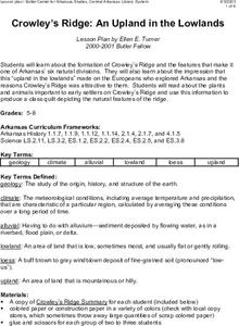
This clever lesson combines elements of geography, art, literature, and storytelling. Pupils take a close look at the six geographical regions of Arkansas, and pay close attention to Crowley's Ridge - which is one of the six. In groups,...
Curated OER
Arkansas: A Changing Climate, a Changing Land
Here is a lesson on the climate zones and geography of Arkansas. In it, learners look at maps (embedded) of different climate zones found throughout Arkansas. They engage in discussions regarding how global warming and climate change is...
Curated OER
Geography: examining the Glacial Features of Cape Cod
Students examine satellite images of the glacial features of Cape Cod. They analyze where human activity is located in terms of those features. Students make models of the features, including kettle holes. They also use contour maps...
Scholastic
Study Jams! The Ocean Floor
Under the sea, the geography is as varied as it is on land! Young oceanographers find out about continental shelves, abyssal plains, seamounts, trenches, and mid-ocean ridges by viewing and reading the eight high-quality slides. Then...
Curated OER
Coastal Geography
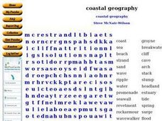
In this geography worksheet, students identify and locate vocabulary terms related to coastal geography. There are 54 words located in the puzzle.
NOAA
Into the Deep
Take young scientists into the depths of the world's ocean with the second instructional activity of this three-part earth science series. After first drawing pictures representing how they imagine the bottom of the ocean to appear,...
Curated OER
Growth of a River
Students evaluate geography by drawing an image in class. In this river lesson, students identify a list of vocabulary terms associated with bodies of water. Students identify how a river is formed and draw a picture of one including the...
Polar Trec
Touring the Poles
Would you want to vacation in the Arctic or Antarctic regions? Scholars research both regions and produce a travel brochure trying to convince tourists to visit. The project focuses on the geography, climate, flora, fauna, and indigenous...
Environment Agency - Abu Dhabi
Plate Tectonics
Young scholars observe a presentation on plate tectonics, layers of the earth, and plate boundaries. They then use the Internet to research major plates and label them on a world map.
Science Matters
Ring of Fire
Over a period of 35 years, earthquakes and volcanoes combined only accounted for 1.5 percent of the deaths from natural disasters in the United States. The 15th lesson in a 20-part series connects the locations of earthquakes and...
Curated OER
Geographic Landforms
Each slide is a simple notebook page with one landform in blue and its definition in red. There are 26 vocabulary terms in all, some you may want to use, and others easily hidden. It is recommended that you add photos or other graphic...
Curated OER
Stack #94414 Word Search Puzzle
In this language arts worksheet, learners study the 20 terms in a word bank which seem to pertain to earth science or environment. Students locate the words in a word search puzzle.
Curated OER
Ozark Karst: A Fragile Landform
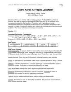
Young geologists become familiar with the Karst Topography in the Ozark Mountains. They study how human activity has affected the cave ecosystem. They conduct a simulation in which a large development is proposed in the area, and they...
Curated OER
Explore Surface Types on a Journey Around Earth
Students explore satellite data. In this technology cross-curriculum math and world geography lesson, students locate specific map areas using a microset of satellite data. Students use technology and math skills to determine percentages...
Curated OER
Map Maker, Map Maker
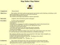
Map maker, map maker, make me a map! Your class can sing this tune as they work to create their own regional maps by taping paper to the wall, projecting an overhead transparency image, and tracing. Where this lesson plan intends for the...
Environment Agency - Abu Dhabi
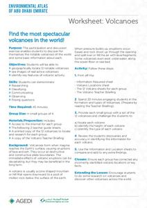
Find the Most Spectacular Volcanoes in the World!
Heat things up in your earth science class with this collaborative lesson plan on volcanoes. After first being introduced to the different types of volcanoes and how they are formed, young geologists work in small groups to research the...
Curated OER
Understanding Topographic Maps
Underclassmen create a cone-shaped landform and then draw a contour map for it. Then they examine a quadrangle (which was easily located with an online search), and relate it to what they experienced. The accompanying worksheet is...
Curated OER
Microclimates of Our School
Learners read the story "Weslandia" by Paul Fleischman, define the term microclimate, gather and record data in various places on school grounds to establish the presence of difference microclimates, analyze and compare microclimates,...
Curated OER
Are We Falling Apart? Exploding Volcanoes
Students research and demonstrate volcanic activity. In this volcanism lesson plan, students research the types of volcanoes and define related terms using the Internet. They demonstrate volcanic activity with water, corn syrup, and flour.
Curated OER
What in Our World Affects the Way People Live
Sixth graders study various maps that show geographical features and population. They compare the maps and make inferences about how various geographical features influence the population and human activities of an area.
Orange County Water Atlas
Location, Location, Location…
Young geographers discover not only how to read and recognize coordinates on a map, but also gain a deeper understanding of latitude and longitude and how climate changes can vary significantly across latitudes.
Montana State University
Meet Mount Everest
Learning about one landform might seem boring to some, but using the resource provided practically guarantees scholar interest. The second in a sequential series of eight covering the topic of Mount Everest includes activities such as a...
Newspaper Association of America
Cereal Bowl Science and Other Investigations with the Newspaper
What do cereal, fog, and space shuttles have to do with newspapers? A collection of science investigations encourage critical thinking using connections to the various parts of the newspaper. Activities range from building origami seed...
Curated OER
Bringing the Rain to Kapiti Plain
Students analyze the story Bringing the Rain to Kapiti Plain geographically, and explain the term climate and discuss its relevance in the story as well as to their own lives.
Other popular searches
- Geography Terms Smartboard
- Basic Geography Terms
- Geography Terms Smart Board
- Esl Geography Terms
- Basic Geography Terms Lesson
- Sixth Grade Geography Terms
- H2o Geography Terms
- Geography Terms Lesson
- Geography Terms Flashcards
- Geography Terms Lesson Plans


