Curated OER
Ecoregions of Texas
Students map the ecoregions in Texas and illustrate the vegetation native to the region. They will use their maps to investigate why prehistoric hunter-gatherers might have decided to live in one area over another, such as the ancient...
Curated OER
Waltz Across Texas
Seventh graders conduct research about regions of Texas by using the web. They research an endangered plant AND an endangered animal that is found in their region. Students prepare and deliver oral reports about their region.
Curated OER
Texas Ecoregions Summary Sheet
In this ecoregions of Texas worksheet, students complete a summary of a particular ecoregion in Texas. They find the producers and consumers of the region, they draw a food chain, the draw a food web, and they complete an energy pyramid...
Curated OER
Ecoregions of Texas
Seventh graders discuss why hunter-gatherers might have favored certain areas in which to live. In pairs, they research specific regions to examine in depth. Students present their eco-region vegetation findings (in this case Central...
Baylor College
Mapping the Spread of HIV/AIDS
Where is HIV/AIDS most prevalent and what are the current trends regarding HIV? Have groups work together to map the world's HIV/AIDS rates, then create a class map with all the data. Lesson includes cross-disciplinary concepts including...
Curated OER
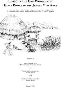
Living in the Oak Woodlands: Early People of the Jewett Mine Area
Students examine the archeology and native peoples of the Jewett Mine area of Texas. Using a map, they explain the economic patterns of the native groups and how the geography of the area affected activities. They compare and contrast...
Curated OER
Texas Weather Report
Students use provided links to observe selected weather sites and collect temperature and precipitation data for listed cities. They enter the information onto their spreadsheet. Students study maps of the Texas natural reagions,...
Curated OER
Seashells of Galveston, Texas
Students take a trip to Galveston's beaches. They collect empty shells, and visit the internet site to identify the seashells they find. Students visit the linked websites to view pictures of seashells and aid in their identification....
Curated OER
Dark Days on the Prairie
Students explore U.S. geography by researching agriculture. For this dust bowl lesson, students complete a cause and effect worksheet based upon the dust bowls that covered a large portion of Oklahoma and Texas in the early 1900's....
Curated OER
Temperature (Celsius)
Third graders solve Celsius and Fahrenheit conversion problems, watch weather forecast and convert temperatures to Celsius, and design and present their own weather forecasts for different regions based on information gathered from...
Curated OER
Climate in the Western Regions
Students examine the interactions of the Earth's systems and other objects in space. In this climate change lesson students study the pros and cons of different climates and what their preferences are.
Curated OER
Patterns and Adaptations in Plants and Animals
Fourth graders conduct research about some of the regions of Texas. They compare plants and animals to identify different adaptations. The statistics of survival rates are measured for changes.
Curated OER
Estimation, Sampling, and Beyond
Students examine an ISS EarthKAM image of farm land in Texas and New Mexico. They select sample region of image and count the number of fields in that region. They estimate how many fields are in the entire region.
Curated OER
A River Runs Through It
Learners evaluate and interpret flood data from Central Texas. They list the tributaries that feed into the Guadalupe River and explain why is it important to include the tributaries in a discussion of the river, especially a discussion...
Curated OER
Properties of Soil
Fourth graders conduct investigations to test different types of soil from different regions of Texas. They make comparisons and identify the characteristics of the soil. The end product of the inquiry is a student report.
Curated OER
How Deep is the Ocean
Students predict and then analyze the layout of the tectonic plates that form the ocean's floor using mapping skills and Inquiry based problem solving, They compare the depth of various regions in the ocean with the geologic age to...
Curated OER
Water Regulations and Policies
Students discuss, examine and review copies of their local Water Quality Reports. They discuss state laws regarding water quality regulations and how water planning groups decisions impact aquifers. They describe the pros and cons of the...
Curated OER
Popping Up Bluebonnets!
students make 3-d bluebonnets Using popcorn and powder paint. They students create a field of bluebonnets on a bulletin board or wall space with their hand-made bluebonnets. students color leaves and stem of the bluebonnet outline with a...
Curated OER
"Go Batty"
Students make a bat from a paper tube. They suspend bats from the ceiling or create a "cave" from black construction paper on a bulletin board or wall. Have students help you! Tape or staple student made bats in the "cave" to stress to...
Curated OER
Make a Bison
Students discover how bison were hunted by the Native Americans and compare it to the buffalo. Using construction paper, they trace a bison outline given to them and use coffee grounds to fill in the space where the fur would be. They...
Curated OER
Prairie Dog Town
Fourth graders use their knowledge of prairie dog communities to design their own model prairie dog towns. Teachers are provided with background information on prairie dogs and are encouraged to show examples to stimulate creativity. ...
Curated OER
Geothermal Energy in Latin America
Here is a wonderful series of lessons designed to introduce learners to the variety of renewable, clean energy sources used by people all over the world. Geothermal energy is the resource focused on. This particular sources of energy...
National Wildlife Federation
Quantifying Land Changes Over Time in Areas of Deforestation and Urbanization
Is qualitative or quantitative research more convincing when it comes to climate change? In the eighth lesson during this 21-part series, scholars begin by performing a quantitative analysis of deforestation and urbanization. Then, they...
National Institute of Food and Agriculture
Water Supply
Participate in three activities that look at the earth's limited water supply and the changes water goes through as it enters each phase of the water cycle. The resource is complete with three activities that demonstrate the changing...
Other popular searches
- Regions of Texas
- Natural Regions of Texas
- 4 Texas Regions
- Four Regions of Texas
- Texas Regions Map
- Texas Regions Geography
- Map of Texas Regions
- Texas Regions and Climate
- 7th Grade Texas Regions
- Texas Regions Lesson Plans
- 4 Regions of Texas
- Texas Regions 3rd Gr


