Curated OER
What is the Rock Cycle and Its Processes?
Geology beginners examine three different rock samples and determine their origin by their characteristics. By making and recording observations, they become familiar with features of igneous, metamorphic, and sedimentary rock types....
Curated OER
What Effect Does Climate Have on Wildlife?
Young scholars explore the international scope of climate change. They identify variables that cause changes in the climate. Students examine how changes in climate affect the food chain.
Curated OER
Manduca
Middle schoolers study the definition of a "global society". They take this knowledge and speculate about the positive and negative ramifications of living in a global society.
Curated OER
Follow a Fish
Students choose a fish from anywhere within the Ocean Center. They observe it for a given time, recording its behavior. Students comprehend the concept that living things have individual characteristics that enable them to live in their...
Curated OER
On the Surface
Young scholars draw and label the 15 major rivers in Texas. They then draw and label another map with the major lakes and reservioirs of Texas. Students use the maps and locate and label the location of the following major Texas cities:...
Curated OER
Star Patterns
Third graders create constellation maps and record their own legends of how constellations came into existence. After observing the sky at night, 3rd graders discuss star maps, read previously recorded legends on the origin of stars. ...
Curated OER
Surface Water Supplies And The Texas Settlements
Students engage in a lesson that is concerned with the allocation and finding of water resources. The location of different settlement areas is considered as one looks how the water is distributed. They map some of the early Spanish and...
Curated OER
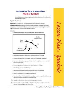
Weather Symbols
Students study weather symbols. In this weather symbols lesson, students review the symbols for cold, warm, and stationary fronts. Students use a weather map to study the weather symbols, complete a weather illustration and prediction...
Curated OER
Earthquake Analysis
Students analyze and plot the coordinates for several recent earthquakes on a world map. They learn not only about research and geology, but about map-making and data analysis. They think of other ways to analyze the data given.
Curated OER
Water Resources
Students explore the differences between surface water and ground water. They collect data using maps and graphs and investigate a Texas river basin and a nearby aquifer. They complete a written report of their findings regarding the...
Curated OER
Oregon Rainshadows
Young scholars brainstorm list of possible highest locations in Oregon, identify and label places from list on map using color code, and discuss and identify causes of a rain shadow.
Curated OER
Plot Studies
Third graders are introduced to how to properly read a plot map. As a class, they take a field trip to an area surrounding the school and work together in groups to examine small sections of the different environments. To end the...
Curated OER
Investigation 4 - Plot Studies
Third graders use a plot map to study the plants and animals living in a small area of their environment.
Curated OER
Sea Secrets
Students study the following: For centuries, people have been challenged by the mysteries that lie beneath the blue depths of our ocean planet. Very little was known about the ocean until late in the nineteenth century, although nearly...
Curated OER
Earthquakes on the Surface
Students view topographic or relief maps of Southern California and discuss what they see. They make predictions based on the topography of the region.
Curated OER
Loss of Wetlands: Subsidence
Students observe subsidence and the effect it has on wetlands with a classroom demonstration. They think about the impact of global warming and the sea level and how it affects the marsh.
Curated OER
Meteorology
Seventh graders examine the job of meteorologists. They decide which characteristics of the atmosphere that meteorologists focus on. They use local weather maps from newspapers to predict weather in their area.
Curated OER
San Francisco Bay Watershed
Students examine relief maps of California and discuss the San Francisco Bay watershed. Discussion continues with the class helping complete a journey of water through seasons in a "finish my sentences" style lecture. They label rain...
Curated OER
San Francisco Bay Watershed
Students locate important landmarks on a map and explore the watersheds in California. In this watershed lesson plan students complete a worksheet and discuss what they learned.
Curated OER
Natural Features as a Resource
Learners research how people use land and water features to meet their basic needs. For this natural features lesson, students review land and water features. Learners discuss how the land is used to meet needs using a landscape picture...
Curated OER
Newspaper Weather
Students use their knowledge of the weather to evaluate information from the newspaper. They also take this knowledge and construct a weather map predicting the next day's weather.
Curated OER
Pangaea Puzzle
Students test evidence for the existence of Pangaea in the Earth's past. They create a current map of the Earth's continents and put them together like a puzzle. They compare this result to a a picture of the shape of Pangaea.
Curated OER
Native Plant Restoration Project
Students distinguish between exotic and native plant species. They work in groups in the field to restore a natural habitat. A class map is created to reflect their work in the field.
Curated OER
A Brand New Day
Students locate Maine on a classroom map and discuss if Maine is where the nation's first light is found, where would the nation's last light be seen. They explore the idea of the sun rising in the east and setting in the west.

