PBS
Map a Model Solar System
Creating a solar system map is a snap thanks to a hands-on activity! Science scholars explore the solar system by building it wherever they choose during an interactive from PBS's Space series. Users pick both the location and scale for...
Curated OER
How To Make a Science Concept Map
Here is a clever way to get your pupils thinking about a science topic they'd like to research for a report, or a project they'd like to do for a science fair. The three-step process is easy to follow, and it really should help your...
G. Turrell
Science Activity 2: Light & Sound
Little learners experiment with sunlight and map out how light travels. Using a mirror and slotted card, they find out about items that can reflect or absorb the light. They experiment with a variety of materials to find out how light...
Education World
Edible Resource Maps!
Young scholars discuss resource maps and examine examples from library resources. Working in groups, they create edible resource maps by drawing examples, such as popcorn on the border of Iowa and Nebraska. Then they use cookies in the...
Curated OER
Weather Maps and Prediction
Young meteorologists read basic weather maps by learning about the symbols that are associated with them. This two-day instructional activity has some excellent demonstrations and activities to get youngsters thinking about the weather...
Texas State Energy Conservation Office
Investigation: Concept Mapping Fuels
After reading an article, "Fuels for Everything," collaborative groups create a concept map poster of the transportation and non-transportation fuels. This makes a strong introduction to the different types of fuels used for transportion...
Columbus City Schools
Thinking Like A Soil Scientist
Ready to roll up those sleeves and get your hands dirty? Dirty with soil science content, that is! Overcome those "But it's just dirt" objections with a trip outside to collect soil samples for some in-class analysis. Use the...
Curated OER
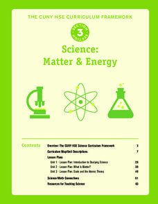
Science: Matter and Energy
Designed to use when teaching adults preparing for their high school equivalency exam, the resource integrates reading practice, writing, and analytical thinking in every lesson. The unit covers 23 topics, but it only includes three...
National Wildlife Federation
Hot, Hotter, Hottest: Extreme Weather's Impact on Our Resources
How dry is it? It's so dry, the river only runs twice a week! Through an analysis of maps and discussions, pairs learn about droughts across the United States in the ninth of 12 lessons. They then read about, answer questions, analyze...
K-State Research and Extensions
Water
How are maps like fish? They both have scales. The chapter includes six different activities at three different levels. Scholars complete activities using natural resources, learn how to read a map, see how to make a compass rosette,...
Curated OER
CSI Interdisciplinary Projects
Work across content areas with an engaging project that highlights higher-level thinking, teamwork, and a STEM focus.
National Endowment for the Humanities
On This Day With Lewis and Clark
Walk in the footsteps of Lewis and Clark as they discover the wonders, beauty, and dangers of the American frontier. After gaining background knowledge about Thomas Jefferson and the Louisiana Purchase, young explorers use primary...
Curated OER
Exploring Biomes Lesson 4: Mapping Arizona
Once junior ecologists are familiar with Earth's major biomes, they hone in on Arizona's biomes. Using a website about Arizona's natural resources, learners will identify biotic communities. Beautiful maps and worksheets are provided for...
Curated OER
Unit II Worksheet 4 - Constant Velocity/Motion Maps
This is a smart approach to displacement concepts. Physics learners analyze a motion map and then draw qualitative graphs for time versus displacement and time versus velocity. Get your class thinking critically through the use of a very...
NOAA
Into the Deep
Take young scientists into the depths of the world's ocean with the second lesson of this three-part earth science series. After first drawing pictures representing how they imagine the bottom of the ocean to appear, young scholars...
International Technology Education Association
Become a Weather Wizard
Accurate weather forecasting is something we take for granted today, making it easy to forget how complex it can be to predict the weather. Learn more about the terms and symbols used to forecast the weather with an earth science lesson...
Rainforest Alliance
Knowing the Essential Elements of a Habitat
To gain insight into the many different types of habitats, individuals must first get to know their own. Here, scholars explore their school environment, draw a map, compare and contrast their surroundings to larger ones. They then...
Scholastic
Drones Take Off
Ever wonder what drones are doing high above us in the sky? This article gives your class an insight to what those robots in the sky are doing. After reading an article on drone technology, pupils are prompted to respond to a...
Curated OER
Soil: Food Mapping
Students examine the concept of food mapping . In this agriculture lesson, students explore food and agriculture systems in the United States in the past and today. Students complete food mapping activities.
Curated OER
Shizuko's Daughter: Concept of Definition Word Map
Help your class use critical thinking when it comes to unfamiliar words. With vocabulary from Kyoko Mori's Shizuko's Daughter, kids write the word in the center of a graphic organizer, and find its category, comparisons,...
Curated OER
Think GREEN - Utilizing Renewable Solar Energy
Students use data to find the best renewable energy potential. In this solar energy lesson students import data into Excel and explain how solar energy is beneficial.
Curated OER
20,000 Leagues Under the Sea
Guide your class on an adventure 20,000 Leagues Under the Sea with this Hampton-Brown outline. It provides educators with a guide to increase reading comprehension, critical thinking, literary analysis, and reading strategies. This...
NOAA
Subduction Zones
Sink into an interactive learning experience about subduction zones! Junior oceanographers examine the earth-shaking and earth-making effects of subduction in the fourth installment in a 13-part series. Hands-on activities include...
PBS
Earthquakes and Volcanoes
Earth's surface constantly changes thanks to a variety of geological forces; in fact, Australia currently moves faster than GPS technology. Scholars connect the idea of continental drift to earthquakes and volcanoes with the help of an...


