CK-12 Foundation
Topographic and Geologic Maps: Topographic Maps
Maps are great for helping you get where you're going, but what does that place actually look like? Geology scholars compare and contrast the features of topographical and geologic maps using an interactive lesson. The resource describes...
CK-12 Foundation
Identify Line Types: Intersecting and Parallel Lines
Navigate your way through a lesson on types of lines. Individuals drag line segments to illustrate paths between pairs of houses on an interactive map. They determine if these line segment pairs are intersecting or
parallel.
Curated OER
Karnaugh Mapping
In this electrical circuit worksheet, students answer a series of 17 questions using a Karnaugh map to generate a Boolean expression, and identify logic gates and functions. This worksheet is printable and the answers are available on-line.
Seterra
Northern Europe: Countries - Map Quiz Game
Remembering geography is a tiring and tedious task to many scholars. Change it up by assigning the map quiz game. Elementary and middle schoolers alike test their knowledge and compete with the clock to match as many countries as...
CK-12 Foundation
Position and Displacement Simulation
How can we use vectors to determine a person's position when traveling? The simulation offers guided practice at determining the coordinates and the distance between coordinates on a map grid. It reinforces the importance of positive...
NOAA
Subduction Zones
Sink into an interactive learning experience about subduction zones! Junior oceanographers examine the earth-shaking and earth-making effects of subduction in the fourth installment in a 13-part series. Hands-on activities include...
NOAA
Seamounts
How do chains of islands form? Young oceanographers explore the mountains of the deep in the final installment in a 13-part series. The interactive compares types of seamounts based on their overall height and height under the water, as...
Curated OER
Europe Map Quiz
In this online interactive geography quiz worksheet, students respond to 45 identification questions about the countries located in Europe. Students have 5 minutes to complete the quiz.
Curated OER
Pictures of Data
In this data worksheet, students look at maps and charts and answer multiple choice questions about them. Students complete 10 questions.
Curated OER
Oil Spill ESI Maps
In this environmental science worksheet, students study and read ESI maps on oil spills and complete 8 short answer questions that follow.
Howard Hughes Medical Institute
BiomeViewer
Which holds more influence, the environment over humans or humans over the environment? Young scientists explore an online interactive that addresses this discussion. They observe changes in the natural world over time and see which...
Curated OER
Getting Together - a Groupings Crossword Puzzle
Introduce your class to words for groups of animals and people. This is a crossword puzzle that includes 25 clues for collective nouns. The puzzle is online interactive and learners can receive immediate online feedback. Answers are not...
Curated OER
Frayer Model
For this Frayer model worksheet, students use the Frayer model to complete a chart about a word study. Students complete 5 steps in the model.
Howard Hughes Medical Institute
Virus Explorer
Most pupils know about the flu, HIV, and other viruses, but they don't know what each actually looks like. This interactive shows their relative size, structure, and allows for comparisons. It stresses the similarities and differences...
Describing Egypt
Ptah-Hotep and Akhet-Hotep Mastaba
Did you know that mastaba means bench in Arabic? Learn why a mastaba was so important to ancient Egyptian architecture. Middle and high schoolers alike stay entertained while reading a passage that describes the virtual tour of...
Curated OER
English Exercises: A Check on the Weather
In this weather words interactive worksheet, students use drop down menus to label the clip art pictures of different types of weather. They examine a weather map of Andalusia and use drop down menus to tell what the weather is in each...
Curated OER
Air Pollution: What's the Solution?
This air pollution worksheet provides a step-by-step process for gathering data about the ozone and weather. Amateur meteorologists enter data for 3 days including the air quality, the temperature, the wind speed, any particular events...
Annenberg Foundation
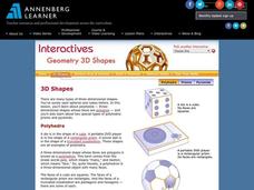
Geometry 3D Shapes: 3D Shapes
Explore vocabulary related to three-dimensional shapes. An instructional website describes the characteristics of different geometric solids. Learners can use an interactive component to view nets, faces, vertices, and edges of common...
Curated OER
SAT Grid Ins Practice Test 04
In this SAT Practice Test, students solve a variety of problems that range from solving for a variable, rate, probability, and area.
Curated OER
Nowhere to Run
In this environmental science worksheet, students explore the different climate change around the world and summarize them. They fill in the table provided.
Curated OER
Problem Solving with Multiplication and Division II: Post Test
In this multiplication and division worksheet, students answer multiple choice questions where they problem solve multiplication and division problems in word problems. Students answer 10 questions total.
Curated OER
Words with Short A, I, O, and E #4
In this short vowel sounds worksheet, students match words to pictures, complete sentences, write words that represent pictures, and more. Students complete 4 activities total.
Curated OER
Freshwater Fish and Fish-keeping
In this online quiz worksheet, students answer a set of questions about freshwater fish. Answers may be submitted for review by clicking a link at the bottom of the page.
NASA
Nasa: Aerial Photography: The Adventures of Amelia the Pigeon
An animated adventure story, developed by NASA, that helps children understand earth science concepts by using satellite photography and other types of aerial photographs to identify physical features on the surface of the earth. Teaches...
Other popular searches
- Different Types of Maps
- Reviewing Types of Maps
- Types of Maps Grids
- Types of Maps Worksheets
- 10 Types of Maps
- Three Types of Maps
- 2 Types of Maps
- Types of Maps Australia
- Types of Maps "Australia
- Types of Maps "Australia"
- Maps Types Key Symbols


