Curated OER
U.S. Mint Releases New Jefferson Nickel
Learners share their knowledge of Lewis and Clark, then read a news article about the redesign on the U.S. nickel to commemorate Lewis and Clark's expedition. Introduce the article with a discussion and vocabulary activity, then students...
Anti-Defamation League
Impact of the U.S. Expansion on Indigenous People and Stereotypes About Native American People
The 2004 U.S. bicentennial sparks a discussion about its meaning and importance to United States history. Readings, maps, tables, and reflective writing prompt small groups to explore the westward expansion, Lewis and Clark, and how...
Curated OER
U.S. and Canada: How are We the Same? How are We Different?
Get high school geographers to compare and contrast Canada and the United States. They begin by drawing a freehand map of North America, then complete readings to gain insight into Canada. The text is not provided; however, another text...
Smithsonian Institution
Borders with the World: Mexican-American War and U.S. Southern Borderlands
The Mexican-American War created social borders—not just physical ones. Scholars learn about the effects of the Mexican-American War on the people living in the borderlands using text excerpts, maps, and partnered activities. Academics...
Curated OER
What do Maps Show: How to Read a Topographic Map
Middle schoolers identify the characteristics of topographical maps. Using examples, they practice reading them and describing the information they gather from them. They also discover how to use the website from the U.S. Geological Survey.
K20 LEARN
Manifest Destiny: U.S. Territorial Expansion
A close examination of John Gast's painting "American Progress" launches a study of the concept of Manifest Destiny used to justify United States' policy of westward expansion. Young historians read statements from persons with different...
Library of Congress
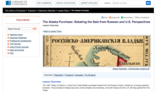
The Alaska Purchase: Debating the Sale from Russian and U.S. Perspectives
Seward's Folly or brilliant strategic move? Class members investigate primary source documents from each country to determine the rationales behind the sale and purchase of Alaska, and then stage a debate.
National Endowment for the Humanities
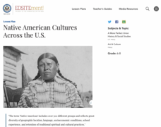
Native American Cultures Across the U.S.
Middle schoolers examine how American Indians are represented in today's society. They read stories, analyze maps, and complete a chart and create an illustration about a specific tribe.
Curated OER
Lesson 1: Map Data and the Census
Students learn about the history of the census. In this U. S. Census lesson plan, students develop an understanding about how the United States Constitution grants and distributes power and discover how the spatial organization of...
Institute of Electrical and Electronics Engineers
Coloring Discrete Structures
What's the least number of colors needed to color a U.S. map? The lesson plan begins by having pupils view a video clip on continuous and discrete phenomenon, then launches into an activity reminiscent of Zeno's paradox. A separate video...
Curated OER
Lesson 2: Mapping Our Home
Students recognize the importance of community participation in the census. In this U. S. Census lesson plan, students use map-reading skills to find answers and learn the difference between senators and members of Congress.
Curated OER
Mapping the Census
Students learn why the census makes a difference. In this U.S. Census lesson plan, students learn the key elements of cartography, examine the difference between data and their representation, and create a map using census data.
Curated OER
MAPPING YOUR NEIGHBORHOOD
Learners uses atlases, maps, and Web resources to generate and examine maps of their own neighborhoods. This activity serve as background for the map-reading tasks in the next lessons.
Curated OER
Size It Up: Map Skills
Compare information from a US population cartogram and a standard US map. Learners draw conclusions about population density by analyzing census data a population distribution. They discover that census data is used to apportion seats in...
Indian Land Tenure Foundation
Create a Map
Do your students have a connection to their natural environment? Create neighborhood maps together with your little learners. The instructional activity starts as the class talks about where they live and what their homes look like. They...
Curated OER
Where is Kansas?
Students explore U.S. Geography by analyzing a map. For this state vs. country lesson, students utilize a U.S. map and locate the state of Kansas before researching the history and customs of the state. Students collaborate as a class to...
Curated OER
Caves
Explore caves with your class! Your scholars will participate in scientific observation, research, inference and deduction, reading, vocabulary, and writing activities about caves with this lesson plan. This resource contains five...
Curated OER
About Life: The Photographs of Dorothea Lange Going to the Promised Land
To better understand the migrant experience during the Great Depression, pupils analyze two primary resources: photographs by Dorothea Lange and a U.S. Map that shows the Dust Bowl. They compare and contrast Lange's images to Steinbeck's...
Curated OER
Philadelphia and the Constitutional Convention "Heat Up"
Students explore the Constitutional Convention of 1787. In this U.S. Constitution lesson, students role play the parts of delegates in a simulation of the convention.
National Geographic
Australia, Antarctica, and Oceana
Go on a traveling adventure throughout Australia, Oceana, and Antarctica! This textbook excerpt offers a full unit of study that can easily be supplemented by extra projects or research materials. Learners study maps, read about native...
Tennessee State Museum
An Emancipation Proclamation Map Lesson
Did the Emancipation Proclamation free all slaves during the Civil War? Why was it written, and what were its immediate and long-term effects? After reading primary source materials, constructing political maps representing information...
PBS
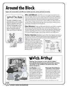
Around the Block
Arthur and his friends help children explore the concepts of family, community, and diversity in a fun series of activities. From performing peer interviews to mapping out the different places students have lived or visited, this...
McGraw Hill
Study Guide for Island of the Blue Dolphins
Dive your class into a reading of Island of the Blue Dolphins with this in-depth study guide. Breaking the novel into three parts, the resource begins each section with a focus activity that identifies a specific theme or question to be...
Curated OER
Where in the World Is Mexico?
Students practice map-reading skills as they locate Mexico and its cities on a world map. By creating a puzzle out of a map of Mexico, students engage in a meaningful hands-on activity to help them explore that country's geography.


