Curated OER
Activity 2: Salinity & Tides
High schoolers explore the effects of tides and salinity on an estuary. In this salinity and tides lesson plan, students complete 3 activities which help them understand estuarine systems. They study the tides in the Chesapeake Bay, they...
Curated OER
Estuary and Watershed
High schoolers investigate the San Francisco Bay Estuarine Research Reserve and watershed. In this estuary and watershed lesson plan, students complete 4 activities to better understand estuarine systems. They include studying the San...
Curated OER
The Excretory System
In this excretory system instructional activity, students read a brief excerpt about water balance and the excretory system. Then they identify what compound birds, insects and reptiles living in dry habitats excrete. Students also...
National Park Service
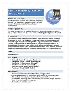
Aspect, Treeline, and Climate
Head to the treeline and beyond to examine how this feature of the landscape affects weather and climate, which gives scientists clues about its health. Class members' observations of photographs provide the data that drives the...
Curated OER
Boston Harbor Cruise: A Shoreline Survey
The students take a harbor cruise, photograph, and draw shore line features attending to evidence of human impact/consequences, and its cost on marine/land animal habitats vegetation, weather patterns, signs of erosion, and the water...
California Academy of Science
Pollution in Our Watershed
The concept of a how pesticides and other chemicals pass through a watershed can be difficult for younger learners to grasp without a concrete example. In the activity here, some blank paper, markers, and a spray bottle are all you need...
Curated OER
Would You Drink This?
Students examine how they affect water quality of those who live downstream after identifying rivers and river basins in Kansas.
Space Awareness
Let's Map the Earth
Before maps went mobile, people actually had to learn how to read maps. Pupils look at map elements in order to understand how to read them and locate specific locations. Finally, young cartographers discover how to make aerial maps.
Teach Engineering
Red Cabbage Chemistry
Using the natural pH indicator of red cabbage juice, groups determine the pH of different everyday liquids. As they work, pupils gain an understanding of pH that may help deal with contaminants in the water supply.
Biology Junction
Origin of Life
Aristotle explained the idea of spontaneous generation, a concept which lasted almost 2,000 years before scientists proved it wrong. Scholars learn about the history of our understanding of the origins of life. They read examples of...
Curated OER
Water Cycle Reading and Writing
Here is a great way to get pupils to express a scientific concept in a fun way. After hearing the story of Walter the Water drop and learning facts about the water cycle, the class will write a creative expository piece describing what...
NorthEast Ohio Geoscience Education Outreach
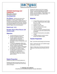
Hydrology and Landforms
Three days of erosion exploration await your elementary geologists. Learners begin by examining rivers via Google Earth, then they model water flow in sand, and finally, they identify resulting landforms. This lesson is written...
Curated OER
Alaska's Physical Systems and History
Students read about Alaska's physical systems and determine how Alaska's physical makeup has impacted its history. They create timelines of their particular physical system.
Curated OER
Red River of the North Flooding 1997
Students describe factors that affect the flow of rivers and explain their relationships. They research the factors involved in flooding events. describe the effects of present and future practices in land use, and river control methods.
Curated OER
T3 Lesson Plan: Number 3
Sixth graders investigate local water. In this water cycle lesson, 6th graders take samples from surrounding water sources. Students record data from the samples, compare and graph the results.
Curated OER
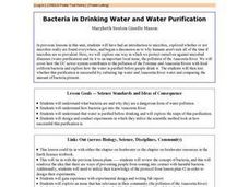
Bacteria in Drinking Water And Water Purification
Students explore how sewer systems can contribute to water pollution and perform an experiment to see how well a water purification technique can protect against water-born microbial illnesses. They compare the bacterial growth from...
Curated OER
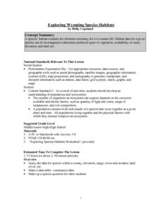
Exploring Wyoming Species Habitats
Students are introduced to the concept of species habitats and ranges. They introduced to ArcView GIS as a tool for mapping. Pupils use query data for species withina county, elevation, range, rivers and streams, land cover, and etc....
Curated OER
Cypress/Tupelo Swamps
Students study the geologic history of terrain, soils, and drainage patterns. They recognize ecological processes that determine the dynamic nature of habitats. They investigate the influence of human activity on the landscape.
Curated OER
Know Your Watershed
Students investigate the importance and the location of their own watershed by visiting and EPA website and also work in groups to create an action plan on how to protect their local watershed.
Curated OER
The Water Cycle
Young scholars research the water cycle and identify main vocabulary associated with the water cycle. They build and observe a closed system model that demonstrates the water cycle in action.
Curated OER
Carve That Mountain
Students investigate major landforms (e.g., mountains, rivers, plains, hills, oceans and plateaus). They build a three-dimensional model of a landscape depicting several of these landforms. Once they have built their model, they act as...
Curated OER
A Powerpoint Presentation On Sustainability
Students are introduced to the important geography concept of sustainability by looking at the Roseau River floods of 2002. They discuss the impact of humans on the environment. They explain how sustainability relates to everyday geography.
Curated OER
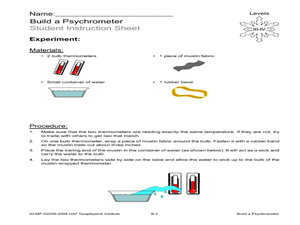
Build a Psychrometer
Students understand that a psychrometer is a weather instrument used to detect humidity. In this psychrometer lesson, students build a psychrometer. Students use their psychrometers to measure humidity activity.
Curated OER
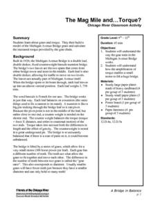
The Mag Mile and ... Torque!
Students use paper plates and detailed directions to build a model of the Michigan Avenue Bridge's gear system. By carefully measuring and cutting "teeth" for the gears of the "Gear Train," they create small gear that will intersect the...


