Curated OER
TE Activity: The Trouble with Topos
Students study the uses of topographical maps including the many forms that they take. They discover that the map features show its intended use such as city maps, wilderness maps, and state maps. They complete a worksheet in which they...
Curated OER
Southwest Bus Ride
In this geography skills practice worksheet, students take a trip through the southwestern United States as they examine maps, information cards, and respond to 12 questions.
Curated OER
Regions of the United States
Middle schoolers research maps in order to propose geographic reasons for geographic patterns such as state boundaries, interstates and elevations.
Curated OER
Geography, Energy, and the Twenty-First Century
Students examine the past and present effects of energy sources on geography in the 21st century. They compare/contrast energy consumption and production in the U.S. and the world, make predictions for future energy consumption, and...
Curated OER
Northeast States and Tribes Word Search
In this geography instructional activity, students find the words that are used to describe places in the Northeastern United States. The answers are found at the bottom of the page.
Curated OER
Mapmaker, Make Me a Map!
Here is a well-designed, very thorough lesson plan on mapping for very young children. Within the six-page plan, you will find everything you need to implement the lesson plan. They will identify various landforms found in Colorado on a...
Education World
Edible Resource Maps!
Young scholars discuss resource maps and examine examples from library resources. Working in groups, they create edible resource maps by drawing examples, such as popcorn on the border of Iowa and Nebraska. Then they use cookies in the...
Curated OER
American Symbols and Figures
Students examine a variety of symbols important in American culture. They investigate the history of the Great Seal of the United States and the painting "The Spirit of 1776". They create an original seal and identify important monuments.
Curated OER
Flat Stanley
The geography of the United States is the focus of this lesson plan, as well as writing friendly letters. Your second graders read, "Flat Stanley," by Jeff Brown. They create their own Flat Stanley out of poster board, markers, crayons...
Curated OER
The Ultimate Road Trip
Sixth graders experience and practice real-world geography, science and math as they imagine planning out the ultimate road trip. They set goals and maintain a daily budget as they are given a set of rules as they plan their road trip...
Curated OER
Celebrating Cinco de Mayo Without Stereotypes
Put more meaning into your Cinco de Mayo party with geography lessons, literature, and more!
Curated OER
Day to Day Life in a Small African Village
Learners analyze what it is like to live in an African village. They locate Tanzania on a map and compare life there to life here in the United States. They write about the health issues in East Africa.
Curated OER
A Collage of Canada
Learners explore geography and culture of Canada. They play game that involves reviewing materials and answering questions about Canada, and create posters and brochures about life in Canada.
Curated OER
Dos mapas de Florida, el Caribe y parte de Sur America
What can maps tell us about the past? Find out with a Spanish lesson that incorporates geography. After examining maps individually, comparing two old maps of Spanish Florida and writing notes in the provided Venn diagram, pupils pair up...
Cornell University
Too Much of a Good Thing?
Continuing their study of beneficial insects, young entomologists discover where in the world some of these bugs are. By labeling, coloring, and using the scale on a map, pupils explore the territories and arrival of the Asian lady...
Curated OER
Will There Be a White Christmas This Year?
Young scholars examine historical weather data, and create map and color key that illustrates the likelihood of a white Christmas in different locations across the United States.
Pulitzer Center
Revolution in Tunisia
How much do your pupils really know about the revolution in Tunisia? In order to inform your class and spark discussion, first create a country profile, comparing and contrasting Tunisia with the United States. Learners then analyze the...
Denver Public Schools
Kung-hsi Fa-ts' ai! – A Chinese New Year Celebration
Looking for ideas for your Lunar New Year celebration? Check out an interdisciplinary unit of study that includes lessons in counting, calligraphy, culture, geography, literature, art, and music. Kung-hsi Fa-ts' ai! (May you...
Curated OER
Journey to America
Fifth graders carefully analyze the artwork, Les Emigrants, and explore the reasons that people emigrated to the United States, and what life was like for new arrivals. They discuss what things immigrants were able to bring with them and...
Curated OER
What Can We Learn about India from a Ten Rupee Bank Note?
The class finds and cites evidence showing India's unity in diversity and work to recognize some of the complex interactions of a civilized community. They read to understand how geography, history, politics, economics,...
Curated OER
The Railroads and Settlement of the Great Plains
Enhance your American literature unit with this resource, in which readers access the Nebraska Studies website and read about "Railroads and Settlement." They search for a photograph of some aspect of the railroad from the Prairie...
Smithsonian Institution
Dia de los Muertos: Celebrating and Remembering
Help scholars understand the history, geography, traditions, and art of Dia de los Muertos, the Day of the Dead. Find background information for your reference as well as a detailed cross-curricular lesson plan. Learners compare...
Curated OER
Tears of Joy Theatre Presents Anansi the Spider
Accompany the African folktale, Anansi the Spider, with a collection of five lessons, each equipped with supplemental activities. Lessons offer multidisciplinary reinforcement in English language arts, social studies, science,...
C-SPAN
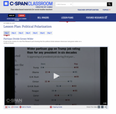
Political Polarization
Dive into the political breach with pupils and explore the reasons for political polarization. Using clips from C-SPAN that include discussions from reporters and scholars, class members consider what is causing the political fault lines...
Other popular searches
- United States Geography
- Geography of United States
- Geography of the United States
- Physical Maps United States
- United States Geography Maps
- United State Maps
- United States Geography 4 6
- United State Geography
- Picture United State Maps
- United States + Geography
- Physical Maps of United States


