Curated OER
Across the United States- Home Learning Activity
In this home-school United States map worksheet, students work with a family partner as they study a map of the United States. They talk about the states they have visited, play a game by giving each other clues about states, and write...
Ed Helper Clip Art
USA States
Looking for a map of the Unites States of America? Look no further than this printable map designed to accompany your geography instruction and to give map skills a boost.
Curated OER
The United States and Its Capitals
Have your class learn about the fifty states in the United States and their capital cities. Learners play matching games, complete quizzes, and a variety of activities in order to cement their knowledge of the states.
Curated OER
Way to Go! Create a Road Map Game
Learners create a travel game of one of the United States. They research a state of their choice and create a travel game using a common road map. They interpret map symbols as they calculate map mileage for their games. They create...
West Virginia Department of Education
A State of Convenience: The Creation of West Virginia
Ever wondered why there is a West Virginia but not an East Virginia? The resource answers questions like this one and more as it takes an in-depth and detailed look at the history of West Virginia and how it became a state. Several...
Curated OER
Map Memory
Fifth graders, working in a whole class setting, label a United States map with the names of all the states that they know. They transfer the names of the states to an individual map and color it. Next, they receive directions on how to...
Little 10 Robot
Geography Drive USA™
A trivia-style virtual road trip in which the player's car is moved from state to state as questions are correctly answered. Ideally, a player would learn about different states by reading the simple brochures available in the...
Curated OER
States and Capitals of the United States
Students label states and capitals on a United States map and complete research on one of the states. In this states lesson plan, students fill in the states on blank maps.
Curated OER
States and Capitals
This map skills PowerPoint features an interactive states and capitals game. The object of the game is to identify the capital cities of each of the 50 states. The excellent presentation includes United States maps, game directions, and...
New York State Education Department
US History and Government Examination: August 2017
Developing a test that uses primary sources to assess class members knowledge of the history of the United States is no easy task! Save yourself the time and stress and use a final exam that includes essay, multiple choice, and short...
Curated OER
Capitals, Oceans, And Border States
Students investigate geography by completing games with classmates. In this United States of America activity, students examine a map of North America and identify the borders of Mexico and Canada as well as the Pacific and Atlantic....
Curated OER
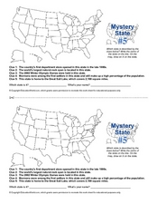
Mystery State # 5
Mystery state number five is none other than Utah! Quiz your kids on state knowledge while building deductive reasoning skills. They use each of the five clues to determine the name of the mystery state. A great warm up when studying...
National Geographic
Mapping the Americas
Celebrate the geography of the Americas and develop map skills through a series of activities focused on the Western Hemisphere. Learners study everything from earthquakes and volcanoes of the Americas and the relationship between...
Center for History Education
Road to Revolution: How did Actions and Responses Lead to an Independent United States?
Using primary sources, maps, and an interactive M&M game, young historians examine the American revolution as if they were detectives trying to solve a crime. Resource includes graphic organizers and a final writing prompt to aid...
Curated OER
Our 50 States
Students identify the location of the 50 states using an interactive map. They practice geography skills by playing a fun game. Pupils become familiar with the state abbreviations for the US states. Students become familiar with the...
Curated OER
The Great States Race
Here is another in the interesting series of lessons that use the special State Quarters as a learning tool. This one uses the Indiana State Quarter. During this lesson, utilize a brilliantly-designed board game that is embedded in the...
Curated OER
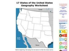
17 states
In this states worksheet, students label states in the United States that are on the west side of the country. Students label 17 states.
Curated OER
Where the Parks Are
Students research major league baseball in United States and Canada. In this baseball history lesson, students use a map of the United States and Canada to find and label each major league team. Students then color the home cities of the...
Curated OER
States in the USA Quiz
In this online interactive geography quiz worksheet, students respond to 50 identification questions about the states in the United States of America. Students have 4 minutes to complete the quiz.
Curated OER
Chalkboard Challenge: Social Studies Online
If used as an independent review, this presentation could be a quick way for students to study U.S. History facts. Since it only presents a few simple facts, it would not be adequate for a comprehensive review, but a teacher could...
Curated OER
Take Me Out To the Ball Game
Students use a map to graph and locate major league teams of different sports. In groups, they analyze the population data of the United States and compare it with the amount and location of the major league teams. They share their...
Curated OER
What State Are You In?
Students identify the major U.S. cities. In this U.S. geography lesson, students work in pairs and use game cards to name various cities in the United States.
Curated OER
Blank Jeopardy
Games are a great way to motivate learners to internalize information.. Using this PowerPoint which is in a Jeopardy format, students can review map skills and facts about the Civil War, famous places, and our government. This is a handy...
Curated OER
States/capitals
Students identify the geographic locations of each state of the United States. Working cooperatively, they put togehter a giant puzzle of the United States using their individual pieces.


