Curated OER
Using Different Kinds of Maps
Third graders explore the landforms and population diversity. They read maps and examine geographic terms. Students create their own map of the United States and answer questions about the location of people. After exploring the map, 3rd...
Curated OER
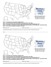
Mystery State #12
What's better than learning about US geography? Having fun while your doing it! After reviewing each of the five given clues, learners attempt to name the mystery state. A great way to reinforce geography skills and deductive reasoning...
Curated OER
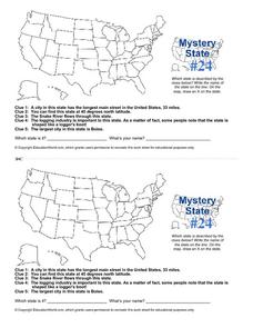
Mystery State # 24
Prepare those brains for a rousing day of learning with a fun geography activity. Your pupils use five different clues to determine the name of mystery state number 24. Where do all those potatoes come from? Idaho!
Curated OER
Mystery State # 28
Using clues is a great way to increase deductive and logical reasoning skills. Boost thinking skills while quizzing kids about us geography. They use five clues to determine which state is in question.
Curated OER
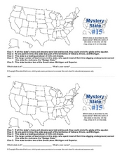
Mystery State #15
Do you know the name of the Badger State? Using five fantastic clues, your super sleuths will determine the name of mystery state number 15. A wonderful way to warm up the class!
Curated OER
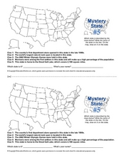
Mystery State # 5
Mystery state number five is none other than Utah! Quiz your kids on state knowledge while building deductive reasoning skills. They use each of the five clues to determine the name of the mystery state. A great warm up when studying...
Curated OER
Mystery State #2
Which is the mystery state for today? Using five super clues, your class will work to uncover which state is being described. They'll have no problem remembering facts about Nevada after this fun warm-up activity.
Curated OER
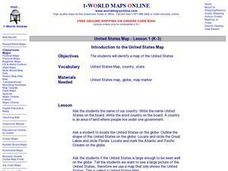
Introduction to the United States Map
Students explore the United States using a map. In this map lesson, students discover how to use a United States map and a globe to locate places.
Curated OER
Spy the Flycatcher
Explore the symbols and special features of Oklahoma. By focusing on Oklahoma's state bird, the flycatcher, learners identify similes, write metaphors, and answer questions about this famous state symbol.
ESRI
Juneteenth: An American History through Maps
An interactive website traces the history of Juneteenth celebrations from their origin in Galveston, Texas, on June 19th to the present day. Using interactive maps, learners can find information about the African-American population...
Curated OER
United States Map - Lesson 2 Introduction to Symbols
Students explore the United States using a map. In this map lesson plan, students discover how to use map symbols in order to read maps.
Curated OER
Capitals, Oceans, And Border States
Young scholars investigate geography by completing games with classmates. In this United States of America lesson, students examine a map of North America and identify the borders of Mexico and Canada as well as the Pacific and Atlantic....
Curated OER
Do You Know Your 50 States?
Learners use the names and abbreviations of the 50 states to label a blank map of the United States.
Curated OER
Maps
If your students are just starting a unit on Geography this could be the introduction you're looking for. This PowerPoint presents a clear and organized overview of the different types of maps people use and why each is important. Tip:...
Curated OER
Max Knows Mexicao, United States and Canada
Students utilize their map skills to explore the regions of North America. They explore the physical characteristics and climates of the regions. Students label their map and prepare a presentation of their findings.
Curated OER
50 States: New England States
Students discover where certain states are located and what the look like. They look for their information on a web site. Each student is assigned a state which they must research then present to the entire class.
Annenberg Foundation
Contested Territories
United States expansion into Western territories impacted much more than just lines on a map. The seventh installment of a 22-part series about America's history puts scholars into the lives of those making the journey westward as well...
National Endowment for the Humanities
Sources of Discord, 1945-1946
From Allies to enemies within a year. Scholars research the falling out between the United States and the Soviet Union from 1945-1946 in the first lesson of a three-part series. Using primary source materials, group work, and interactive...
PBS
An Attack on Syria- What Would You Do?
Has United States military intervention in the conflicts of other countries always been warranted? After reviewing a brief background on contemporary US conflicts and reading articles describing the civil war in Syria, your learners...
Curated OER
The Great Military: Map of Texas
The battle at the Alamo may be one of the most famous military campaigns in Texas history, but it is by no means the only one. As part of their study of the military history of Texas, class members research less-well-known sites, locate...
Curated OER
Mystery State #42
In this mystery state learning exercise, students are given five clues which they try to answer to identify the state in question. Then, they locate the state on a map.
Curated OER
Mystery State #21
In this mystery state instructional activity, students answer five clues to identify the state in question. They then locate that state on a map.
Curated OER
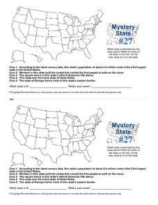
Mystery State #27
In this mystery state worksheet, students answer five clues to identify the state in question. They then locate that state on a map.
Curated OER
Puerto Rico: The 51st State?
Learners explore Puerto Rico. In this Puerto Rico current events lesson, students conduct a Webquest to answer questions about Puerto Rico's culture. Learners discuss whether Puerto Rico is a country or a state, and defend their...


