Curated OER
Regional Economics in the United States
Learners describe and provide examples of the primary factors
behind the regional pattern of economic activity in the United States. They create maps showing regional economics patterns
in the US and examine those patterns in comparison...
Curated OER
Name That Place: Cultural Place Names in the United States
Students examine the origin of the people that settled in the United States. In this United States History lesson, students work in small groups to complete several activities that explore early settlement, such as a worksheet, a...
Curated OER
Nature and Place Names in Arkansas
Middle schoolers examine the way that many place names in Arkansas came to be. By looking at Arkansas highway maps, they find names that come from the characteristics of each of the state's six geographical divisions. This interesting...
California Academy of Science
California's Climate
The United States is a large country with many different climates. Graph and analyze temperature and rainfall data for Sacramento and Washington DC as you teach your class about the characteristics of Mediterranean climates. Discuss the...
Curated OER
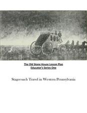
Old Stone House Lesson Plan
From stagecoach to railroad tracks, your class will discover how advancements in travel in the United States during the nineteenth century played an integral role in the industrialization and development of American society. The main...
American Battle Monuments Commission
Honoring Service, Achievements, and Sacrifice: A WWI Virtual Field Trip
The largest offensive in United States military history comes alive in a online interactive resource. Young historians explore the Meuse Argonne battlefield and scour the landscape for evidence from the battle. They then use primary...
National Museum of the American Indian
The A:Shiwi (Zuni) People: A Study in Environment, Adaptation, and Agricultural Practices
Discover the connection of native peoples to their natural world, including cultural and agricultural practices, by studying the Zuni people of the American Southwest. This lesson includes examining a poster's photographs, reading...
Curated OER
United States Climates
Students identify regional climates by using weather maps. They, in groups, locate and mark their city on the small map, then go to the larger map to locate and mark their city when they are called upon by teacher.
Curated OER
The Power of Maps & Native American Cultures
Sixth graders discover where and how five Native American cultures lived in North America in what is currently the United States. They examine their way of life and the regions they inhabited. Additionally, 6th graders will understand...
Curated OER
Africa's Climatic Regions
Students are introduced to the different climates and vegetation of Africa, and compare them to similar climatic regions found in the United States.
Curated OER
Grade 8 Unit 4
Eighth graders analyze aspirations and ideals of the people of the new nation, in terms of its physical landscapes and political divisions, and the territorial expansion of the United States during the terms of the first four presidents.
Curated OER
The Constitution: A New Federation
Students explore political parties by researching world history in class. In this Australian government instructional activity, students identify the term "federation" and discuss the elements of Australian politics. Students analyze a...
Curated OER
California Geography
Fourth graders explore geography of four distinct regions of California: mountains, coast, central valley, and desert. They locate California on map, identify state's boundaries and borders, and explore agriculture, a major economic...
Curated OER
Fourth Grade Social Studies
In this social studies worksheet, 4th graders complete multiple choice questions about the climate, landforms, regions, government, and more. Students complete 25 multiple choice questions.
Curated OER
Geography Puzzles
Students study the continents of the world. In this Internet geography lesson plan, students connect to online mapping games. Students collaborate in order to develop their understanding of world geography, including countries and...
Curated OER
State My Name
Students study the names of all fifty states, their capitols, location on a map, and an economic resource of each state. They complete a matching game activity.
Curated OER
How Big is Big?
Geography learners compare and contrast population densities throughout the world. Using maps, they estimate the relative size of the world's regions and populations. They develop analogies to discover the world they live in and...
Curated OER
Find a Cave
Students locate their own communites and the nearest caves on a United States map. They calculate the distance to the nearest cave using rough scale.
Curated OER
Population Density
Students examine world population density and population distribution. They create pie charts showing population distribution and analyze population patterns in the United States and major regions of the world. They identify...
Indian Land Tenure Foundation
Indian Trust Lands
An important aspect of studying Native American history is understanding the nature of trust lands. Budding historians will learn that as Native Americans were removed from their home lands, trust lands were provided in the form of...
Curated OER
Across Five Aprils
Eighth graders are introduced to the novel "Across Five Aprils" written by Irene Hunt. They become familiar with the people, places, and events referenced in the story and comprehend the story of the Civil War. Students are given a...
Curated OER
Creating and Comparing Climographs
Students are introduced to the importance and usefulness of climographs. In groups, they create a climograph of two cities on about the same latitude. They compare and contrast the locations and climates of the two cities and write a...
Curated OER
Representing Our Nation
Students use pennies to illustrate how our states are represented in Congress. This lesson is to be implemented during a unit covering the branches of United States government.
National Endowment for the Humanities
The 1828 Campaign of Andrew Jackson: Territorial Expansion and the Shift of Power
Young scholars make connections between changes in voting participation and the election of 1828, and describe regional factors evidenced by the voting results of the election of 1828.

