Curated OER
Maps Can Help Us
First graders explore the geography of Montana by analyzing geographic maps of the area. In this Native American reservation lesson, 1st graders discuss the similarities and differences between reservations in the state of Montana....
Curated OER
The 50 States and its Holidays
Though the format of this ELL lesson is confusing (the standards listed are for plate tectonics, yet the objectives are for American geography and holidays), a teacher could glean some ideas from the main idea. Here, pupils complete a...
Freecloud Design
Stack the States™
Kids have fun learning US geography and state facts, including capitals, nicknames, major cities, and landmarks. They can choose between the game, or informational flashcards for each state.
Curated OER
Discovering American Symbols
Help youngsters get to know their states and capitals, explore their own country, and study American symbolism. They take a "trip" across America collecting symbols, images, and information about each state as they go (through text and...
Curated OER
The United States and Canada Review Worksheet and Study Guide
In this geography skills worksheet, students respond to 34 short answer questions about the geographic features and climates found in the United States and Canada.
Curated OER
Geography Application: The Cuban Missile Crisis
A complete activity! The class reads the provided text, then answers the 7 critical-thinking questions. Topics covered are interpreting informational text, reading comprehension, the Cuban Missile Crisis, and US Policy.
Curated OER
The Geography of China
Viewers will love this field trip to China, complete with information about China's economy, topography, geography, climate, and demographics. Maps and photos help to support the claims in the slides, especially in some interesting...
Curated OER
Geography A to Z : Letter H
What starts with the letter H? A lot of things do! Including the names of seven different geographic locations around the globe. Learners use the clues to determine the answers, all beginning with the letter H.
Curated OER
Nature and Place Names in Arkansas
Middle schoolers examine the way that many place names in Arkansas came to be. By looking at Arkansas highway maps, they find names that come from the characteristics of each of the state's six geographical divisions. This interesting...
Curated OER
Places in Arkansas: A Tour of Our Unique State
A great lesson focuses on important cultural and historical places in the state of Arkansas. Learners are introduced to six important places in Arkansas, then create a report on a place in Arkansas. Some excellent photographs, resource...
Curated OER
My Summer Vacation
Students study the United States geography using Google Earth. In this U.S. geography instructional activity, students create travel journals about five U.S. geographical locations. Students research the human and physical...
Curated OER
The United States and Canada: Climate and Vegetation
Display U.S. and Canadian climate and vegetation through this text-companion worksheet. Learners read about the geography of these regions, take notes, and answer 3 comprehension questions as they read the selection. A graphic organizer...
Curated OER
A Study of the United States of America
Students research information about each of the fifty states. They locate information using both the Internet and CD Roms and create databases using the research information. They insert graphics in a multimedia presentation using the...
Statistics Education Web
What Percent of the Continental US is Within One Mile of a Road?
There are places in the US where a road cannot be found for miles! The lesson asks learners to use random longitude and latitude coordinates within the US to collect data. They then determine the sample proportion and confidence interval...
Baylor College
HIV/AIDS in the United States
In the final of five lessons about HIV/AIDS, groups create presentations to share data about the infection rates in the United States, examining demographic and geographic trends over the past ten years. Depending on how much time you...
Curated OER
United States Map Lesson
Students explore basic map skills. In this United States geography lesson, students define "country" and "state," locate their state on a United States map, and identify and trace state boundaries defining their state and surrounding...
Curated OER
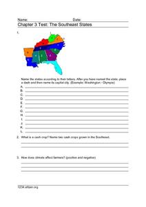
Chapter 3 Test: The Southeast States
In this geography worksheet, students complete a test about the southeastern United States. They name the states, tell about the climate and crops, complete a matching activity about the landforms. and another about the industry.
Curated OER
US States
In this geography worksheet, 3rd graders focus on the northeastern states of Alaska and Hawaii. Students complete 10 single digit addition problems and color each state the correct color according to the given key.
Curated OER
US Policy In Somalia
Students investigate the US policy for the country of Somalia. They conduct research using a variety of resources. They locate the country and then discuss major geographical features of the areas. Students discuss the present US...
Curated OER
Landforms and Resources of the United States and Canada
In this North American geography worksheet, students read about the physical features and resources of the United States and Canada. Students take notes and answer 3 short answer comprehension questions as they read the selection.
US Mint
Symbols in My Eyes
Explore the hidden meanings behind the images on US currency with this elementary school lesson on symbolism. Starting with a class discussion about symbols, children go on to brainstorm different objects that represent the Unites States...
Curated OER
European Elevation Sort
Given a prepared database of European countries, sixth graders sort the countries in ascending order by elevation and identify the five countries with the highest elevations. This cross-curricular activity combines elements of computer...
Curated OER
Getting to the Core of World and State Geography
Students create topography relief maps. In this geography skills lesson, students review geography core knowledge skills, design and make a state relief map, and compile a student atlas.
Curated OER
US Geography Crossword
In this 50 states worksheet, learners complete a crossword puzzle with facts about US geography. There are 22 words to fit in the puzzle, which has no word bank.


