Richmond Community Schools
Map Skills
Young geographers will need to use a variety of map skills to complete the tasks required on this worksheet. Examples of activities include using references to label a map of Mexico, identify Canadian territories and European countries,...
Curated OER
Map Skills
Thirds graders reinforce that a map is a drawing that shows what a place looks like from above. They use a map key and symbols to create a map of the school and its neighborhood.
Ed Helper Clip Art
USA States
Looking for a map of the Unites States of America? Look no further than this printable map designed to accompany your geography instruction and to give map skills a boost.
Curated OER
Map Skills
Learners create two types of maps. In this map skills lesson, students discuss map vocabulary and view maps of Florida. Learners draw a free hand map of Florida and include major cities, bodies of water and land forms. Students work...
Mr. Printables
Map of The USA Jigsaw Puzzle
Encourage young learners to explore the United States with this printable map puzzle. A fun activity that engages children in learning US geography.
Curated OER
Journey Across the USA with Oliver K. Woodman
Challenge your class with this lesson focusing on the fifty states. Learners use ArcMap to show the route the main character in the story Journey of Oliver K. Woodman took across the United States. Then, they write journal entries about...
Curated OER
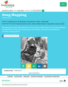
Song Mapping
Students explore locations on the United States map. In this map skills lesson, students recite the song This Land Is Your Land and locate various places listed in the song on the map.
Curated OER
Latitude and Longitude
Students demonstrate how to locate places on a map using a grid. In this map skills lesson plan, students are introduced to latitude and longitude lines. Students define these terms and view a large map of a state. Students come up to...
Curated OER
United States: Physical Features Fun
In this map worksheet, students color and trace eleven listed features on a map of the United States. Students answer six additional questions about the map. A United States map is not provided. However, websites are provided to find...
Curated OER
Food on the Map
Students work together to examine the tastiest towns in the United States. After discovering the names of the equipment, they identify the seven continents. They take a survey and locate the cities and states of the foods mentioned.
Curated OER
Kildare, USA: An Environmental Health Simulation
Your biology class plays the role of epidemiologist when a mysterious illness breaks out in Kildare, USA. Using interviews with doctors, patients, and local citizens, maps, the results from different materials sampling, they work to...
Curated OER
Storm Clouds-- Fly over a Late Winter Storm onboard a NASA Earth Observing Satellite
Students study cloud data and weather maps to explore cloud activity. In this cloud data instructional activity students locate latitude and longitude coordinates and determine cloud cover percentages.
Curated OER
Lesson 3: Seven Day Road Trip
Students plan a seven day road trip. In this travel lesson plan, students plan a driving trip that includes five major cities or attractions in Florida or another state of their choice. They show the trip on a map, calculate distances...
ProCon
Israeli - Palestinian Conflict
Many people think the best solution to the Israeli-Palestinian conflict is a two-state solution. After reviewing the available resources, scholars determine whether they agree with that approach. They analyze graphs and charts about...
Curated OER
Reading a Local and National Weather Map
Students investigate weather maps. In this weather lesson, students discover the meaning of different weather icons and symbols. Working independently, students use the local forecast to correctly label a state map.
Curated OER
Reading a Local and National Weather Map
Students examine weather maps. They examine icons and map symbols. Students explore vocabulary words related to weather. Students analyze and evaluate information provided on the weather map.
Curated OER
Our Land Lesson 2: Song Mapping
Young scholars study the meaning of philanthropy as giving of time. talent, and treasures. They sing This Land Is Your Land while locating five of the places on a map of the United States showing that relief office are everywhere. They...
Curated OER
Bronx Zoo
Pupils prepare for a field trip to the Bronx Zoo. They use maps and descriptions of animal exhibits to give and interpret directions on how to navigate the zoo. They play games, participate in pairwork and whole class discussion.
Curated OER
Latitude and Longitude
In this latitude and longitude activity, learners find a set of 7 coordinates on a map. An answer key is included; a website reference for additional resources is given.
SeaWorld
Animal Migrations
Here is a fabulous set of activities for your young scientists. Each instructional activity contains map, hands-on, and game activities that will help the class understand why and how animals migrate from one place to another. First...
Curated OER
Exploring the USA and the World with Cartograms
Young scholars investigate cartograms in order to explore the different countries on Earth. In this world geography lesson, students use the Internet to analyze data on different cartograms. Young scholars compare data, such as...
Curated OER
Topo Map Mania!
Seventh graders describe the major features of maps and compasses. They read a topographical map. They take a bearing using a compass. They practice using scales on a map.
Curated OER
Muppet Treasure Island
Young scholars watch the movie "Muppet Treasure Island" and then taking on roles of characters in the movie answer navigational questions to try discover the location of a treasure hidden by the teacher.
Curated OER
Projects For USA Units
Young scholars study different regions of the United states through interdisciplinary activities. This lesson presents very creative, artistic ways for students to explore the variety of regions found in the United States.


