Curated OER
Cultural Anthropology Study Using the Fundamentals of Geography and GPS
Students, in groups, operate the GPS unit, plotting each head stone with accompanying description. Two other students to log in data that corresponds to the given points. One student to note general observations
Mission Valley Ambulance
The Crucible
Prepare readers of Arthur Miller's The Crucible for a timed, in-class essay assessment with seven graphic organizers that ask individuals to note conflicts, both internal and external, characters' actions, possible motives, and changes...
Curated OER
Where Am I?
Extensive background on marine navigation is provided for you as the teacher. Assign groups to research marine navigation techniques and construct astrolabes. Resource links are listed for extension ideas. If you are teaching an...
Curated OER
Names in the Field: A Simple GPS Field Exercise
Students explore basic methods of GPS data collection, uploading the data to a computer, and making simple maps of their data using GIS software. They create a map of the data using GIS software (or Excel)
Curated OER
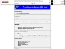
From Home to School, GPS Style
Young scholars are introduced and increase proficiency in the use of the hand held GPS system. They explore the meaning of longitude and latitude lines, then identify the parts of the map.
Curated OER
GPS Receiver Basics
Learners practice using a GPS receiver. They walk in different directions and monitor their progress on maps. They enter specific locations and use information given to them to get them back to their original locations.
Curated OER
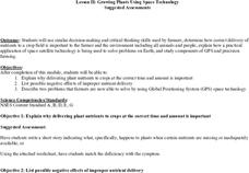
Growing Plants Using Space Technology
Students explain why delivering planet nutrients to crops at the correct time and amount is important. Students list possible negative effects of improper nutrient delivery. Students descrive two problems that farmers are now able to...
Curated OER
GPS Treasure Hunt
Students practice using a GPS receiver and reading directions in an on-campus field trip. Students can identify a building stone, tree, or plant at each stop depending on which area of science is being studied.
Curated OER
Hide and Seek with Geocaching
Students locate objects using a Global Positioning System. In this global geography lesson plan, students explore latitude and longitude using a GPS in order to locate objects.
Curated OER
And a Star to Steer Her By: A Field Trip Guide for the Planetarium Show
In this field trip study guide for the planetarium show lesson, students construct a model of the Earth and describe the relative positions of the continents using latitude and longitude. Students construct a star chart to find...
Curated OER
Finding the Way
Students identify and research navigational tools used in deep sea explorations. They are introduced to a compass, the Global Positioning System and sonar technology and then describe their uses in underwater exploration.
Curated OER
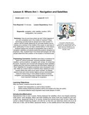
Where Am I: Navigation and Satellites
Young scholars explore the concept of triangulation that is used in navigation satellites and global positioning systems designed by engineers. They determine ways these technologies can help people determine their position or the...
Curated OER
Black Holes...III
In this black holes worksheet, students use a formula for time dilation which causes delays in events that occur near the black hole. They solve 6 problems using the equation.
Curated OER
Lichens as Air Quality Indicators: A beginning lichen identification study (2003
Middle schoolers use GPS and trees to explore lichens and air quality.
Curated OER
Where Am I - Navigation and Satellites
Students explore geography by completing a navigation activity in class. In this satellite positioning instructional activity, students define terms such as orbit, satellite, GPS and triangulation. Students view diagrams of the Earth's...
Curated OER
Getting it Straight with Latitude and Longitude Skills
Teachers can help students learn latitude and longitude skills using games and other motivating activities.
Science 4 Inquiry
Edible Plate Tectonics
Many people think they can't observe plate tectonics, but thanks to GPS, we know that Australia moves at a rate of 2.7 inches per year, North America at 1 inches per year, and the Pacific plate at more than 3 inches per year! Scholars...
NBC
Nutrition, Hydration, and Health
NFL football in science class? Yes, please! In an engaging and motivating three-day lesson, kids take a look at their own nutritional habits and needs compared to those of an NFL player, then experiment with the effects of hydration on...
NOAA
Calling All Explorers
Let's get moving! The second installment of a 2-part series of six adventures helps learners take part in individual explorations by sea and by land. After navigating the waters in an informative WebQuest, groups create and hide their...
CK-12 Foundation
Location on the Earth: Longitude and Latitude
To what degree do learners understand coordinates? Get them some practice in Yosemite National Park in a simple, fun interactive. Pupils explore a map and locate coordinates of popular sights within the park, then answer questions to...
Curated OER
Where in the World?
Students explore how GPS works, the mathematics behind the technology, and how GPS is used. They find positions in one and two dimensions, and participate in a WebQuest that explores how math is used to find a location on Earth using GPS.
Curated OER
You want me to do what with this Dirt?
Eighth graders explore how to take soil samples and use GPS to determine the location of the site they have chosen to take the samples.
Curated OER
Testing Soils for Garden Planting
Sixth graders collect soil samples and record the location of the samples by using GPS.
Curated OER
Can You Find Me Now?
Students locate points using longitude and latitude coordinates. They locate their home using longitude and latitude, explore the uses of GPS, and accurately use a GPS.


