Curated OER
Victory in Europe, 1944-1945
Students examine the overall strategy pursued by the Allies in the final moths of World War II in Europe by examining military documents and consulting an interactive map of the European theater.
Curated OER
Making a Brand for Ourselves the "Cowboy" Way
Students define cowboys and learn about their roles on rangelands. In this rangeland lesson, students define cowboys and cowgirls and complete a KWL chart. Students read Cattle Kids and Til the Cows Come Home. Students visit the...
Curated OER
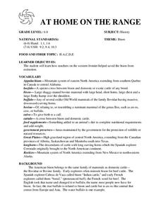
AT HOME ON THE RANGE
The student will learn how ranchers on the western frontier helped saved the bison from extinction.Hand out student worksheets. Have students read the information about bison on Student Worksheet A before completing Student Worksheet...
Curated OER
The Science of Weather: Hurricanes
Students use this USA today activity to learn about hurricane season. In this hurricane lesson plan, students study the map of the earth and hurricane science. Students complete discuss questions. Students draw a map of the United States...
Curated OER
Come One, Come All
Students analyze information from core map and other sources and construct routes from New York and Boston to Cincinnati as they might have existed in 1835.
Curated OER
Alaska the Elephant
Students explore an Internet website, locating and matching the shape of an elephant's head to a state in the U.S. They complete an Alaska worksheet, identifying other geographical locations surrounding Alaska.
Curated OER
Map on the Wall
Students examine the Ogallala aquifer water storage facility, identify rivers that refill the aquifer, and locate major cities near by. Students make maps of the area.
Curated OER
Scenic Attractions in Four Corners
Fourth graders find and list scenic attractions in SE Utah and the Four-Corners-region. They identify geographic characteristics of Utah and other states in the western region of the United States. They review cardinal directions and...
Curated OER
History in Pictures
Sixth graders interpret diary entries, letters and read maps to better understand portions of history. They create an oral presentation demonstrating understanding of how cultural characteristics have been communicated through art,...
Curated OER
The Displacement of the Native Americans
Seventh graders comprehend the interaction and conflict between Native Americans and white settlers in the years following the Civil War. They examine how those conflicts impacted the Native American way of life on the Great Plains.
Delegation of the European Union to the United States
The Founding and Development of the European Union
How did Europe transition from a period of conflict to a period of sustained peace? As class members continue their study of the history and development of the European Union, groups examine the events in six time periods, from the...
Curated OER
Aboriginal Peoples And The Universals of Culture
Sixth graders research specific features of a province or territory of Canada. In this Canadian history lesson, 6th graders identify aboriginal culture areas on a map, identify cultural features represented in their region, and...
Curated OER
Decolonization and Self-Determination
Students define and discuss colonialism and self-determination. After reading the European's view on the topic, they analyze a map of imperialism in 1914. They watch excerpts of a video and take notes on various United Nations...
Curated OER
New Food Saves Lives, Could End Hunger
Students locate the country of Niger, then read a news article about a new type of food that is being used to fight childhood hunger in Africa. In this current events instructional activity, the teacher introduces the article with map...
Curated OER
Controlling the Flow of the Colorado River: A Study of Dams
Students research and map the Colorado River and its dams and predict the effects of a dam on an area. They suggest reasons a dam would be built and compare the Colorado River system with other major river systems within the US and...
Curated OER
Australia
First graders are introduced to the country of Australia through books, Internet research, maps and music. They listen to stories, watch videos, decorate cookies and participate in an Australian-themed day of activities.
Curated OER
A Sense of Place
Students identify and describe one or two places significant to them using vivid language. They describe one of those important places in accurate, evocative language showing an original perspective.
Curated OER
New American Diplomacy
Students explore the presidential era of Teddy Roosevelt. They read about American diplomacy in Asia, the Caribbean, and discuss the Panama Canal and the Roosevelt Corollary. As a class, students take notes and create a bubble map for...
Curated OER
The Railroad Booms!
Students discover how the railroads contributed to the interdependence between farms and towns. Using the railroads, they describe the effect of them on western settlement and the relationship between their location and the availability...
Curated OER
Westward Ho
Students examine primary sources regarding Western migration. In this Manifest Destiny lesson, students determine why the pioneers moved west and what the trip was like as they examine sources and write journals based on their findings.
Curated OER
European Explorers of North and South America
Sixth graders explore the connection between the geography of America and the migration of the Native Americans to the American continents to the future conquering of the continents by the Europeans. They discuss the causes and effects...
Curated OER
Views of the American West: True or False?
High schoolers explain that a landscape painting may or may not accurately represent a specific place. They identify techniques that create the illusion of three-dimensional space on a flat surface.
Curated OER
Geography: Why Is the Sacremento Valley a Good Place to Grow Rice?
Third graders locate the Sacramento Valley in California where rice is grown. In this rice growing location lesson, 3rd graders locate the Sacremento Valley, California on a map, and color the mountain ranges and terrain that is around...
Curated OER
Lewis and Clark Expedition
Ninth graders examine the goals of the Lewis and Clark Expedition and identify the present day cities, towns, rivers, and regions that are on the route of the expedition. They complete an online WebQuest, recreating the route of the...


