Curated OER
How to Use Technology to Teach Landforms
Young scholars create a landform table on the computer. For this geography lesson, students use Microsoft Word to design a 3 column table. They list different landforms, examples, and attach a picture of each.
Science Matters
Landforms from Volcanoes
Three major types of volcanoes exist: cinder cone, composite/strata, and shield. The 18th lesson in a 20-part series covers the various landforms created from volcanoes. Scholars work in pairs to correctly identify the three types based...
Curated OER
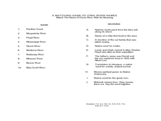
Landforms of Iowa
Students observe the landscape and different landforms where they live. In this landforms lesson plan students list and define materials that make up their local landforms.
Curated OER
Changing Landforms
Students investigate different types of landforms. For this landforms lesson, students explore landforms by participating in a WebQuest. Students research the reasons behind landforms changing and create a picture using KidPix.
Curated OER
Landforms Slideshow
Students identify twelve different types of landforms, and create a slideshow about each landform that includes a title, pictures, definitions, conclusions and a reference page.
Curated OER
Oh, the Regions
Focus on the geography of Oklahoma. In this activity, learners compare different geographic regions in Oklahoma, create a collage to share their results, and identify important landforms throughout the United States, such as the Rocky...
Curated OER
Geography Terms
Students identify different landforms and fill out a worksheet where they explain what each landform is. In this geography lesson plan, students fill in a landform map and then use landform words as they describe the landforms.
Curated OER
The Earth's Crust
Students use clay to form models of the different landforms and then complete a data table using a map, atlas, or the Internet to locate famous landforms in the United States. Students complete various activities, writing down their...
Space Awareness
Valleys Deep and Mountains High
Sometimes the best view is from the farthest distance. Satellite imaging makes it possible to create altitude maps from far above the earth. A three-part activity has your young scientists play the role of the satellite and then use...
Curated OER
Natural Resources
Students explore Iowa geography and topographic maps. In this geography and topographic maps lesson, student investigate maps, newspapers, Iowa flora and fauna. Students gain an understanding of how different landforms can be identified...
Science 4 Inquiry
Let's Get Moving
Rivers top the list of causes of erosion over time. Scholars experiment with wind, water, and ice reshaping sand. They connect the simulations facts about erosion and deposition to understand unique landforms such as the Grand Canyon and...
Curated OER
Earth Book
After viewing a teacher-led demonstration on a variety of landforms of the Earth, 1st graders create an Earth book. This nicely-done hands-on lesson plan has students produce books that describe, in pictures and words, different aspects...
Curated OER
Neither Wind Nor Rain
Here is another in the interesting series of lessons that use the special State Quarters as a learning tool. This one uses the North Dakota State Quarter. During this lesson, your class learns about the different patterns of erosion, and...
Curated OER
Virtual Field Trip
Fifth graders are introduced to the concepts of weathering and erosion. In groups, they rotate between different stations to discover how each process effects different landforms. To end the lesson, they discuss each change in the...
Science Matters
Eruptions and Volcano Types
The Mammoth Lakes area regularly releases warnings to hikers and skiers to be careful because melting snow releases trapped gases from volcanic vents. The 17th lesson in the 20-part series opens with a demonstration of carbon dioxide...
Curated OER
How Does Flowing Water Shape a Planet's Surface?
Students investigate how flowing water influence landforms. In this earth science lesson, students observe water behavior as it flows from the stream table at various inclinations. They discuss whether water shaped Mars landforms or not.
Curated OER
Wet Water, Dry Land
Students observe and examine relationship between landforms and bodies of water, recognizing differences between them. Students then define island, peninsula, isthmus, archipelago, lake, bay, straight, system of lakes, and identify land...
Curated OER
Investigating Different Rock Types
Students analyze a rock using their eyes and then a hand lens. In this science lesson, students determine and discuss how hard or how easy it was to find and classify the assigned rock. Students record their observations on an index card...
Curated OER
Plate Tectonics & Land Forms
Fourth graders discuss the different interactions of plates and the ways mountains are created. In this plate tectonics lesson students complete an activity in groups.
Curated OER
What on Earth is in the Earth?
Students explore the physical properties of sand, soil, and rocks and sort, classify, compare, and contrast the materials found in the soil. The differences between the living and non-living parts of the soil is discussed.
NOAA
Currents
A deep ocean current circles the globe at a force that is greater than 16 times all the world's rivers combined. Groups analyze the effects of submarine topography on deep ocean current speed. They then determine how this speed affects...
Curated OER
Floodplain Modeling
Students simulate the impact of fluctuating river volumes on structures and landforms. They experiment with table top-sized riverbed models and water. Students consider how human design can help mitigate the effects of a flood.
Curated OER
Weathering and Erosion
Students conduct two experiments. In this weathering and erosion lesson, students identify the different ways that weathering occurs, name the natural elements of weather and explain the process of erosion. Students watch a PowerPoint on...
National Park Service
Glaciers and Water
Explore the amazing power of glaciers with a hands-on earth science experiment! After first learning basic background information, learners go on to create their very own chunks of frozen water and gravel in order to observe first-hand...


