Curated OER
A Contouring We Go
Students examine the built environment and infrastructures of their community by constructing contour equipment, using the equipment, and comparing their results to current topographical maps of the same area
It's About Time
Effects of Plate Tectonics
Explore our world from within as you lead young scientists on a thrilling adventure. Pupils examine the location of plate boundaries to determine earthquake and volcano distribution around the globe and explore the cause of hot spots in...
Curated OER
NIGHT AND DAY: DAILY CYCLES IN SOLAR RADIATION
Students examine how Earth's rotation causes daily cycles in solar energy using a microset of satellite data to investigate the Earth's daily radiation budget and locating map locations using latitude and longitude coordinates.
Curated OER
The Prairie Climate
Ninth graders research the average temperature and precipitation of a prairie region to determine the type of climate it is, and how it differs from other biomes. They examine the types of adaptions animals have made to live in the...
National Endowment for the Humanities
Lesson 1: On the Road with Marco Polo: A Boy in 13th Century Venice
Learners investigate Marco Polo's life as a young boy in 13th century Venice. They analyze maps, explore various websites, complete a chart and answer discussion questions, and create a travel brochure about visiting 13th century Venice.
Peace Corps
Family
Family traditions are the focus of a lesson that explores the lives of children in India and those in your classroom. Scholars examine their own family roles and traditions, then respond to an informative text detailing a young girl's...
Curated OER
COLD SEA WATERS
Students examine how old sea waters affected the local and state area during the summer of 1998. Studying a detailed web-site helps students examine sea temperatures.
Curated OER
Cities of the World
Young scholars identify the symbol for cities on a political map. In this world map lesson, students identify specific cities on the World Political Map. Young scholars should identify the country in which the city is located. Students...
Curated OER
Where Should We Put a Store?
Students analyze population data. They convert population data into simple density maps to help make decisions about their world. They select the best location for a school store based on population density. They present their maps...
Curated OER
Maps
First graders look at their classroom or school setting. They use positional word to describe where things are located in the school. Students discuss a map and why they are important. They read the story "Taylor's New School" and...
Curated OER
Making a Globe
Young scholars examine the mercator projection or nautical chart and observe how global maps do not have the same distance as flat maps. They design handmade globes using the meridians and equator as guides to draw in the land. They...
Curated OER
Where in the World War? Mapping WWII in the Pacific
Students study the geography of the Pacific theater of World War II. They study maps to examine the geography and features of the land.
Curated OER
Celebrating the Solstice and Equinox
Fourth graders graph the number of daylight hors throughout the year and examine why day length varies. They discover that seasonal changes and latitude on Earth affect the number of hours of daylight in each day. Students listen to...
Curated OER
Iraq, Where's That?
Students identify the Middle Eastern countries on the map and the oil-producing countries of OPEC in the region. They examine whether the presence of important producing oil fields qualifies as a characteristic of this region.
Curated OER
Rain Forests: A Disappearing Act?
Students examine and locate rainforests on maps, and research the patterns of their destruction. They develop a bar graph of rainfall and temperature data, write a journal entry, and research the people, animals, and plants/products of...
Curated OER
The Clever Monkey Rides Again
Students read and explore a West African folktale. In this folktale lesson, students read the book The Clever Monkey Rides Again and examine West African proverbs. There are several related multi-subject extensions on this lesson which...
Curated OER
GEOGRAPHY: SPACE CENTERS
Students examine the descriptive science dealing with the surface of Earth, its division into continents and countries, climate, natural resources, inhabitants and industries of the various divisions and analyze the political geography...
Curated OER
Ireland: the Emerald Isle
Third graders complete a unit of study that examines several perspectives of Ireland. They explore how climate shapes Irish culture, reference historical and political maps, compute exchange values for Irish money, complete worksheets,...
Curated OER
Decisions, Decisions, Decisions
Students examine graphs to find the most appropriate for various kinds of data. For this graphing lesson, student create bar, line and circle graphs. Students create graphs electronically and manually interpreting the data.
Curated OER
Roman Archy
Third graders use Google Earth to examine Roman architecture. For this ancient Rome lesson, 3rd graders visit the noted URLs to look at examples of Roman architecture. Students work in teams to examine data about the structures.
Curated OER
Interactive Atlas
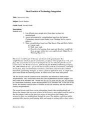
Second graders examine the different ways people move from place to place in a neighborhood. Using the interactive online atlas MapQuest, they identify the various ways people move around their own neighborhood by creating a map and...
National First Ladies' Library
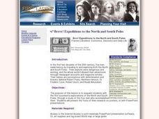
Brrrr! Expeditions to the North and South Poles
Students examine the first successful explorations of the North and South Poles, through a study of the four men who accomplished them. They present the fruits of their research on posters, or with PowerPoint presentations.
Curated OER
Build the Tallest Building
Young scholars examine the design and construction of skyscrapers. They use the internet to research information about different types of skyscrapers. They create their own building and defend it to the class.
Curated OER
Children in the United States and Japan
Students locate Japan on a map or globe and describe the relative location of Japan. They use the Internet to investigate cultural characteristics of children in the United States and in Japan. They use a Venn Diagram as an...


