Curated OER
Make a Classroom Map
Students map the items in their classroom to explain the importance of coordinate systems.
Curated OER
Topo Map Mania!
Students read and use topographical maps. They also use a compass to find bearing to an object on a map and in the classroom. Ask your students how they might travel to somewhere they have never been to befo
Curated OER
Mapping the News
Students explore cartography. For this map skills and map making lesson, Students work in groups to create wall size world maps including legends, compass roses, latitude and longitude, and physical features. Students collect current...
Curated OER
Map It!
Fourth graders demonstrate map making skills by using the computer to create maps of the geographic features, regions, and economy for their state.
Curated OER
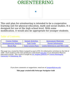
Orienteering
Everything you wanted to know about orienteering, and more! Take your class on an adventure with this creative activity. You will need to gather some supplies and materials and maps for your specific location, but the unit sounds like it...
Curated OER
Volcano Contour Models Activity
Students experiment with water levels and plastic topographic volcano models to determine the contour lines that would be used to create a topograpohic map of a volcano. They use the traced lines to actually develop the map.
Curated OER
Fossils and Lithologic Units
Practicing paleontologists map the geologic time scale, simulate the formation of sedimentary rock, and analyze fossil data. Instructions for four activities and five assessment choices are provided for the teacher. This comprehensive...
Curated OER
What Are Maps For?
Young scholars create a story about a problem someone could have which could be solved by the use of a map. They complete a worksheet that guides them through the features of a map of Chicago. Then they calculate story problems using...
Curated OER
Draw an Inch, Walk a Mile
Learners work in small groups to solve the problems presented. The main project, mapping the classroom, use these discussions to collaborate in creating a tangible demonstration of their understanding.
Curated OER
Stadiums in America
Let's play ball! A great springtime activity to learn about ratios. This activity challenges learners to draw stadiums to scale on standard letter paper and also on construction paper. This three-day lesson plan includes a pre-assessment...
Curated OER
Zipping Through Our Solar System and Beyond
Launch your class on an exploration of the solar system. Learners construct solar system models to scale and get a better understanding of our place in the vast void of space. This is a great way for them to cement their understanding of...
Curated OER
Geography and Culture of China
Take out a map, a paper, a ruler, and those coveted colored pencils for a lesson plan on Chinese culture and geography. This is a multifaceted approach to basic geography skills that incorporate story telling, class discussion, primary...
National Endowment for the Humanities
Lesson 3: On the Road with Marco Polo: From Hormuz to Kashgar
Young explorers examine the route that Marco Polo and his father traveled to reach China. They examine online maps of the Silk Road and harsh terrain of Afghanistan to determine challenges that may have been encountered during travel.
Foundation for Water & Energy Education
What is the Water Cycle? Activity A
Hydrologists create a concept map about how water is used and a sentence strip defining water and describing its unique properties. Small groups work together to fill a small milk carton and compute the mass of water inside. The next...
Curated OER
Waldseemuller's Map: World 1507
Students investigate the 1507 word map. In this world geography activity, students examine the details of each section of the map and then draw conclusions about how the people of 1507 understood the world. Students are evalated on...
Curated OER
Where Am I? Navigating Around the Globe
Third graders review spatial sense learned in grades one and two. They measure distances using map scales. They use atlases, and on-line sources to find geographical information.
Curated OER
You Are Here
Students map local places and learn to use scale and distance. In this mapping lesson, students map their school and a favorite place. Students recreate their maps showing distance and scale sizes. Students locate their location on a...
Curated OER
Mapping Puerto Rico
Students use maps to discover where Puerto Rico is located. In groups, they use the internet to research the vegetation. They also compare and contrast the relationship between the United States and Puerto Rico's government.
Curated OER
Rivers, Maps, and Math
Students use maps to locate and label the major rivers of North and South America. Using the internet, they identify forests, grasslands, mountain ranges and other landforms on the continents as well. They compare and contrast the...
Prince William Network
Migration Math Madness
A great way to incorporate math into life science, this instructional activity has learners measure migratory routes on a map and calculate the actual distance that shorebirds on the routes would cover. Learners compute the distance...
University of Wisconsin
What’s a Square Foot Anyway? Laying Out the Design Plan
Clever! Participants don square-foot cardboard shoes to mark out the rain garden plot that they have spent the last few weeks designing. In this way, they are practicing scale modeling as well! Note that this lesson is part of a unit,...
Curated OER
Introducing Topographic Maps: Guiding Students from Concrete Models to Graphic Representations
Students interpret topographic maps and infer human activity as it is influenced by the landscape.
Curated OER
Plate Tectonics: Second Grade Lesson Plans and Activities
Second graders explore convection currents and how they relate to the movement of tectonic plates. Then, young geologists reconstruct Pangaea with a worksheet and pinpoint plate boundaries on a map using locations of earthquakes and...


