Curated OER
Australian Aboriginal Art and Storytelling
Young explorers investigate Australian Aboriginal culture by listening to traditional Dreamtime stories and examining dot paintings created by Aboriginal artists. In addition, they locate the country on maps, discuss the geography of...
Curated OER
Enough To Make Your Head Spin
Students examine body language in the United States and Bulgaria. They also discover other forms of communication. They also examine a map of Bulgaria.
Curated OER
How Do Artists Effectively Relate Historic Events?
Students explore African American migration. In this black culture and history activity, students use a map to identify northern and southern states in which African Americans lived in the 1900s. Students observe and describe objects and...
Curated OER
Reference Materials
After a class discussion where kids share how they find answers to their questions, learners explore the world of reference materials such as, an atlas, an almanac, and an encyclopedia. The Internet is also discussed as a way to access...
Museum of Disability
Looking Out for Sarah
Perry the dog is Sarah's best friend and her guide to the visual world. Young readers learn about guide dogs and communication with Looking Out for Sarah by Glenna Lang, through a series of discussion questions and activities.
Edmentum
Roald Dahl Day
Who's your favorite Roald Dahl character? What book by Roald Dahl is the most exciting for you? Explore the wacky world of Matilda, The BFG, The Twits, The Witches, James and the Giant Peach, and more with a helpful resource pack for...
Skyscraper Museum
Changes in a City Over Time
Investigate the growth and development of New York City with the final lesson in this four-part series on skyscrapers. Learners first explore the concept of urban growth by looking closely at a series of three paintings made of Wall...
National Nanotechnology Infrastructure Network
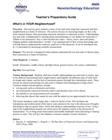
What’s In Your Neighborhood?
Chart your way to an understanding of nanoscale. Using a Google map, learners estimate a radius around their location of 1,000 and 1,000,000 meters. Predicting what 1,000,000,000 meters would look like takes them off the charts!...
Curated OER
New Perspectives
Students examine maps that are designed to give different perspectives. They create mental maps that illustrate their own perspectives and those of people from other parts of the world.
Curated OER
Identifying Continents and Oceans
Students locate and identify the four major oceans and the seven continents on a world map. They use an unlabeled world map and compass rose to describe relative locations of the continents and oceans.
Curated OER
Food Detectives
Students investigate the regions in which particular grains are grown. Using the packaging from a variety of foods, grains are identified and the general locations where they are grown are plotted on a map.
Curated OER
Piecing It Together!
Students use clues to identify states on maps. They work together to identify the state a major city is in as well. They share their map with the class once it is completed.
Curated OER
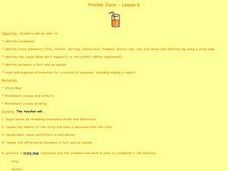
Freckle Juice- Lesson 6
Students read Freckle Juice. In this comprehension instructional activity, students complete a story map and discuss cause and effect based on readings from Freckle Juice.
Curated OER
Individualizing
Students practice reading maps as they plan a day trip. Using the internet, they select a destination of their choice and choose a place to stop along their journey. They write an explanation on why they want to visit the place to end...
Curated OER
Temperature Zones
Students read and make inferences about a map showing various temperature zones across the United States.
Curated OER
What Do You Know About Oceans?
Students brainstorm and discuss what they know about oceans and seas, read poem My Ocean Speaks by Olga Cossi, discuss narrator's feelings about ocean, write reflective journal entries about their experience or inexperience with the...
Curated OER
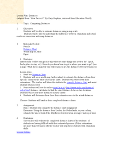
Comparing Distances
Students practice estimating distances by analyzing a map. In this length measurement lesson plan, students view a map with a distance key and use their measurement skills to estimate the distance between two cities. Students utilize an...
Curated OER
Nina Bonita: Culture and Beauty
Students read Nina Bonita by Ana Maria Machado. For this reading comprehension/ geography lesson, students recall various parts of the story and create a map of where the rabbit traveled throughout the story. They participate in group...
Curated OER
Where Should We Put a Store?
Students analyze population data. They convert population data into simple density maps to help make decisions about their world. They select the best location for a school store based on population density. They present their maps...
Curated OER
Time Zones
Third graders have a greater understanding of time zones, explain the basic history and purpose in the creation of time zones, and use time zone maps to calculate the time/day in a certain area.
Curated OER
Dandelion Seed Lesson Plan
Students create a map using the story The Dandelion Seed by Joseph Anthony. In this early childhood lesson plan, students develop map skills as they illustrate the path of the seed in The Dandelion Seed.
Curated OER
Africa - Not Just One Big Safari
Students draw a picture of an African city that is similar to a U.S. city and discover how other parts of the world have the same types of buildings. In this global similarities lesson, students create a map of an ...
Curated OER
Locating Places
Students demonstrate how to use the map grid system. In this map skills lesson, students are given coordinates to locate several locations on a world map. Students use the map grid system to identify these locations.
Curated OER
Treasure Hunt!
Students follow directions on a worksheet to follow directions on a map of the United States and Territories of the United States. In this directions worksheet, students use a compass rose and learn the directions.
Other popular searches
- World War Ii Map
- World War I Map
- World War 2 Map
- World War I Outline Map
- World Climate Map
- World Biomes Map
- World Outline Map
- Blank Map of the World
- World Political Map
- Ancient World Greece Map
- World Time Zone Map
- Deciduous Forests Map World


