Curated OER
U.S. State Reports
Young scholars conduct Internet research on a chosen U.S. state. They include information about the history, climate, geography, symbols, and tourist attractions of their state, and write an original poem.
Curated OER
Surprise at Pearl Harbor
Young scholars review the concept of courage and relate it to their daily life. As a class, they are introduced to the events of December 7, 1941 at Pearl Harbor. Using a map, they locate Hawai'i and label the islands. They use the...
Curated OER
The World At Your Fingertips
In this the world at your fingertips worksheet, students bring in 5 items from home that are not made in the U.S., then complete a chart, indicate on a map and answer 6 questions about imported items.
Curated OER
Agriculture - It Doesn't Just Happen
Sixth graders examine the role of the US Department of Agriculture. In this United States Agriculture lesson plan, 6th graders create maps with sites and specialty areas. Students create a presentation on the topic they were given to...
Curated OER
The Seminole Wars
Young scholars investigate the Seminole Wars, their events, and treaties. They create a timeline, label a map of Florida showing the Seminole population and do research about life on an Indian reservation.
Curated OER
The Seven Wonders of the World: The Statue of Zeus at Olympia
Students explore the culture of classical Greece by examining The Statue of Zeus at Olympia. In this Seven Wonders of the World lesson, students will expand their understanding of Greek mythology, the Olympics and the Greek Isles....
Curated OER
Journey to Tibet
Students create "Culturegrams" from the library and travel guides provided during class. They use the library and PC lab during study hall to work on a PowerPoint presentation and show the PowerPoint to the class to describe your trip.
Curated OER
Unique Landforms
Students create a travel route among different landforms and way the cost and benefits of traveling this way. In this traveling lesson plan, students work in groups and analyze their conclusions.
Curated OER
The Great American Desert
In this American deserts worksheet, students study the images and read the passages to learn about the 6 divisions in the American landscape: the Eastern lowlands, the Flood Plain, the Great Plains, the Rocky Mountains, and the Pacific...
Curated OER
Settlers: Creating Family Trees & Historical Plays
Students discuss who the founding members of their community were. In this community family tree lesson plan, students learn how to read a family tree and discuss information about the founding families of their community.
Curated OER
Rainforest Resources
Students explore products of the rainforest. In this environmental stewardship lesson, students discover the resources that the rainforest holds and examine products from the rainforest used around the world.
Curated OER
Locke and Walnut Grove: Havens for Early Asian Immigrants in California
Students use readings, maps and photos to examine the life of Japanese-American immigrants in Locke and Walnut Grove in the early 1900s. They discuss their research findings, role-play the lives of immigrants and write responses.
Curated OER
Social Studies: The Connecticut Hill Community
Pupils discover the reasons for the settlement of the Connecticut Hill Community. Through an examination of the climate, occupations of the inhabitants, and demographics, they discuss reasons people choose locations for settlement. ...
Curated OER
Music to Learn Countries and Capitals Around the World: Learning Countries and Capitals in Asia
Students use musicto explore the countries and capitals of Asia.
Curated OER
Exploring National Flags
Sixth graders examine the importance of flags throughout the world. Examining different countries, they determine the geographical and historical contributions in the past and modern times. They compare and contrast the flags of five...
Curated OER
Design Your Own Building
Students explore the use of design principles in the real world. They evaluate how problems can be solved using design principles. In groups, students design the floor plan for a building of their choice.
Curated OER
My Community: Then and Now
Students compare and contrast their community to what it was like 50 years ago. They research various aspects of their community and compare and contrast with what it is like now. Students present and discuss their findings.
Curated OER
Glimpses of Japan: Picture books are an avenue to geographical knowledge
Student gains insight into the culture of Japan. They articulate the main ideas and supporting details, also they create a "glimpse of Japan" with an illustrated and written summary of the main idea and four supporting details from the...
Curated OER
Canada...A Visual Journey
Students work together to analyze the six natural regions of Canada. Using this information, they create a visual representation of each region on a large wall map and present it to the class. They must identify five key points of each...
Curated OER
Greece: The Landscape
Students work in small groups to create a topographic map of Greece. They must include labeled line drawings of bordering countries and bodies of water. Students use salt and flour clay to make Greece three dimensional, showing the many...
Curated OER
Finding Your Spot in the World
Students practice locating places on a Thomas Brothers map. In this map skills lesson, students locate places on the map of where their ancestors are from and then practice finding various community places on a map. Students graph the...
Curated OER
The Landscape of Poland
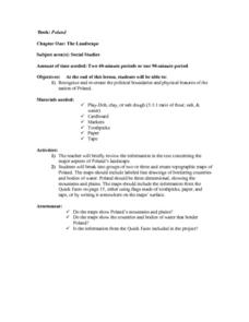
Students recognize and re-create the political boundaries and physical features of the nation of Poland. They create three dimensional topographic maps of Poland. In addition, they compose two journal entries written in two different...
Curated OER
Comparing Neighbors
Students compare and contrast Minnesota to its Canadian neighbors. In this geography lesson, students work in groups to examine a map for their political division to Minnesota. Students compare and contrast information about Minnesota to...
Curated OER
As Simple as Beans: Canada's Population
Students gather facts about Canada from various maps. In this Canada lesson, students use beans to relate the populations of the U.S. and Canada. Students create population distribution maps based on the placement of the beans.
