Curated OER
What Do Maps Show?
This teaching packet is for grades five through eight, and it is organized around geographic themes: location, place, relationships, movement, and regions. There are four full lessons that are complete with posters, weblinks, and...
Curated OER
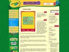
Contour Maps
Students review various contour maps, including local ones, to identify landforms such as mountains and plains. They create a 3-D contour map of an imaginary location that shows at least 10 changes in elevation. Afterward, they write a...
Curated OER
Lesson 2 Activity 2: Mapping Mount St. Helens
Students use topographic map skills to interpret impact of the May 18, 1980 eruption of Mount St. Helens on the volcano's topography, and draw profile views of Mount St. Helens before and after the May 18, 1980, eruption.
Curated OER
Layers with Lines
Students examine topographical maps and the challenges faced by cartographers when drawing the maps. While creating collages, they use contour lines to add dimension much in the same way they are used on maps to show elevation.
Curated OER
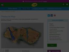
Treasure Map
Students study and recognize topographical symbols on maps. They create their own topographical Treasure Maps using symbols they learned or invent new ones. They create a bird's-eye view and include landscape details such as mountains...
Curated OER
From Maps to Models
Students explore watersheds through the use of a topographic map. They observe topographical maps and discuss their characteristics. In groups, students create a model clay island and make a topographical map of it. Afterward, groups...
Curated OER
Introduction To Topographic Map Activities
Students discuss different types of maps, their similarities and differences. Using a Topographical Maps CD-rom program students create their own map.
Curated OER
How Big is the Playground: Creating a Map
Students create a topographical map of an area outside of the school. For this mapping lesson, students compile data on angles, distances, and key landmarks for a predetermined area on the school grounds to create a map using Geometer's...
Curated OER
Let Me Tell You About...
Students comprehend the differences between flat maps and relief or topographical maps. They recognize how forces such as earthquakes, volcanoes, water, and wind-as well as human actions--have altered the Earth's surface. Students work...
Curated OER
Designing a Hiking Trail
Put your students' map skills to the test with this engaging cross-curricular project. Given the task of developing new hiking trails for their local community, young cartographers must map out beginner and intermediate paths that meet a...
Curated OER
3-D Topographic Maps
Students create a 3-D topographic map. In this map building activity, students use cardboard to create a topographic map of the Catskills mountain region.
Curated OER
Understanding Topographic Maps
Underclassmen create a cone-shaped landform and then draw a contour map for it. Then they examine a quadrangle (which was easily located with an online search), and relate it to what they experienced. The accompanying worksheet is...
Curated OER
Comparing Topographical Maps to 3-Dimensional Models
Learners apply knowledge of topographical maps and how computer programs are used to make 3-D models of areas that humans have never visited. They view a Mars Canyon movie, then map the canyon.
Curated OER
Creating a 3d Model and Corresponding Topographic Map
Students create a landform model and topographic map. In this topography lesson, students use a real landform to create a model and topographic map to scale.
Curated OER
Planning A Railroad
Students use topographical maps students explain the challenges involved in building the railroad in the Sierra Nevada mountains.
Curated OER
Edible Maps
First graders, in groups, identify major geographical features of Texas. They form a topographical map of Texas using edible dough, candy, etc. They present and then eat their maps.
Curated OER
Using Maps to Learn About Antarctic Topography
Pupils explore maps and familiarize themselves with features of Antarctica. They utilize a topographical map to create a three-dimensional model of Antarctica. They identify and describe the different regions of Antarctic ice.
Curated OER
Fantasy / Art Maps
Ninth graders analyze a fantasy art map by Jeremy Anderson, paying careful attention to the way the topographic features of the land are represented. They create a similar map of Sacramento that includes topographical features as well as...
Curated OER
Marine Energy
In small groups, energy engineers research and make a topographic map of a marine natural resource. They report to the rest of the class pros and cons of extracting their assigned resource. The two activities may take up to four class...
Curated OER
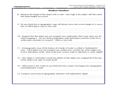
A Watered-Down Topographic Map
Eighth graders explore the ocean floor. In this topography lesson, 8th graders compare topographical maps to bathymetric charts. They will create a topographic map and note landmarks and other land features.
Curated OER
Orienteering - Lesson 1 - Maps & Map Scales
Lesson 1 of 10 lessons in this orienteering unit is about maps and map scales. After all, orienteering is all about maps, compasses, and finding ones' way around. It is imperative to be able to read maps and understand the relevance of...
Curated OER
Exploring Arizona's Biotic Communities Lesson 1: Mapping Biotic Communities
As part of a unit on Arizona's biotic communities, young ecology learners create a map. They describe how humans and animals adapt in their habitat. They take notes and create graphic organizers from articles they read. Beautiful maps,...
Curated OER
Malta: The Landscape
Pupils work in small groups to create a topographic map of Malta. They must include labeled line drawings of bordering countries and bodies of water. Students use salt and flour clay to make Malta three dimensional, showing the nearest...
Curated OER
Put Your Face on the Map
Students investigate topography and contour lines by examining a human face. In this mapping instructional activity, students create a plaster cast of a face and create a map of the contours of the face one centimeter at a time....
Other popular searches
- Reading Topographic Maps
- Science Topographic Maps
- Making Topographic Maps
- Geography, Topographic Maps
- Topographic Maps Labs
- Topographic Maps Computer
- Topographic Maps Isolines
- Topographic Maps Salines
- Topographic Maps + Salines
- Topographic Maps + Isolines
- Geography Topographic Maps
- Topographic Maps Profiles


