Curated OER
Application of Graph Theory
Learners investigate different online tutorials as they study graphing. In this graphing lesson, students apply the concept of graphs cross curricular and use it to make predictions. They define the purpose and theories behind graphs.
Curated OER
Exploring an Atlas
Students explore global geography by participating in an atlas activity. In this countries of the world lesson, students collaborate in small groups and analyze an atlas while researching continents, countries and demographics. Students...
Miami-Dade County Public Schools
Five Themes of Geography Packet
The five themes of geography are perfect for introducing learners to some of the ways that people interact with the world around them. This packet contains 20 full lessons, each focused on topics relating to the five themes of geography,...
Sharp School
Geography Project
This very simple geography project can lead to a lot of useful referential information that can be displayed in your classroom! Learners construct a poster-size map of a country, identifying major demographic points and including pie/bar...
Curated OER
Draw A Coastline
Students identify, locate and draw at least ten different geographical features on a map. Using the map, they must make it to scale and include their own legend and compass rose. They share their map with the class and answer questions.
Curated OER
Where's the Barbecue?
Students identify the major landforms, regions and rivers on a map of South Carolina. They compare the locations of the major Native American groups in the state as well. They chart where barbecue restaurants are located and write...
Curated OER
Comparing Distances
Students practice estimating distances by analyzing a map. In this length measurement instructional activity, students view a map with a distance key and use their measurement skills to estimate the distance between two cities. Students...
Curated OER
Exploring the Constellations, a WebQuest Activity
Students explore space science by participating in a class WebQuest. In this constellation identification lesson, students view star charts based on the four seasons and identify the changes our sky goes through in the course of 12...
Curated OER
What Are Alternative Fuels? Concept Mapping Alternative Fuels Investigation
Middle schoolers compare and contrast the different types of alternative fuels. They create a concept map to understand their classification. They examine the properties of matter and energy as well.
National Nanotechnology Infrastructure Network
What’s In Your Neighborhood?
Chart your way to an understanding of nanoscale. Using a Google map, learners estimate a radius around their location of 1,000 and 1,000,000 meters. Predicting what 1,000,000,000 meters would look like takes them off the charts!...
University of Richmond
Renewing Inequality: Family Displacements through Urban Renewal 1950-1966
What is progress? Who bears its cost? High schoolers consider the questions as they review data on families displaced by urban renewal projects in the 1950s and 1960s. An interactive, curated data project asks historians to consider the...
Curated OER
Where Are the Bugs?
Students trap, collect and identify arthropods in a newly created desert tortoise preserve area over a period of one school year. They determine the rate at which various arthropods take up residence in the newly landscaped area. Data is...
Curated OER
Where is Everybody?
Students collect data from different grade levels at their school and develop thematic maps which show population density, and determine how this might affect the school and themselves in the future.
Curated OER
Latitude
Pupils examine the theory of finding latitude and discuss the uses of an astrolabe, cross-staff and octant. They determine an Astronomical Table for their classroom.
Michigan Sea Grant
What's in This Water?
Pupils investigate the biological and chemical characteristics of water to determine where purple loosestrife occurs. They create data sheets to record water quality tests in several locations and work in groups to conduct the water...
Curated OER
Planetary Poster
Pupils engage in a study about the planets and create a poster as one of the projects during the study. They create individual charts for mapping the solar system so the locations can be found in mock space missions to other planets.
Curated OER
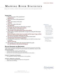
Mapping River Statistics
Young scholars research different statistics to do with the Mississippi River. They answer questions about finding data and collect it by conducting research. The research is used to construct a data table. Then students use the table to...
Curated OER
Lesson 1 Activity 1: Tools of the Ancients
Students examine how Christopher Columbus determined his latitude.
Curated OER
Wolves: Friend or Foe?
Students study wolves and their habitat in Yellowstone. In this environment and behavior lesson students create an interactive map of wolves in Yellowstone.
Curated OER
War of 1812
Eighth graders locate the major land forms and bodies of water on a map of Louisiana. In groups, they discuss the role of the Mississippi River in the Battle of New Orleans and how land and water affect the outcome of battles. To end...
Curated OER
Aquifer Model
Students, after researching and brainstorming about aquifers and locating aquifer maps of Texas, participate in the building of a model of an aquifer complete with a pumping station. They also answer a variety of questions at the...
Curated OER
The Built Environment-An Integrating Theme
Learners observe, record, and present knowledge of their local built environment while conducting a walking tour of their community. They develop written and photo journals, drawings, time lines, graphs, and charts to engage in...
Curated OER
How To Teach How - To Writing
Students practice their writing skills by creating "How To" articles. In this journalism lesson, students grab tasks from a hat and are asked to explain orally how to complete these activities. Students complete flow charts with their...
Curated OER
COLD SEA WATERS
Students examine how old sea waters affected the local and state area during the summer of 1998. Studying a detailed web-site helps students examine sea temperatures.
Other popular searches
- Maps and Charts
- Analyze Maps and Charts
- Reading Maps and Charts
- Ireland Maps and Charts
- Tables, Maps and Charts
- Maps Graphs and Charts
- Maps, Charts, Globes
- Interpreting Charts and Maps
- Tables Maps and Charts
- Graphs, Charts and Maps
- Graphs\, Charts and Maps
- Word Maps and Charts


