Columbus City Schools
Constructive and Destructive Geologic Processes
Show the class the world as they've never seen it before—from way above! Learners try to unravel the mysteries presented by rich satellite imagery, learn to interpret topographic maps, and study erosion by constructing their very...
Curated OER
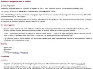
Mapping Mount St. Helens
Students study topographic maps and contour lines and construct a simple three-dimensional model of Mount St. Helens before the May 18, 1980, eruption. They use topographic map skills to interpret the impact of the May 18, 1980, eruption...
Curated OER
Marine Energy
In small groups, energy engineers research and make a topographic map of a marine natural resource. They report to the rest of the class pros and cons of extracting their assigned resource. The two activities may take up to four class...
Curated OER
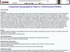
Comparing Topographical Maps to 3-Dimensional Models
High schoolers apply knowledge of topographical maps and how computer programs are used to make 3-D models of areas that humans have never visited. They view a Mars Canyon movie, then map the canyon.
Curated OER
Fantasy / Art Maps
Ninth graders analyze a fantasy art map by Jeremy Anderson, paying careful attention to the way the topographic features of the land are represented. They create a similar map of Sacramento that includes topographical features as well as...
National Endowment for the Humanities
On This Day With Lewis and Clark
Walk in the footsteps of Lewis and Clark as they discover the wonders, beauty, and dangers of the American frontier. After gaining background knowledge about Thomas Jefferson and the Louisiana Purchase, young explorers use primary...
Curated OER
Is Urban Sprawl Causing Us To Lose More Than Ground?
Students map the changes that occur in the land as a result of urban sprawl. They explore the problems that paving and building have on the watershed and the habitats on the Northshore.
Curated OER
Natural Resources
Students explore Iowa geography and topographic maps. In this geography and topographic maps lesson, student investigate maps, newspapers, Iowa flora and fauna. Students gain an understanding of how different landforms can be identified...
Curated OER
The Delicate Balance - Iowa's Natural Resources
Discover the natural resources in Iowa by studying it's history. In this environmental lesson, your young scholars will observe a topographical map of Iowa and identify where its most valuable resources are. They complete an Iowa name...
Curated OER
Introduction of the Lunar Relief Map Project
Pupils investigate the geographic features of the surface of the moon. In this lunar relief map instructional activity, students watch and discuss the Apollo II Moon landing and make preliminary plans for their lunar maps.
Curated OER
River Study
Students explore a stream in their area and show the class the topographic map of the stream. They locate the topographic map and name the streams, lakes and ponds in their watershed. They write a paragraph about their stream and...
Curated OER
Siting Wind Power
Students analyze a variety of curves that describe the power extracted from the wind by a variety of commercially produced wind turbines. They utilize site specific topographic maps and political boundary data to evaluate and make...
Curated OER
Running Water/Rivers-Life Cycle
Students explore the parts of a river system and use topographical maps to determine the stage of the river.
Curated OER
A Shuttle's Eye View
Students explore the goals of the Shuttle Radar Topography Mission as a springboard to exploring the topographical features of their own state or region. They synthesize their understanding of landforms and topography by mapping their...
Curated OER
The Marsh Land as a Changing Environment
Sixth graders continue their examination of the state of Connecticut. After taking a field trip, they identify the types of birds, plants, invertebrates and vertebrates who make their home in the salt marshes. In groups, they identify...
Curated OER
Take Me to the River! Using the Black River for Earth Science Review
Ninth graders use maps to identify landscape regions and drainage patterns producing the Black River. They create PowerPoint presentations pertaining to the Black River watershed, its geologic history and highlighting safe rafting...
Curated OER
Stranded along the Coast
Students plot stranding sites onto a map using latitude and longitude as well as compass directions with respect to coastal features. They identify several species of marine animals that might become stranded; distinguish their...
Curated OER
When You Were My Age, What Was This Place Like?
Students discover how land use in their community has changed. In this community and ecology lesson, students scan old newspapers to find articles about the development of community land. Students discuss and predict how land use has...
Curated OER
Interior of the Earth
Sixth graders identify and describe the composition and physical properties of the layers of the Earth. They also explain how scientists used the scientific process to know about the center of the Earth. Finally, 6th graders read a...
Curated OER
A Thoreau Look at Our Environment
Sixth graders write journal entries o school site at least once during each season, including sketched and written observations of present environment. They can use sample topographical maps and student's own maps. Students can use...
Curated OER
Mapping Seamounts in the Gulf of Alaska
Students describe major topographic features on the Patton Seamount, and interpret two-dimensional topographic data. They create three-dimensional models of landforms from two-dimensional topographic data.
Curated OER
Nebraska's Geology, Soils, Groundwater Regions, and Topographic Regions
Students examine the distribution of geology, soils, groundwater, topography, and geography in Nebraska. They identify various regions and characteristics on a map, and develop a plan to manage the soil and groundwater resources of the...
Curated OER
Topography of Africa
Students study Africa's diverse landscape and investigate how these features impact the available water supply, food sources, and population distribution of the continent. They compare topographical features and
their affect on each...
Curated OER
GEOGRAPHY: SPACE CENTERS
Young scholars examine the descriptive science dealing with the surface of Earth, its division into continents and countries, climate, natural resources, inhabitants and industries of the various divisions and analyze the political...

