Curated OER
States and Capitals, Mountains and Rivers
Students identify geographical locations in the midwestern United States. In this geography lesson, students identify 12 states and capitals and geographical features in the region by using U.S. maps. Students use blank maps to fill in...
New York State Education Department
US History and Government Examination: August 2010
Geography has played a complex role in America history. The Atlantic Ocean has served as a buffer to protect the United States from European Wars, but its proximity to Cuba, however, left it vulnerable to nuclear war during the Cuban...
Curated OER
Grid Frame Mapping
Young scholars map and describe small area of the schoolyard and discuss habitats.
Curated OER
Mapping West Virginia
Fourth graders explore West Virginia. For this Unites States geography lesson, 4th graders discuss the type of land and the cities in West Virginia. Students create two overlays, with transparencies, that show the natural land and the...
Science Matters
Ring of Fire
Over a period of 35 years, earthquakes and volcanoes combined only accounted for 1.5 percent of the deaths from natural disasters in the United States. The 15th lesson in a 20-part series connects the locations of earthquakes and...
Chicago Botanic Garden
Unit 2 Pre-test, Grades 7– 9
This pre-assessment launches a unit on climate change and weather. 15 questions, both short answer and multiple choice, asses the classes' knowledge about these concepts.
PBS
What's In a Name?
What is in a name? Eager historians trace the geographical history of places in the United States with Spanish names. Using a worksheet activity, clues, and web research developed in conjunction with the PBS "Latinos in America" series,...
Curated OER
"Place the State" Game
Students participate in a computer game in which they locate and place the U.S. states on a blank outline map. In small groups, they take turns dragging and dropping the states in the proper location on a map.
Curated OER
Opening Doors to Social Studies with Children's Literature: The Desert Alphabet Book
Students explore the geography of the United States. For this social studies lesson, students identify the major deserts on a map of the United States.
Student Handouts
Geography of Dr. Martin Luther King, Jr.
Young geographers follow Dr. Martin Luther King's journey during the civil rights movement by identifying major events on a map of the eastern United States, such as his birth in Atlanta, Georgia and his famous "I Have a Dream" speech in...
Curated OER
America and Texas: Where's The Symbol?
Students explore the flags of the United States and the state of Texas. They identify the flags using PowerPoint. Students use location words to drag symbols to the correct location.
Curated OER
Basic U.S. Geography
Provide your 11th graders with a basic understanding of U.S. Geography. They label the state, regions, and boundaries found in the contiguous U.S. as well as Hawaii and Alaska. Then, they complete two Internet related activities.
Curated OER
Naming the States of the U.S
Fifth graders study the 50 states on a map. In this social studies lesson, 5th graders identify the names of the states and location. Additionally, students work in small groups to name and locate as many states as they can on a blank map.
National Endowment for the Humanities
Hopi Place Names
What's in a name? Historians consider the question as they examine places important to the Hopi people and the meanings of their place names. Included worksheets include maps and charts to help class members examine the geography of Hopi...
Huntington Library
The Corps of Discovery: The Lewis and Clark Expedition
Don't miss this fantastic comprehensive lesson plan on the Lewis and Clark Expedition, packed with instructional guidance, worksheets, map work, informational texts, and secondary source materials.
Curated OER
Wales: An Interdisciplinary Unit
Students practice basic map and geographic skills as they compare Oregon to Wales. Students color map of Wales and Oregon using color codes to distinguish between land, water, and bordering nations or states, listen to stories and...
Curated OER
Mapping the News
Students explore cartography. In this map skills and map making lesson, Students work in groups to create wall size world maps including legends, compass roses, latitude and longitude, and physical features. Students collect current...
Cornell University
Too Much of a Good Thing?
Continuing their study of beneficial insects, young entomologists discover where in the world some of these bugs are. By labeling, coloring, and using the scale on a map, pupils explore the territories and arrival of the Asian lady...
Curated OER
The 50 States
Fifth graders use maps and music to learn the 50 states. In this US Geography lesson plan, 5th graders map out a region of the United States and practice singing the song, The 50 States that Rhyme.
Curated OER
Water Features - Lesson 2 - U.S. Political Map Grade 4-5
Students locate water features on maps. In this geography lesson plan, students complete worksheets that require them to identify water features on a U. S. political map.
Curated OER
U.S. Political Map
Students explore the symbols found in a map legend. In this map skills lesson, students locate the legend on a political map and explain what each of the symbols mean. Students locate and identify several symbols on the map.
Mathematics Assessment Project
Hopewell Geometry
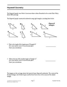
Right triangles from 2,000 years ago? Learners investigate different right triangles found in the earthworks of the Hopewell people, a Native American culture that populated the United States from 200BC to AD 500. Learners apply concepts...
Curated OER
Weather, Data, Graphs and Maps
Learners collect data on the weather, graph and analyze it. For this algebra lesson, students interpret maps and are able to better plan their days based on the weather reading. They make predictions based on the type of clouds they see.
Curated OER
Where In the World Are You?
Fourth graders fill in blank copies of the United States Map and then the World Map.
Other popular searches
- United States Map Skills
- United States Maps Regions
- Northeast United States Maps
- 50 United States Maps
- Create United States Maps
- Map of United States
- Western United States Maps
- Map of the United States
- Custom United States Maps
- Outline Maps United States
- Blank United States Maps
- United States Map Activities


