National Endowment for the Humanities
The Mexican Revolution
The legacies of the Mexican Revolution are visible today—even if some history classes don't cover them. Using primary sources from leaders in Mexico at the time of the popular uprising and other evidence, such as railroad maps, young...
Curated OER
United States Map - Lesson 9
Students explore the concept of cardinal directions. For this geography lesson, students identify the compass rose on a large U. S. map and then discuss the cardinal directions.
National History Day
“Saving the Bear”: The Russian Expeditionary Force of World War One
How have Russian politics affected countries on a global stage? The discussion of the Russian Revolution and World War I begins with an analysis of primary resource letters. Learners finish with a project where they create a timeline of...
Curated OER
Grid Frame Mapping
Young scholars map and describe small area of the schoolyard and discuss habitats.
Geography 360°
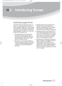
Introducing Europe
Provide your learners with a comprehensive introduction to Europe with this great set of worksheets. Map activities include matching European countries to their capitals and places on a political map, as well as exploring different...
The Alamo
A Teacher’s Guide to Antonio LóPez De Santa Anna
Who was Antonio Lopez de Santa Anna, and how did he relate to the Texas Revolution? Use an informative resource to find out! By reading primary sources, viewing maps and graphs, and answering short-answer written prompts in handouts,...
Annenberg Foundation
America's History in the Making: Using Digital Technologies
How can digital technology of today link us to the events of the past? Scholars use technology to uncover the vast number of historical resources available in lesson 12 of a 22-part America's History in the Making series. Using databases...
iCivics
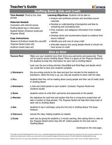
Drafting Board: Kids and Credit
Should kids under the age of 18 be given access to credit cards? Learners identify pros and cons of using credit, develop claims based on evidence, and finally argue reasons for or against credit for minors.
University of Pennsylvania
Mock Trial of Alfred Dreyfus
What if scholars based mock trials on history? The fourth installment of a five-part series on the Dreyfus Affair asks learners to read various pieces of evidence before conducting a mock trial for a French officer. Teams answer...
Curated OER
Cardinal Directions
First graders study cardinal directions on maps. In this geography instructional activity, 1st graders determine and show where North, South, East, and West are on various maps.
Curated OER
Plotting a Hurricane Using Latitude and Longitude
Learners define and use "absolute location," latitude, and longitude. They locate on a map or globe the Earth's poles, circles, tropics, and beginning points of measurements for latitude and longitude.
Prairie Public Broadcasting
Egyptian Pyramids Virtual Field Trip!
A virtual field trip takes enthusiastic travelers to the pyramids of Giza. Using Google, scholars explore the grounds of the ancient pyramids found in Egypt then complete three worksheets: a photo analysis page, a reflection sheet, and a...
National Endowment for the Humanities
The Creation of the Bill of Rights: “Retouching the Canvas”
While the Constitutional Convention lay the foundation of the new government for the United States, the protections given under the Bill of Rights were controversial. Using documents, such as James Madison's and Thomas Jefferson's...
New York State Education Department
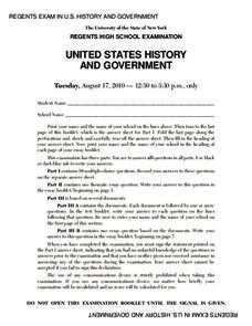
US History and Government Examination: August 2010
Geography has played a complex role in America history. The Atlantic Ocean has served as a buffer to protect the United States from European Wars, but its proximity to Cuba, however, left it vulnerable to nuclear war during the Cuban...
Curated OER
Learn the States and Postal Abbreviations
If you are preparing to cover the 50 states with your class, you don't want to miss this resource. It includes an excellent set of worksheets through which learners practice identifying states from their abbreviations and placing those...
Curated OER
California Geography
Fourth graders explore geography of four distinct regions of California: mountains, coast, central valley, and desert. They locate California on map, identify state's boundaries and borders, and explore agriculture, a major economic...
Curated OER
Latitude and Longitude
Learners demonstrate how to locate places on a map using a grid. In this map skills lesson, students are introduced to latitude and longitude lines. Learners define these terms and view a large map of a state. Students come up to the map...
Curated OER
Cardinal Directions
Students explore cardinal directions. In this social studies lesson, students create maps of home and school using the cardinal directions.
Curated OER
It's Happening, Where? Find the Absolute and Relative Location of News Articles
Students read newspaper articles. In this social studies lesson, students locate the latitude and longitude of the location where the news article takes place. Students write a summary of the news article.
Curated OER
NATO Geography & Language
The class receives background information on NATO, an atlas, and a blank world map. They color the original 1949 countries in red, the 1952 additions in green, and the 1990 additions in blue. This exercise would be a good starting point...
Curated OER
Mapping India
Young scholars participate in an activity in which they place placards listing geographic features, landmarks, etc. in the correct place on a large fabric map of a given country. They also examine artifacts, photos, sounds/music, etc....
Curated OER
Globe Lesson 17 - Alaska and Hawaii - Grade 4-5
Students develop their globe skills. In this geography skills lesson, students explore the area added to the United States when the Alaskan territory was purchased from Russia.
Curated OER
U.S. Political Map
Learners explore the symbols found in a map legend. In this map skills lesson, students locate the legend on a political map and explain what each of the symbols mean. Learners locate and identify several symbols on the map.
Curated OER
Globe Skills Lesson 11The Vietnam War
Students develop their globe and map skills, In this geography lesson, students examine the Vietnam War as they complete an activity that requires them to plot latitude and longitude.


