Curated OER
Scaling it Down: Caves Have Maps, Too
Measurement and map skills are the focus of this lesson, where students crawl through a "cave" made out of boxes, desks and chairs, observing the dimensions. Your young geographers measure various aspects of the cave and practice...
Curated OER
Map Skills
Students explore geography by creating a poster presentation in class. For this mapping lesson, students identify the different components featured on a modern day map and how to utilize them in order to navigate. Students read a book...
Curated OER
Mapping the Aegean Seafloor
Earth science learners create a two-dimensional topographic map of the floor of the Aegean Sea. They use it to then create a three-dimensional model of the ocean floor features. This comprehensive resource delivers strong background...
Curated OER
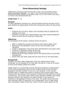
Three Dimensional Geology
Here is a fine lesson plan on geology designed for high schoolers. Learners use rocks, fossils, and other geological clues to determine the geology of an area. Then, they make recommendations to a fictitious city council about the...
Centers for Ocean Sciences
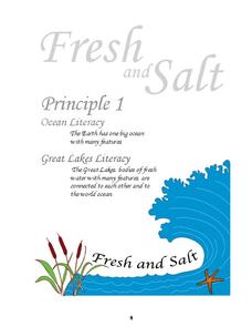
Ocean and Great Lakes Literacy: Principle 1
Is your current lesson plan for salt and freshwater literacy leaving you high and dry? If so, dive into part one of a seven-part series that explores the physical features of Earth's salt and freshwater sources. Junior hydrologists...
Curated OER
Should the Ming End the Treasure Voyages?
During the first century of Chinese Ming dynasty (1368-1644), the government sent out a total of seven voyages into the Indian Ocean. Young historians will discuss, explain, role play, and compare the decisions made by rulers during the...
Curated OER
A View from the Ground
Students look at a park from ground perspective. In this map skills lesson, students are introduced to a story about a girl at a park and make observations about the park based on a picture. This prepares students for the next lesson in...
Curated OER
Tortoise and Hare Races
Practice basic map skills with the story of The Tortoise and the Hare. After listening to the story, class members create a map that indicates the starting line, the path the animals took, where they stopped to rest, and the finish line....
Curated OER
Map Literacy
Students locate their home state on a map. They differentiate between physical and population sizes of states. In two groups, students "become" states with string for boundaries. They ascertain that area does not always equal large...
Curated OER
Those Who Have Come Before Me
Class members are transformed into explorers as they work in groups to locate hidden items and map their journey along the way. They then leave clues for other groups of learners to follow, and ultimately discover how past explorations...
Curated OER
Crude Conversation
Students analyze text and maps in determining the effect the world's energy resources have on human society, and make charts illustrating at least three ways each resource makes life easier for human society.
Curated OER
Land Plan Challenge
Links to two different versions of this mapping activity are available. In "The Small Version," youngsters design a town, keeping the water supply in mind. In "The Large Version," they also design a town, but they consider services and...
Curated OER
Drake's West Indian Voyage 1588-1589
Middle schoolers investigate several maps detailing Sir Francis Drake's voyages. In this geography lesson, students practice reading maps and locating the precise locations of where Sir Francis Drake visited. Middle schoolers...
Curated OER
Where Is Rome?
Third graders discover Ancient Rome through maps and worksheets. In this world history instructional activity, 3rd graders locate Rome on a world map and identify the scope of the Roman Empire. Students label an entire map of...
Curated OER
Continents and Oceans
Students identify oceans and continents and their locations on a map. They color-code and label their own map of the world's continents and oceans. They play the game Continents and Oceans to identify specific areas.
Curated OER
Exploring an Atlas
Learners explore global geography by participating in an atlas activity. In this countries of the world instructional activity, students collaborate in small groups and analyze an atlas while researching continents, countries and...
Curated OER
My Daily Routine
Foreign language learners work in pairs to translate the daily routine of celebrities or everyday people, presented in daily planner format, into English. They then illustrate and record their own daily routines in storyboard (film...
Curated OER
Understanding Stereotypes
Pupils confront age-related stereotypes, explore how stereotyping impacts their lives, and discuss how they can make changes to reduce over-generalizations, unfair assumptions, and critical judgments about people groups. They use a...
Curated OER
Location, Location, Location!
Twelfth graders locate cities, states and countries on maps. They use the cardinal directions to locate places on maps. They describe where they were born by giving clues without naming the exact state. They trade papers and try to guess...
Curated OER
Trailblazers - Now and Then
Young scholars, working in pairs, use maps to determine the most efficient routes between two cities. They research which route would have been used by early trailblazers. They present a first person account of one of the trailblazers...
Curated OER
Where Am I? Navigating Around the Globe
Third graders review spatial sense learned in grades one and two. They measure distances using map scales. They use atlases, and on-line sources to find geographical information.
Curated OER
What Are the Good & Bad Aspects of Regional Shopping Centres?
Seventh graders study the impact of regional shopping centers and local ones, and create a TV/ video expressing the results of the research.
Curated OER
Muppet Treasure Island
Students watch the movie "Muppet Treasure Island" and then taking on roles of characters in the movie answer navigational questions to try discover the location of a treasure hidden by the teacher.
NOAA
Into the Deep
Take young scientists into the depths of the world's ocean with the second lesson of this three-part earth science series. After first drawing pictures representing how they imagine the bottom of the ocean to appear, young scholars...
Other popular searches
- Map Skills Lesson Plans
- Map Skills Worksheets
- Elementary Map Skills
- Geography Map Skills
- Basic Map Skills
- Social Studies Map Skills
- Globe and Map Skills
- Beginning Map Skills
- United States Map Skills
- Map Skills, Continents
- Early Explorers Map Skills
- Free Map Skills Worksheets


