Space Awareness
Let's Map the Earth
Before maps went mobile, people actually had to learn how to read maps. Pupils look at map elements in order to understand how to read them and locate specific locations. Finally, young cartographers discover how to make aerial maps.
Curated OER
Use Google Maps to Teach Math
Capture the engagement of young mathematicians with this upper-elementary math lesson on measuring time and distance. Using Google Maps, students first measure and compare the distance and time it takes to travel between different...
Civil War Trust
Map the Civil War
Mapmaking was a very important element in successfully planning attacks on enemies during the Civil War. Guide pupils through the process of pacing to find the average length of their steps, measure the distance between one object...
Just Health Action
Environmental Justice Matters: Mapping Cumulative Impacts (Part 2)
A case study enables class members to confirm whether different geographic parts of Seattle, Washington have disproportionate environmental burdens and benefits. Groups use the EPA's Cumulative Health Impact Analysis formula and...
Centers for Ocean Sciences
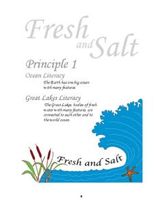
Ocean and Great Lakes Literacy: Principle 1
Is your current lesson plan for salt and freshwater literacy leaving you high and dry? If so, dive into part one of a seven-part series that explores the physical features of Earth's salt and freshwater sources. Junior hydrologists...
Just Health Action
What Makes a Community Healthy?
Young people have an opportunity to make it a beautiful day in their neighborhoods with an activity that asks them to identify what is healthy and unhealthy in their community and develop some ideas about what they can do to fix the...
Austin Independent School District
Social Studies Strategies: Concept of a Definition Map
Model for your class members how to use a definition map to make connections between new words and prior knowledge. Although the strategy is designed for social studies classes, the approach can be use at any grade level and in any...
Baylor College
Pre-Assessment Activity: What Do You Know About Microbes?
In an introductory lesson, youngsters take a pre-assessment quiz, get a grasp of a gram of mass, and then estimate the mass of microorganisms that live within a human body. Using Glo Germ™, a material that allows you to simulate the...
Teaching Oasis
Gingerbread Baby Lesson Plan Guide
Reinforce reading comprehension and story mapping skills with the help from a story, Gingerbread Baby by Jen Brett. Individuals discover new vocabulary, make predictions, retell main events, respond to reading using a graphic...
Rainforest Alliance
Knowing the Essential Elements of a Habitat
To gain insight into the many different types of habitats, individuals must first get to know their own. Here, scholars explore their school environment, draw a map, compare and contrast their surroundings to larger ones. They then...
Center for Learning in Action
Water – Changing States (Part 2)
Here is part two of a two-part lesson in which scholars investigate the changing states of water—liquid, solid, and gas—and how energy from heat changes its molecules. With grand conversation, two demonstrations, and one hands-on...
Teach Engineering
Stormy Skies
Young meteorologists examine the four main types of weather fronts and how they appear on a weather map. Participants learn about the difference between the types of weather fronts along with their distinguishing features. A...
American Institute of Physics
The Tuskegee Weathermen: African-American Meteorologists during World War II
Chances are good that young scholars have heard of the Tuskegee Airmen but few would predict that these pilots had their own support in the form of the Tuskegee Weathermen. These Black meteorologists were recruited and trained to provide...
K20 LEARN
Show and Tell Museum - Investigating Primary Sources: Read and Interpret Primary Sources
Scholars become detectives in a lesson plan that focuses on primary sources. Learners practice their observational skills by examining the teacher's artifact and visiting the Show and Tell Museum that highlihgts items from...
EngageNY
Synthesizing Information from Texts about Natural Disasters: What Makes an Earthquake a Natural Disaster?
Are all disasters natural? Scholars reread Earthquakes! to determine what classifies these events as a natural disaster. They label earthquake facts as N for natural or D disaster to support their ideas. They then discuss academic...
TED-Ed
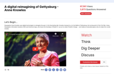
A Digital Reimagining of Gettysburg
Why would Robert E. Lee order Pickett's Charge, an action that changed the course of the Civil War? Geographer and historian Anne Knowles uses digital technology to explain what she thinks is the missing piece in trying to understand...
Chicago Botanic Garden
Historical Climate Cycles
What better way to make predictions about future weather and climate patterns than with actual climate data from the past? Young climatologists analyze data from 400,000 to 10,000 years ago to determine if climate has changed over...
NOAA
Into the Deep
Take young scientists into the depths of the world's ocean with the second lesson of this three-part earth science series. After first drawing pictures representing how they imagine the bottom of the ocean to appear, students...
Curated OER
Call to Arms: A Service Project
Sick of selling candy and washing cars? How about hosting a Digital Day or a Learning Lunch? The suggestions here make fund raising fun and rewarding. Raise money to preserve important maps and other primary source documents.
Laboratory for Atmospheric and Space Physics
Planetary Distances on the Playground
There's no need to stay inside; get out of the classroom and create a scaled map of the solar system on your playground field! In collaborative groups, scholars identify the distance between the sun and other planets, place planet...
NY Learns
Geography of the Fertile Crescent by ECSDM
Using Google Earth, a vocabulary assignment, and map handout, your class members will outline the Fertile Crescent in Mesopotamia and identify the source of the Tigris and Euphrates rivers. They will then complete graphic organizers...
Civil War Trust
Creating a Historic Site
A historic site marks a place where a relevant historical event occurred, no matter how many people know about it. Small groups choose their own historical sites, including a place where a class member was born, or even a...
Curated OER
Introduction to Age of Absolutism
Who were the absolute monarchs of Europe and what effect did they have on their countries? Young historians begin by naming qualities they believe are important for a monarch to possess. They then take notes on four key factors...
The Alamo
The Alamo
Remember the Alamo! Scholars investigate the Battle of San Jacinto during the Texas Revolution. Using models, maps, quotes, biographies, and the Oath of Allegiance, the Alamo comes to life as the stories of those who fought and died in...
Other popular searches
- Making Maps Geography
- Making Maps and Research
- Making Maps Using Technology
- Making Maps of History
- China, Making Maps
- Making Maps of Community
- Reading Making Maps
- Neigborhoods and Making Maps
- Making Maps Lesson Plans
- Making Maps Usign Technology
- China Making Maps
- Neighborhoods and Making Maps


