Curated OER
The Seven Continents Scavenger Hunt
Who doesn't enjoy an engaging scavenger hunt? Here, scholars listen to, and discuss, the informative text, Where is my Continent? by Robin Nelson. They then explore the seven continents and four major oceans using...
PBS
Make a Balloon Globe
"We've got the whole world in our hands," is what your students will be singing after completing this fun geography activity. Using the included templates for the seven continents and a balloon, they create their very own globes.
NOAA
Mid-Ocean Ridges Interactive
Your class will be on top of their game when it comes to mid-ocean ridges! The second installment in a 13-part series focuses on the 65,000-km underwater ridge system that spans our globe. Junior oceanographers practice placing the...
Devine Educational Consultancy Services
Geography Student Workbook, Australia
Your youngsters will be experts on the geography of Australia after working with these activities and worksheets, which review the continent's weather, major landforms, dimensions, history, and climate.
Curated OER
Plate Tectonics: Kindergarten Lesson Plans and Activities
This unit focuses primarily on plate tectonics and plate boundaries surrounding continents. It contains pre- and post-lab sections that walk young geologists through plate movements in order to visualize what's going on inside Earth.
Howard Hughes Medical Institute
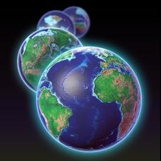
EarthViewer
Can you imagine Washington DC and London as close neighbors occupying the same continent? Learners will be fascinated as they step back in time and discover the evolution of the earth's continents and oceans from 4.5 billion...
Evan-Moor
Daily Handwriting Practice: Traditional Cursive
Keep your class practicing handwriting each day in a 36-week school year with this comprehensive resource that combines daily cursive practice with content such as poetry, geography facts, continents, and much more.
National Wildlife Federation
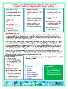
Is It Getting Hot in Here, or Is It Just Me?
Currently, only 2.1% of global warming is felt on continents, while over 93% is felt in the oceans. The fourth lesson in the series of 21 on global warming is composed of three activities that build off one another. In the first...
Institute for Geophysics
Understanding Maps of Earth
Here is your go-to student resource on primary geography concepts, including facts about the surface of the earth and its hemispheres, latitude and longitude, globes, types of maps, and identifying continents and oceans.
NASA
Outline Maps
Don't miss this gold mine of blank maps for your next geography lesson! Regions include traditional continents such as Asia, Europe, and Africa, as well as other major world areas such as the Pacific Rim and the Middle East.
Australian Government
The Great Artesian Basin
Covering 23% of the continent and holding 64,900 cubic kilometers of water, the Great Artesian Basin is the primary source of water for much of inland Australia. Using detailed student worksheets, experiments, and case studies,...
Reed Novel Studies
Mr. Popper's Penguins: Novel Study
Antarctica is actually a desert. Using the novel study that explores Mr. Popper's Penguins, pupils find four of their own interesting facts about the amazing continent. They also practice putting words in alphabetical order and answer...
Howard Hughes Medical Institute
EarthViewer Climate Guide Activity
What did Earth look like 4.5 billion years ago, and what was the climate like then? Scholars explore a view of Earth throughout history. They observe continents moving, temperatures fluctuating, and huge changes in ecosystems. A...
Curriculum Corner
Earth Day Book
This Earth Day, celebrate our beautiful planet with an activity book that challenges scholars to show off their map skills, complete a crossword puzzle, write acrostic poems, alphabetize, and reflect on their personal Earth-friendly habits.
Museum of Tolerance
Immigration Journeys
Through the journey of four stories of immigration, scholars complete graphic organizers and apply knowledge to create a visual representation of their findings on a large poster. Third and fourth readers write a letter to their...
BrainPOP
Latitude and Longitude Differentiated Lesson Plan
Scholars warm-up their map skills with a discussion using location words to describe familiar places. An engaging video informs class members about latitude and longitude. Three leveled activities extend the learning experience for...
National Wildlife Federation
I’ve Got the POWER Wind Energy Potential at Your School
The 20th lesson in a 21-part series connects the wind data and expectations of a turbine to whether such devices should be built in your area. Scholars begin with estimating the wind potential at school by using long-term climate...
Curated OER
The Columbian Exchange
Take a closer look at what was traded between the Europeans and the Americas during the Columbian Exchange and which led to important cultural and economic developments in both regions. Tip: Expand the assignment to include animals,...
American Chemical Society
Joseph Priestley, Discoverer of Oxygen
Do you want to hear a joke about nitrogen and oxygen? NO. We all know there is oxygen in the air and that plants produce oxygen, but how was it discovered? Scholars read a handout, answer questions, and analyze material in the...
MENSA Education & Research Foundation
Connecting Africa: A Project-Based Learning Adventure
Mission Possible: Your task is to design a new highway route from Tunis, Tunisia to Cape Town, South Africa. If you accept the challenge, you must create a small map of the route that has already been rejected, a...
Humanities Texas
Primary Source Worksheet: Abraham Lincoln, Draft of the Gettysburg Address
Young historians closely examine the words of Abraham Lincoln's Gettysburg Address with this primary source analysis learning exercise.
National Wildlife Federation
I Speak for the Polar Bears!
Climate change and weather extremes impact every species, but this lesson focuses on how these changes effect polar bears. After learning about the animal, scholars create maps of snow-ice coverage and examine the yearly variability and...
Polar Trec
Where in the World Is Our Teacher?
Kirk Beckendorf, a middle school teacher, joined researchers at the McMurdo Station in Antarctica to help maintain automatic weather stations. The lesson plan encourages pupils to track his travels around the region. They connect with...
California Polytechnic State University
Australian Geography Unit
At the heart of this resource is a beautifully detailed PowerPoint presentation (provided in PDF form) on the overall physical geography of Australia, basic facts about the country, Aboriginal history, and Australia culture and lifestyle.
Other popular searches
- Continents and Oceans
- 7 Continents
- Continents Oceans
- The Seven Continents
- Learning 7 Continents
- Map Skills, Continents
- Continents and Countries
- Acronym for Continents
- Social Studies Continents
- 7 Continents and Oceans
- Blank Map Seven Continents
- Seven Continents Worksheet


