Curated OER
3-D Topographic Maps
Students create a 3-D topographic map. In this map building activity, students use cardboard to create a topographic map of the Catskills mountain region.
Curated OER
Lesson 4 Activity 1: Mapping the Third Dimension
Students work in pairs to construct a simple stereoscope.
Curated OER
Conversation Map
In this writing a conversation worksheet, students use the conversation map to identify the greeting, starting comment or question, body, short explanation, and farewell and then use them to create a written conversation. Students write...
Curated OER
Introduction to Topographic Maps
Tenth graders create a topographic map and see how it represents different elevations. In this topographic maps lesson students read and interpret topographic maps.
Curated OER
NUMB3RS Activity: Where’s the Source? Episode: “Undercurrents”
Several real-world problems are posed as a way to learn about vector fields in order to make some predictions after analyzing the data. The main problem comes from the tv show NUMB3RS and is based on solving a crime where a body has...
Curated OER
Lakes of Methane on Titan
In this methane lakes worksheet, learners read about the false-color synthetic radar map taken by the Cassini spacecraft indicating methane lakes on Titan. Students solve 4 problems about the surface area of the lakes from the image, and...
Mathematics Assessment Project
A Day Out
An applicable task presents a problem for pupils to solve: where to go for a class field trip. The pupils must take into consideration the first and second choices of members of the class when determining where to go. Individuals also...
Curated OER
Agriculture: It Doesn't Just Happen
After reading an informational text on the Agricultural Research Service, learners research the role of the ARS in Oklahoma. Using reputable online sources, they label a map of the state with relevant areas. Researchers focus on one of...
Curated OER
Geologic Mapping I
Students create a geologic map and cross-section of an area of horizontal sedimentary rocks, exposed in several locations. Map must include a complete key or legend with rock descriptions of the various formations.
Curated OER
Field Trip - San Francisco Bay Model
Students investigate scale models while attending a field trip within the San Francisco Bay Area. In this oceanography lesson, students identify the currents of the Bay Area and discuss how they are created by different tides. Students...
Curated OER
Cemetery Mapping Lesson
Eighth graders explore historical records. In this cemetery mapping lesson, 8th graders analyze local community data as they examine gravestones and read epitaphs.
Curated OER
Principles of Flight: Where are We?
Students explore the concept of topographical maps. In this topographical map lesson, students discuss how airplanes know where to fly. Students use topographical maps to simulate a field trip on the computer.
Curated OER
Forestry and Changing Feelings
Students investigate how the forest affects their daily lives by creating a concept map. In this ecological lesson, students create a concept map linking the forest to the many things they use each day. Students take a field trip in...
Curated OER
TE Activity: Northward Ho!
Middle schoolers design a simple compass. They examine how the Earth's magnetic field has both horizontal and vertical components. They determine how a compass works and work with cardinal directions.
Curated OER
Finding Your Way on the Farm
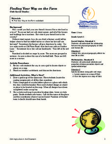
Third graders make a grid map. For this directionality lesson, 3rd graders review how to use a grid to locate objects or places on a map. Students draw a grid map of the classroom and locate seating assignments. Students create a grid of...
Curated OER
Where in the Latitude Are You? A Longitude Here.
Students distinguish between latitude and longitude on the map. In this mapping lesson, students participate in mapping skills to recognize spatial relationships, and where to find natural resources on the map. Students create their own...
Curated OER
Arthur's Nose
Students read a story and complete a story map. In this diversity and acceptance lesson plan, students read Arthur's Nose, make a story map, research Aardvarks, complete a Venn Diagram comparing Arthur's nose to other animals in the...
Curated OER
Money Matters: The Importance of Global Cooperation
Students prepare for a visit to the International Monetary Fund (IMF). In this lesson students create a concept map of money. They discuss the goals of the IMF. Students research countries currently changing into market economies. After...
Curated OER
Where Do You Live?
Students discuss the community in which they live. They take an observation field trip and then use paper and boxes to design and construct a model of their community.
Curated OER
Reading a Map 1
In this map reading worksheet, students examine the map of Melton Park and determine if the sentences are true or false. Students answer 20 questions.
It's About Time
The Electricity and Magnetism Connection
Magnets don't grow in fields, but magnetic fields are important to understand. The lesson covers the effect electricity has on magnetic fields. Scholars use a compass, magnets, and electrical wire to test magnetic fields and energy...
Curated OER
MAP Practice
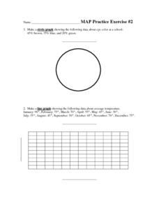
In this geometry activity, students create circle, line and bar graphs using different comparisons of events. There are 24 questions with an answer key.
Urbana School District
Magnetism
The compass was first used in 206 B.C., but we didn't discover magnetic poles until 1263 A.D. Presentation begins with the history of magnetism before continuing on to magnetic fields, magnetic forces, electromagnets, currents,...
Curated OER
Field Trip to Mammoth Cave
Students, when given a microscope or a camera, write two observations they have seen using technology that they did not see with just their eyes with 100% accuracy. When given a blank map, they mark the location of Mammoth Cave along...


