Curated OER
Distribution of Active Volcanoes Exercise
Students collect and plot data, then interpret the results and answer questions about the geologic causes and the human effects of volcanic eruption. They participate in a role-play activity and a virtual field trip, as well.
Curated OER
Identifying Your Watershed
Learners identify the watershed where they live and how it is related to their own water consumption. In this watershed instructional activity students locate their watershed on their town map. The learners find the source of their water...
Curated OER
Geography: examining the Glacial Features of Cape Cod
Students examine satellite images of the glacial features of Cape Cod. They analyze where human activity is located in terms of those features. Students make models of the features, including kettle holes. They also use contour maps...
Curated OER
Earthquakes And Fault Lines
Students discuss major causes of earthquakes and identify famous fault lines, access and map information about ten largest earthquakes in world from 1989 to 1998, and theorize about location of these earthquakes as they relate to Earth's...
Curated OER
Exploring Energy with GIS
Learners examine GIS technology as it is used to locate energy sources. For this GIS lesson, student access an assigned website to locate a series of lessons using the GIS software. They use the maps that are located on the primary...
Curated OER
Earth Forces
Students use geological techniques such as plate tectonics, mountain building, earthquakes, and volcanoes, in order to explain the earth.
Curated OER
National Parks
Students conduct research on the U.S. National Parks. They conduct Internet research, analyze maps, and create and solve riddles that present specific clues pertaining to a selected national park and it's location.
Curated OER
Island Biogeography and Evolution
Young scholars use this activity as a logic problem that is based on real organisms and real data. The problem is to develop phylogenies for seven related populations of lizards living on the Canary Islands. Three phylogenetic charts...
Curated OER
Plate Tectonics: Movin' and Shakin'
Students are introduced to the causes of plate movements and the hazards they present. They plot the location of 50 earthquakes and 50 volcanic eruptions on a map and explore the relationships between plate tectonics, earthquakes, and...
Curated OER
Water: A Necessity for Life
Students examine types of aquifers and make a model landfill. In this water usage instructional activity, students determine the difference between confined and unconfined aquifers. They build a model landfill, observe it for two weeks,...
Curated OER
Regional Landforms and Native People
Third graders study the Native American tribes of Maidu and Miwok by studying Internet artifacts, culture, language, music, storytelling, architecture, food, clothing, crafts and geology.
Curated OER
Navigating by the Numbers
Students observe how math is important in navigation and engineering. They study how surveyors use math and science to calcute, count, measure, label, and indicate distances on a map. They estimate specific distances.
Curated OER
Earth Structure and Materials
Students explain what is meant by term nuclear radiation, describe in detail electromagnetic spectrum, differentiate between ionizing and non-ionizing radiation, understand half-life of isotopes, differentiate between processes of...
Curated OER
The 50 States and its Holidays
Though the format of this ELL lesson is confusing (the standards listed are for plate tectonics, yet the objectives are for American geography and holidays), a teacher could glean some ideas from the main idea. Here, pupils complete a...
Curated OER
Water Quest
Students visit the Hydrology Study Site, conduct a visual survey to discover info about local land use and water quality, and document their findings by mapping the water body. They use this investigation to raise questions for further...
Curated OER
A Special Relationship: Connecticut and Its Settlers
Pupils study both geological and geographical features of Connecticut and the New Haven area. They focus on map works and rock formation.
Curated OER
States with Attitude, Latitude and Longitude Dude
Sixth graders identify states whose boundaries are formed by lines of latitude and longitude or natural borders such as rivers. They trace a map of the U.S., and fill in borders, rivers and lines of latitude and longitude.
Curated OER
Groundwater Pollution Site Assessment
Students study how a geologist examines a hazardous waste spill using an actual site. They use site data to map the spill, find its source and determine how fast the spill is spreading.
NOAA
Plate Tectonics I
Young geologists get a glimpse beneath the earth's surface in this plate tectonics investigation. After first learning about the different layers of the earth and the constant movement of its plates, young...
Teach Engineering
Earthquakes Living Lab: The Theory of Plate Tectonics
Find out if your class agrees with Ice Age: Continental Drift ... or if it's just a fun family movie! Class members research the theory of continental drift, examine evidence of plate tectonics, connect...
Kids Discover
Ancient Egypt by KIDS DISCOVER
Discover Ancient Egypt! Learn about mummification and gods, visit pyramids and temples, examine cliff carvings and paintings, take quizzes and engage in activities. Colorful, interactive, and easy to use, this app is not just for kids!
NOAA
Community Ecology and Sampling
Seamounts in the Coral and Tasman Seas are home to more than 850 different species. Groups explore hydrothermal vents, researching the organisms found there and their energy source. They also learn about seamounts, exploring their unique...
Curated OER
Lahar Travel Time
Ninth graders analyze published geologic hazard maps of California and comprehend how to use the map's information to identify evidence of geologic events of the past and present and predict geologic changes in the future. They select...
Curated OER
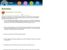
Earthquakes In Your State
In this earthquake worksheet students complete an interactive activity then answer a series of short answer questions on different earthquakes and their magnitude, and epicenter.
Other popular searches
- Geologic Mapping Loveland
- Geologic Mapping of Loveland
- Geologic Mapping Love Land
- Creating a Geologic Map
- Geologic Mapping of Love Land
