Curated OER
Cattle Trails
Students identify and locate cattle trails on a globe. In this map skill lesson, students use a marker to locate Texas and Montana and use the map scale to calculate the distance of the cattle trail.
Curated OER
Planning A Railroad Online Lesson
Students plan a route across Donner Summit using topographical maps in order to understand the challenges involved in constructing the railroad in the Sierra Nevada Mountains. In this history lesson, students first discover how to read...
Curated OER
An Early American Culture
Students identify the locations of the Hopewell culture. In this map skills instructional activity, students use a globe to mark several locations of the Hopewell culture.
Curated OER
Globe Skills Lesson 11The Vietnam War
Learners develop their globe and map skills, In this geography lesson, students examine the Vietnam War as they complete an activity that requires them to plot latitude and longitude.
Curated OER
Globe Skills Lesson 10 Apollo 11
Students develop their globe skills. In this geography skills instructional activity, students use a globe and a softball to replicate distance between the earth and its moon.
Curated OER
From Hypothesis to Conclusion...Reading Maps to Understand Proofs
Tenth graders explore the concept of proof. In this proof lesson, 10th graders work in groups to collectively write proofs for directions to places on a map. Students give directions to specific places in big cities such as from the New...
Curated OER
The Pilgrims
Students use distance measuring tools to follow directions and chart the path the pilgrims made from Plymouth, England to Boston, Massachusetts. In this Pilgrim voyage lesson plan, students use a map to chart the distance traveled by the...
Curated OER
Underground Railroad Mini-Unit
Students watch a film about slavery. Students view a PowerPoint about the Underground Railroad and use various resources to make a timeline for the topic. Students research a historical figure from the Underground Railroad era and give a...
Curated OER
Teen America Travels New England
Students simulate the role of a travel agent to understand how to read and use road maps. They plan a bus trip through New England for a group of travelers that includes, bus travel, meals and attractions. They plan the distance that...
Curated OER
Volcanoes!: The Dangers of Snow and Ice
Students observe a demonstration of how melting snow and ice can contribute to mudflows. They then observea list of continents with the number of snow and ice covered mountains on each continent and discuss. They then label a group of...
Space Awareness
Where on Earth Am I?
Almost every phone has GPS installed, but a large number of teens don't know how the technology works. An initial activity illustrates how GPS determines a location on Earth. Scholars then apply trilateration procedures to a...
Curated OER
The History of Life on Earth
Using meters as years, your class works together to map out the geologic time scale on a football field. Plenty of background information is included in this lesson plan as well as several resource links and a student worksheet. Your...
Curated OER
Taking Its Toll
Students explore ratios. For this rates lesson, students create a ratio to compare the price of a toll to the distance travelled. They compute the average cost per mile, determine the slope between two ordered pairs, and make...
Curated OER
Plan a Cruise Lesson Plan
Students measure distances and report them in fractions, convert fractions to decimals, and multiply decimals.
Curated OER
From Home To School
Students locate and use internet maps to trace a route from their home to school. They calculate the distance of the route using the map legend then determine the distance they travel to school and back in a regular school week and over...
Curated OER
Pearl Harbor
Students identify the location of Pearl Harbor and Hawaiian Islands on a map. In this map skills lesson, students use latitude and longitude coordinates to locate various places of importance of the Pearl Harbor attack.
Curated OER
Tracing Highs and Lows in San Francisco
On a topographic map, pupils identify the scale bar, north arrow, and contour interval. They then locate a hill on the map and make note of the contour lines. Students then locate other places with similar contour line patterns....
Curated OER
T-shirt Passport Lesson Plan
Students locate their t-shirt place/name on maps, then share facts/artifacts (souvenirs) from their place/name location orally with whole class. They create a database using information gathered from the whole class.
Curated OER
Water Monitoring Vocabulary
As the title implies, this is a list of vocabulary terms relating to water monitoring. If your ecology class is learning about how to test water quality, this will be an appropriate reference sheet for them. As a bonus, if you live in...
Curated OER
Formulas Multiple Choice
In this formulas worksheet, students determine the distance between two points. They read story problems, identify needed information, write equations and solve them. Students find the midpoint of a line. This two-page worksheet...
Curated OER
The Distance Between Us and Them: Sea Floor Spreading in the Atlantic Ocean
Students examine how geologists determine rates of sea floor spreading between two tectonic plates. They apply mathematical concepts such as the calculation and use of velocities and conversion from one set of units to another.
Curated OER
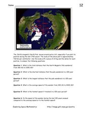
Earth's Magnetic Pole
In this Earth's magnetic pole learning exercise, students use a diagram showing the changes in the magnetic pole of the Earth over time. Students use the given scale of the changes to answer 6 questions about the average speed of the...
Curated OER
White Bear Lake Fitness Challenge
Students participate in fitness challenge. After choosing a destination they would like to visit, students record their mileage to their destination after riding on bikes and walking on treadmills. Students receive an incentive...
Curated OER
Globe Lesson 4 - The Compass
Young scholars study compass' and their use in navigation. In this compass lesson, students use a compass and a globe to answer the questions about navigation.


