Curated OER
Mapping Your Way Around
First graders identify a map, symbols on a map, and locate places on a map. Finally, they construct a map
Curated OER
Giving Verbal Directions/ESOL
Students practice giving verbal directions accurately and employ correct prepositions and prepositional phrases and adverbs when giving those directions. They focus on using correct grammar, imperatives and infinitives when giving those...
Curated OER
Where in the World Is Mexico?
Students practice map-reading skills as they locate Mexico and its cities on a world map. By creating a puzzle out of a map of Mexico, students engage in a meaningful hands-on activity to help them explore that country's geography.
California Academy of Science
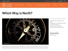
Which Way is North?
Who needs a compass to find cardinal directions? Just place a stick in the ground and record the movement of its shadow over the course of a day. Then, measure the shadow lengths in order to determine a north-south line. A simple...
Curated OER
Geographic Features of the East Coast
Fourth graders view a map of the thirteen colonies and discuss why the people who came from England built towns along the Atlantic coast. They read the directions on the worksheet and underline words in the question that ask them to do...
Curated OER
Directionality
Second graders discuss the cardinal directions and intermediate directions and then look at the spooky map to locate different points on the map. They answer questions about where things are located in reference to another object and...
Curated OER
That's NorthEastWestSouth to Me!
Students demonstrate north, south, east and west. In groups, students participate in games to decide what directions a specific bear must travel. They play a "Simon Says" game to develop single step directions. Students listen to and...
Curated OER
Giving Directions
Students explore communication by participating in language description activities. In this directions lesson, students practice using communicative terms and prepositions of places to direct a classmate to an exact location. Students...
Curated OER
Lesson Design Archaeology- U.S. Map
Young scholars examine the U.S. map and identify cultural areas. In this archaeology lesson, students locate cultural areas on the U.S. map and fill in the proper locations.
Curated OER
Following Directions
Pupils identify and descibe how to follow directions in detail. Then, they create and construct something requiring them to read directions. Students explain what they would do if they were driving to a particular place, but did not have...
Curated OER
Mapping Population Changes In The United States
Students create a choropleth map to illustrate the population growth rate of the United States. They explore how to construct a choropleth map, and discuss the impact of population changes for the future.
Curated OER
Requesting Directions
Students work with their partners to role play giving and receiving directions to familiar and unfamiliar places. Students practice verifying directions through verbal repetition. This lesson plan is intended for students acquiring...
Curated OER
The Middle East- Geography
Students discover the geography of the Middle East. In this geography lesson plan, students use reference books and the Internet to research the geography of the Middle East. Students complete an activity sheet to match the capital...
Curated OER
The Places We Will Go
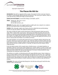
Second graders demonstrate basic map skills. They each bury a bag of chocolate coins, create a map with directions to find their "treasure," and follow another student's directions to locate a bag of coins.
Curated OER
Mapmaking
Students examine the craft of cartography and how the Lewis and Clark expedition created and used maps. They analyze maps, read a handout, create a map, participate in a mini expedition and map out a route based on travel directions,...
Curated OER
Why Koala Has A Stumpy Tail
Students examine Australian folktales. In this folktales lesson, students read the Australian folktale, Why Koala Has a Stumpy Tale. Students list characteristics of the characters from the book. Students act out these characteristics...
Curated OER
States and Capitals
This map skills PowerPoint features an interactive states and capitals game. The object of the game is to identify the capital cities of each of the 50 states. The excellent presentation includes United States maps, game directions, and...
Curated OER
Principles of Flight: Where are We?
Students explore the concept of topographical maps. In this topographical map lesson, students discuss how airplanes know where to fly. Students use topographical maps to simulate a field trip on the computer.
Curated OER
Traveling aroud Our Town
Students are asked to describe to a partner how he or she walks to school or the bus stop. They are shown on the overhead an one-inch grid paper, and at the intersection of two lines on the grid paper, students are shown a house and...
Curated OER
Map Your Community
Learners study their community's assets and needs to create a service project that would meet the needs. For this community project lesson, students research their community and look for the strengths and weaknesses of the community. As...
Curated OER
Right Place, Right Time
Fourth graders complete mathematical word problems. They study the relationships among distance, speed, and time; and measure travel distances. They measure distances using a piece of string and a ruler and practice converting several...
Curated OER
A View from the Ground
Students look at a park from ground perspective. For this map skills lesson, students are introduced to a story about a girl at a park and make observations about the park based on a picture. This prepares students for the next lesson in...
Curated OER
Celebrate Hanukkah in Israel
Explore Hanukkah and its origins with a social studies lesson. Learners discover the history of Hanukkah and its traditions. They locate Israel on a map, hear the story of the menorah and create their own...
Curated OER
Where in the World Is ...
Students locate and place countries and continents on a large map using tag board and yarn. They locate a new geographic location on the map each morning.


