Curated OER
Four Main Directions
Students describe directions using a globe for north, east, south and west. In this mapping lesson students identify the north and south pole. Students understand the importance of the equator and the Prime Meridian. Students explain how...
Curated OER
What do Maps Show?
Eighth graders practice the skill of reading maps. In this geography instructional activity, 8th graders participate in a classroom lecture on how to read a map.
Calvin Crest Outdoor School
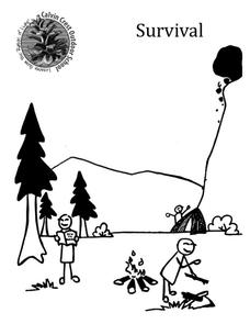
Survival
Equip young campers with important survival knowledge with a set of engaging lessons. Teammates work together to complete three outdoor activities, which include building a shelter, starting a campfire, and finding directions in the...
Curated OER
A High-Interest Novel Helps Struggling Readers Confront Bullying in Schools
Bully, bullied, or bystander? Paul Langan's The Bully is the anchor text in a unit that examines bullying and violence. After a close reading of the text, readers imagine themselves as the characters and consider how they would react in...
Curated OER
"Asking for Tourist Information" (Italian)
Students explain and use verbal directions, recognize the prepositions used in a conversation, explore Italian art, and acquaint themselves with tourist services in Italy.
Curated OER
Ancient Rome: Map Work
Seventh graders explore the Roman Empire. In this ancient Rome lesson, 7th graders participate in activities that require them to examine the history , political structure, chronology, and significant figures of the empire.
Curated OER
Directions on a United States Map
Students generate directions for an imaginary trip. In this map lesson, students review the four main directions and how to use a map legend. Students locate destinations based on directions given by classmates.
Curated OER
Cultural Maps
Fifth graders examine map elements. In small groups they create a map of an imaginary country that includes a title, legend, directional indicator, scale, boundaries, capital cities, country name, and icons of five natural resources. ...
Curated OER
Mapping the Local Community
Young scholars review the symbols and legends of a map. In groups, they follow a set of directions to create a map showing the route to a specific place. They present their map to the class and review the basic components of a community.
Curated OER
Building A Model of the East Pacific Rise
Students describe the physical attributes of the East Pacific Rise. After locating the region on a map, students work in groups do define each layer of the structure in order to begin their build. Students build their model according to...
Curated OER
Weather Maps
Learners explain the collection of weather data as presented in different formats. They use appropriate terminology related to weather maps and use the Internet to capture weather data from a city of choice and present a TV style weather...
Curated OER
Mapping an Encounter
Students recognize aspects of a historical map drawn around 1721 by a Native American for presentation to British governor of South Carolina, compare it to European map of the same period, and create map that shows relationships of...
Curated OER
Creating a Map
Third graders examine the process of creating an accurate map, and create a map of their playground. They identify what objects are on their playground, and discuss what is found on a map. Students then draw a map of their playground...
Curated OER
Making Sense of Journey North Maps
Young scholars use maps and answer core curriculum questions in order to increase comprehension and practice higher order thinking skills. This helps them develop writing skills through the practice of keeping Science Journals.
Computer Science Unplugged
Treasure Hunt—Finite-State Automata
Introduce your class to the concept of finite-state automata with an activity that asks individuals to try to map their way to Treasure Island by taking different routes though an island chain. Each island has two ship sailing...
Channel Islands Film
Island Rotation: Lesson Plan 1
How do scientists provide evidence to support the theories they put forth? What clues do they put together to create these theories? After watching West of the West's documentary Island Rotation class members engage in a series of...
August House
The Ogre Bully
English language arts, math, science, dramatic arts, and cooking; this lesson has it all! In this multidisciplinary resource, your scholars will take part in a read aloud of The Ogre Bully by A.B. Hoffmire and have a grand...
Common Sense Media
The Masque of the Red Death
Poe goes high tech with a lesson that asks high schoolers to use the internet and various apps as they read and analyze "The Masque of the Red Death." In addition to responding to comprehension questions in Quizlet, they use Minecraft to...
Statistics Education Web
What Percent of the Continental US is Within One Mile of a Road?
There are places in the US where a road cannot be found for miles! The lesson asks learners to use random longitude and latitude coordinates within the US to collect data. They then determine the sample proportion and confidence interval...
Bowland
Outbreak: Infection Detection
Explore the mathematics of infection outbreaks with activities that ask learners to use coordinate grids to locate infected patients. They calculate amounts of ingredients for antidotes and determine which groups of people should be...
The New York Times
Making Do: Learning and Growing Through Adversity
What is it that makes people keep going when they face challenges in life? Ask your class to consider this question in relation to their own experiences and as they read material from The New York Times. Using personal experiences...
NOAA
Currents
Learn how ocean currents are vital to humans and marine life. The eighth installment of a 23-part NOAA Enrichment in Marine sciences and Oceanography (NEMO) program, focuses on ocean currents and how they affect global climate. The...
Curated OER
Locating IIT Using Ordered Pairs
Students investigate ordered pairs. In this math lesson, students plot and locate ordered pairs in a coordinate plane and are exposed to how to read and create a map.
Curated OER
Understanding the Compass
Young geographers view an excellent description of how compasses work, then work in partners to make a compass of their own. There is a heavy religious component in this activity; for example, as closure, the teacher reads a verse from...


