Curated OER
"Place the State" Game
Pupils participate in a computer game in which they locate and place the U.S. states on a blank outline map. In small groups, they take turns dragging and dropping the states in the proper location on a map.
Curated OER
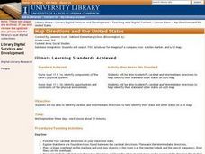
Map Directions and the United States
Third graders search TDC database for images of a compass rose, a miles marker, and a US map. They identify cardinal and intermediate directions to help identify their state and other states on a US map.
Curated OER
Blank US Map
In this blank outline map worksheet, students study the physical boundaries of the 50 states that make the United States. This outline map may be used for a variety of geographic activities.
Student Handouts
Geography of Dr. Martin Luther King, Jr.
Young geographers follow Dr. Martin Luther King's journey during the civil rights movement by identifying major events on a map of the eastern United States, such as his birth in Atlanta, Georgia and his famous...
Curated OER
Let's Build a Map
Students gain an understanding of maps while studying the map of the Louisiana Purchase and the trail of Lewis and Clark and the Corps of Discovery. They demonstrate understanding of maps by creating a basic classroom map.
Curated OER
Basic U.S. Geography
Provide your 11th graders with a basic understanding of U.S. Geography. They label the state, regions, and boundaries found in the contiguous U.S. as well as Hawaii and Alaska. Then, they complete two Internet related activities.
Curated OER
Student Exploration: Building Topographic Maps
In this earthquake exploration learning exercise, students complete 2 prior knowledge questions, then use "Building Topographic Maps Gizmo" to conduct several activities, completing short answer questions when finished.
Curated OER
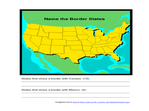
Identifying Border States of the U.S.
In this identifying border states of the U.S. worksheet, 3rd graders visually identify then write the names of the states that border Canada and Mexico; page 1 is a lesson, page 2 is the worksheet.
Curated OER
Naming the States of the U.S
Fifth graders study the 50 states on a map. In this social studies lesson, 5th graders identify the names of the states and location. Additionally, students work in small groups to name and locate as many states as they can on a blank...
Curated OER
European Union Map Quest
Sixth graders identify countries of the European Union. They locate countries of Europe on a map and pair with a student to complete a blank map of Europe. They label each country and complete worksheets for the European Union. They...
Curated OER
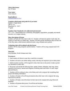
Our Fifty States
Seventh graders identify and locate all fifty states in the United States and their capitals. Individually, they research one state identifying when it became a state, its motto, song, flower and nicknames. To end the lesson, they are...
Curated OER
The 50 States
Fifth graders use maps and music to learn the 50 states. In this US Geography lesson plan, 5th graders map out a region of the United States and practice singing the song, The 50 States that Rhyme.
Curated OER
Mapping China
Students identify cities in China on a map. In this map skills instructional activity, students locate the continent of Asia and the country of China. Students use a blank map to label China and bordering countries.
Curated OER
Rockin' Round New York State
Students discuss their favorite rock groups and bands. They create rock groups that will be touring New York State. Students research cities in New York, determine dates of concerts, create touring itineraries, and develop Inspiration...
Curated OER
Mapping Your State's Role in the Vietnam War
Learners recognize reasons to celebrate Memorial Day. Students create a map of victims of the VIetnam War. Using the internet, learners research information about soldiers from their state who were killd in action in Vietnam. Students...
California Academy of Science
California's Climate
The United States is a large country with many different climates. Graph and analyze temperature and rainfall data for Sacramento and Washington DC as you teach your class about the characteristics of Mediterranean climates. Discuss the...
Curated OER
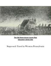
Old Stone House Lesson Plan
From stagecoach to railroad tracks, your class will discover how advancements in travel in the United States during the nineteenth century played an integral role in the industrialization and development of American society. The main...
University of California
Anti-Communism at Home
Have you ever been accused of something without cause? The sixth installment of an eight-part series asks scholars to create a museum exhibit on the anti-communist activities in the United States at the start of the Cold War. To make...
Annenberg Foundation
A Nation Divided
Can a presidential election cause a civil war? Learners research the events surrounding the presidential election of 1860 in a lesson that explores America's history. Using maps, videos, and primary sources, they uncover, brainstorm, and...
Curated OER
Map Keys
Third graders examine maps and map keys. In this locating map features lesson, 3rd graders use crayons, markers and colored pencils to label maps. Students work in partners to read map keys and locate given places and things.
Curated OER
Africa: Political Map
Students create a political map for Africa. In this country identification lesson, students locate Africa on a globe and discuss some of its major countries and bodies of water. Students complete a political map of Africa and...
Curated OER
Understanding Weather Maps and the Importance of StormT
High schoolers explain how storm tracking is important to understanding sources of acid rain pollution. The read and explain a weather map. They set up plastic or glass collection container for rain in an open area away from buildings...
Curated OER
Orienteering - Introductory Lesson
Gain knowledge of directions and degrees while learning how to read a compass. NEWS - north, east, west, south, and everything in between. It's crucial to be accurate in reading a compass and understanding degrees and direction when...
Bismarck Public Schools
Chapter 9 Review WKST
Here is a traditional multiple-choice, true/false, and fill-in-the-blank assessment on the presidency of James Monroe in the United States. It was designed to supplement a particular textbook chapter, but could be used to assess learning...

