Curated OER
The Geography of Latin America
Perfect for a geography or world cultures lesson, the slides in this presentation cover the topography, demographics, and climate of Central America, South America, and the Caribbean. From the apex of the Andes Mountains, to the depths...
Curated OER
Geography: Caribbean
Students research and view a video on the geography of the Caribbean. In this Caribbean geography lesson, students go on an imaginary trip to the Caribbean and write postcards and letters telling of their trip. Students will include...
Curated OER
Geography Experience: Low Vision
The world is a big and beautiful place; but how do you begin to understand it when you have low vision? Here is a great set of ideas focused on transforming any small room into a sensory paradise, themed to incite understanding about...
Curated OER
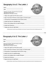
Geography A to Z: The Letter J
How many states, capitals, countries, and locations do your kids know that begin with the letter J? Hopefully they know seven of them, because that's the number of questions on the fun and fast worksheet.
Smithsonian Institution
Braiding Rhythms: The Role of Bell Patterns in West African and Afro-Caribbean Music
Africans transported to the Caribbean as part of the transatlantic slave trade brought with them a rich tradition of music and dance. Four lessons teach young musicians the rumba clave rhythm, cascara rhythm, and the 6/8 bell patterns...
Curated OER
Geography, Climate, and Community in the Dominican Republic
Students familiarize themselves with the geography and culture of the Dominican Republic. They use primary source materials on the Dominican Republic to explore the question: How does where you live influence how you live? They describe...
Curated OER
Hershey and the World: The 5 Themes of Geography and Google Earth
Students invsestigate cocoa producing regions in the world. In this geography skills activity, students examine how the 5 themes of geography affect the Hershey Chocolate Company as they compare and contrast cocoa production in America,...
Curated OER
Geo-portrait of the Caribbean: 1492 -1992
Students compare and contrast the Caribbean region in 1492 with the same region today , and use five themes of geography as avenues of comparison.
Curated OER
Caribbean Cooking
Learners complete a unit that explores the cultures of the Caribbean, Puerto Rico, the Dominican Republic, and Cuba through cooking. They follow step-by-step directions of a variety of recipes, create a Caribbean scrapbook or cookbook,...
Curated OER
Caribbean Map Quiz
In this online interactive geography quiz worksheet, students examine the map that includes 20 Caribbean countries and territories. Students identify the names of the countries and territories in 3 minutes.
Curated OER
Geography, Climate, and Community in the Dominican Republic
Students familiarize themselves with the geography and culture of the Dominican Republic. In this Dominican Republic lesson, students use the given scenarios as starting points to analyze the geography and culture of the Dominican...
Curated OER
United States Geography: Crossword Puzzle
In this geography learning exercise, students use the 14 clues in order to fill in the crossword puzzle with the appropriate United States geography answers.
Curated OER
Central America and the Caribbean Culture Travel Brochure
Ninth graders take a trip to Central American and the Caribbean. In this culture and geography lesson, 9th graders research selected countries of the region. Students use their findings to create tri-fold brochures to share with others.
Curated OER
The Pirates of the Caribbean
Third graders participate in a demonstration activity that shows a map of the Caribbean Islands. They examine a natural resource that each island is known for. Next, they listen to a read aloud of Gail Gibbons, "Pirates: Robbers of the...
Curated OER
A Taste of the Caribbean
Pupils are introduced to the foods and traditions of the Caribbean. In groups, they brainstorm their own definition of culture and review the physical and political geography of the Caribbean. They spend time sampling different foods...
Curated OER
A Bird's Eye View of the Caribbean: Art, Folklore, and Music
Students examine the Caribbean in terms of its music, art, and folklore. As a class, they listen to a folktale and discuss the difference between telling a story and reading a story. In groups, they write their own folktale and share...
Curated OER
World Map Labels
In this geography skills worksheet, students identify the countries and bodies of water labelled on the maps of the world, Africa, Asia, Canada, Europe, the Caribbean, the Middle East, North America, Australia, and South America.
Curated OER
My Little Island
Students engage in a lesson which features a video trip to the Caribbean Island of Montserrat to teach about the human and physical characteristics of place and human/environmental interactions between the two. Students create their own...
Curated OER
Beyond Demographics
Students study the Dominican Republic through watching and discussing a video about the country and its people. They explain life in the Dominican Republic and describe the emerging picture of the Dominican Republic as viewed through...
AGSSS
World Regions
Help your learners to visualize where historical events have taken place around the globe with a map that details the major regions of the seven continents.
Curated OER
West Indies and The Caribbean: Sugar & Slavery
Students study the state of the world before the slave trade. They explain the geography and economics of the slave trade. They explore primary sources and how historians use these sources to create historical interpretations.
Curated OER
Geography, Climate, and Community in the Dominican Republic
Young scholars examine primary source materials on the Dominican Republic in an exploration of how environment influences lifestyles. They compare and contrast life in the Dominican Republic with life in the United States.
Curated OER
Travel Brochure
Students, using the internet and other sources, research a Caribbean island. They work, in groups, to design a travel brochure. Students share their findings and information with their classmates. Additional cross-curriculum...
Curated OER
Geography of South America
Student's identify geographic features of a South American map. They use the scale of the map to calculate distances between points. They identify examples of the five geographic themes on the map of South America.


