Curated OER
Layers with Lines
Students examine topographical maps and the challenges faced by cartographers when drawing the maps. While creating collages, they use contour lines to add dimension much in the same way they are used on maps to show elevation.
Curated OER
Cartographer on Assignment: Creating a Physical Map of Africa
Students use geographic information to make an outline map of Africa, then demonstrate their understanding of the physical landscape of Africa by using a variety of materials to create a physical map of Africa
Curated OER
Be A Cartographer
In this be a cartographer instructional activity, students read about the history of cartography, make a map of a familiar place, share it with a friend and answer 2 questions about their friend's map.
Computer Science Unplugged
The Poor Cartographer—Graph Coloring
Color the town red. Demonstrate the concept of graph theory with a task that involves determining the least number of colors needed to color a map so that neighboring countries are not represented by the same color. Pupils make...
Curated OER
Geo-Class Mapping My Neighborhood
Students create a map of the school and surrounding neighborhood. In this mapping lesson, students discover their school's location and learn about its past. Students use math skills and the steps in the design process to complete the...
Curated OER
Map Keys
In this geography worksheet, students identify who a cartographer is and what they do specifically. They study an outline map of a fictitious island and then, respond to the three questions that follow. Finally, students add three more...
Curated OER
Making Maps
For this map making worksheet, students learn about the science of making maps, which is cartography. They then answer the 11 questions on the worksheet. The answers are on the last page.
Curated OER
Local History: Mapping My Spot
Students explore maps to discover historical information about their local area. In this mapping and history instructional activity, students use panoramic maps of their own town/city to interpret historical information. Students also...
Curated OER
What Color is the Ocean?
Learners view satellite pictures of the ocean, and discuss the presence of phytoplankton and the colors of the ocean. Students compare/contrast ocean satellite images with maps and globes, then color world maps to replicate the satellite...
Perkins School for the Blind
Beginning Map Skills
Maps can be so much fun, they help you understand spatial relationships, distance between objects, and can foster direction skills. Budding cartographers with visual impairments use the Wheatley Tactile Diagramming Kit to create their...
Curated OER
In Celebration of the Silk Road
Sixth graders explore the ancient trade routes of the Silk Road with a focus on a province in China to identify artifacts and research how these items arrived in the city of Turpan.
Curated OER
Aerial Photographs
In this geography worksheet, students read an excerpt about aerial photographs and how they are taken. Then they identify shape, size, tone, shadows, and other hints that might be seen. Finally, students respond to 5 short answer...
Curated OER
Reading Maps Critically
Students discover that maps represent different values of the cultures who make them. Using the internet, they research the role of a cartographer and how their culture affects them. In groups, they are given examples of maps in which...
Curated OER
Tiles, Blocks, Sapphires & Gold: Designing a Treasure Map
Young cartographers in groups hide treasure at school and then create a map to find it using pattern blocks and tiles. They make paintings with clues to create a visual representation of the location of their treasure. Groups present...
Curated OER
Mapping Worksheet #1
Get out the compass and a pencil its time to use a coordinate grid to practice mapping skills. Young cartographers use the prompts and provided grid to plot locations, draw parallel lines, and determine distances between points.
Curated OER
Tortoise and Hare Races
Practice basic map skills with the story of The Tortoise and the Hare. After listening to the story, class members create a map that indicates the starting line, the path the animals took, where they stopped to rest, and the finish line....
Friends of Fort McHenry
British Attacks in the Chesapeake during the War of 1812
This is a fun mapping activity that will have your class knowing the ins and outs of the battles in the War of 1812. Your young cartographers will not only plot decisive attacks, but will analyze their purpose, goals, and impact on...
Curated OER
The Notorious Four-Color Problem
Take a walk through time, 1852 to 2005, following the mathematical history, development, and solution of the Four-Color Theorem. Learners take on the role of cartographers to study a United States map that is to be colored. One rule: no...
Curated OER
Designing a Hiking Trail
Put your students' map skills to the test with this engaging cross-curricular project. Given the task of developing new hiking trails for their local community, young cartographers must map out beginner and intermediate paths that meet a...
Space Awareness
Let's Map the Earth
Before maps went mobile, people actually had to learn how to read maps. Pupils look at map elements in order to understand how to read them and locate specific locations. Finally, young cartographers discover how to make aerial maps.
Curated OER
The Four-Color Problem: Concept and Solution
Take a walk through time, 1852 to 1994, following the mathematical history and development of the Four-Color Theorem. Learners take on the role of cartographers to study an imaginary world of countries that need to be mapped. One rule:...
Curated OER
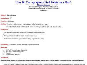
How Do Cartographers Find Points on a Map?
Ninth graders describe latitude and longitude and how they may be useful to find things on a map. In this cartography lesson students divide into groups and devise a coordinate system that can be used to communicate a position.
Teach Engineering
What is GIS?
Is GIS the real manifestation of Harry Potter's Marauders Map? Introduce your class to the history of geographic information systems (GIS), the technology that allows for easy use of spatial information, with a resource that teaches...
Curated OER
A Walk Around the School: Mapping Places Near and Far
After reading Pat Hutchins’ Rosie’s Walk, have your young cartographers create a map of Rosie’s walk. Then lead them on a walk around the school. When you return class members sequence the walk by making a list of how the class got from...


