Curated OER
Oceanic Heat Budget Activities
Young scholars map and research imaginary islands located in different parts of the world. They describe the weather and climate of their island and show how local currents, water temperatures and waves may influence the weather patterns.
Curated OER
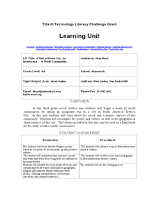
A Visit to Mexico City: An Introduction to World Communities
Third graders complete a variety of activities as they take an imaginary trip to Mexico City, complete with passports, maps, and Spanish dictionaries. They write postcards to send home and create items to sell at the market. The unit...
Curated OER
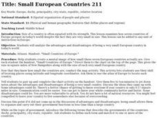
Small European Countries
Students examine the advantages and disadvantages of being a very small European country in today's world. They locate each country on a map using the coordinates, discuss the governments of each country, and develop a list of...
Curated OER
War of 1812
Eighth graders locate the major land forms and bodies of water on a map of Louisiana. In groups, they discuss the role of the Mississippi River in the Battle of New Orleans and how land and water affect the outcome of battles. To end...
Curated OER
Aquifer Model
Young scholars, after researching and brainstorming about aquifers and locating aquifer maps of Texas, participate in the building of a model of an aquifer complete with a pumping station. They also answer a variety of questions at the...
Curated OER
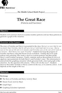
The Great Race
Learners are presented with a story about two individuals running a race in which one is given a head start. Students must map the progress of the runners, create a chart examining patterns and graph the progress. In the end, learners...
Curated OER
World War I
Learners justify how alliances lead to war. They compare the conflicts of war that arose because of imperialist interest. Students explain the cause of World War I. They compare and contrast European maps before and after World War I....
Curated OER
Spelling Instant Activity
Sixth graders understand the usage of capital letters for mapping skills. In this capitalization lesson plan, 6th graders correct sentences to insert appropriate capital letters. Students select cities from the sentences and make a word...
Curated OER
The Built Environment-An Integrating Theme
Students observe, record, and present knowledge of their local built environment while conducting a walking tour of their community. They develop written and photo journals, drawings, time lines, graphs, and charts to engage in...
Curated OER
Charlotte's Web Trading Card
Students read Charlotte's Web, view variety of trading cards, discuss what they know about trading cards and their purpose, choose character from story, complete bubble map about character, and create character trading card using...
Curated OER
Winter Holidays Around the World
How much do you know about the holidays around the world? Second graders put their knowledge to the test with a 14-day instructional activity about global celebrations. They read informational text, employ KWL charts, and compare and...
Curated OER
How the Environment Affects Our Health
Ninth graders explore how the environment affects health. In this infectious disease lesson, 9th graders investigate what environmental situations cause infections diseases. Students study the symptoms, treatments, prevention, and...
Curated OER
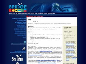
Iced In
Introduce junior oceanographers to ice conditions in The Great Lakes. The ice map links are no longer available, so you will not be able to have your class perform the mentioned data activity. You can, however, access the Canadian Ice...
Curated OER
Exploring California
While incomplete, this lesson could be used as a starting point for an exploration of the geographic features of California. Learners describe the four regions of California and discuss population and economic development. Then, they use...
Delegation of the European Union to the United States
The Geography of Europe
What is the European Union? Where is it? Why is it? To begin a study of the EU, class members examine the physical geography of Europe and the size and population density of 28-member countries in comparison to non-member countries...
Center for Learning in Action
Density
Explore the concept of density within states of matter—gases, liquids, and solids—through a group experiment in which young scientists test objects' texture, color, weight, size, and ability to sink or float.
Chicago Botanic Garden
Recent Weather Patterns
Decide whether weather is changing! A two-part activity first challenges classes to review the differences between weather and climate. Once finished, individuals then analyze historical data to determine if climate change is happening...
Virginia Department of Education
Functions 1
Scholars learn what it means for a relation to be a function and see various representations of functions. After learning the definition, they participate in a card sorting activity classifying relations as functions or not.
Curated OER
Making Sense Of A Round World On A Flat Surface
Students engage in a lesson that is concerned with the development of geography skills. They take part in a number of activities that center around finding and traveling to different locations. The lesson has resource links that can be...
Curated OER
COLD SEA WATERS
Students examine how old sea waters affected the local and state area during the summer of 1998. Studying a detailed web-site helps students examine sea temperatures.
Curated OER
A Bird's Eye View of our 50 States
Third graders focus on state birds as they learned absolute location (latitude/longitude) of each state, as well as their relative location (bordering states).
Curated OER
Asian Civilizations
Seventh graders complete computer based research to complete a travel brochure that highlights an Asian civilization.
Curated OER
Home: the Story of Maine "A Love for the Land": Where Are You? Who Are You?
Students investigate their neighborhood both as it is now and as it was 100 years ago. They take a walk around their neighborhood and fill out a worksheet before completing a worksheet.
Curated OER
Lost at Sea: The Search for Longitude
Students research and chart the shortest course to circumnavigate the globe.
Other popular searches
- Maps and Charts
- Analyze Maps and Charts
- Reading Maps and Charts
- Ireland Maps and Charts
- Tables, Maps and Charts
- Maps Graphs and Charts
- Maps, Charts, Globes
- Interpreting Charts and Maps
- Tables Maps and Charts
- Graphs, Charts and Maps
- Graphs\, Charts and Maps
- Word Maps and Charts

