Curated OER
Virtual Field Trip
Are we there yet? Young trip planners learn about their state and plan a trip. They will select sites to see in three cities in their state, and record associated costs in a spreadsheet. While this was originally designed as a...
Curated OER
Rivers Run Through It
Using a relief map of New York State, learners answer questions about the distance between different cities, identify bodies of water, and more. First, they discuss vocabulary related to the Hudson River area. Then, they complete a...
Curated OER
Around the Town
In the world of GPS, make sure your kids can still read maps and determine distances between locations. You will need neighborhood street maps, ideally of your class' home turf. Ask kids questions about different locations in relation to...
Curated OER
Travelogs
Students make travelog journals to send to acquaintances in other states in order to receive mail in return. They make scrapbooks with the return mail they receive.
Curated OER
Ancient Greece and Ancient Rome Unit Plan
Students make two T charts, one for Sparta and one for Athens, showing pros and cons for living in either city-state. They use the physical information from the map and the cultural captions given for Athens and Sparts to come to their...
Scholastic
Volleyball Road Trip
Review coordinate mapping with your young geographers by matching cities on a volleyball team's road trip itinerary to their appropriate coordinate locations.
Alabama Department of Archives and History
Alabama's Steps to Statehood
To demonstrate their understanding of the steps Alabama took to become a state, groups create a poster that identifies what the United States Constitution and the Northwest Ordinance required of a territory to become a state.
Los Angeles Unified School District
River Systems
Scholars must react to the ecosystems of a river. They use inquiry-based learning along with maps and visuals to better understand the impact of rivers on everyday life. To finish, they create final written projects and presentations.
Curated OER
State Capitals Fun
Third graders study the capitals of each state. In this social studies activity, 3rd graders use a map of the United States to identify and locate each state's capital city. Students discuss map symbols used to identify capital cities.
Curated OER
Our City
Second graders familiarize themselves with the town they live in by practicing their imagination, library research and writing skills.
Curated OER
Location, Location, Location!
Twelfth graders locate cities, states and countries on maps. They use the cardinal directions to locate places on maps. They describe where they were born by giving clues without naming the exact state. They trade papers and try to guess...
Curated OER
What You Can Learn From a Map
Young scholars investigate the use of road maps, shadeded relief maps, and topographic maps.
Curated OER
Introduction to Maps
Students investigate a variety of maps to explain what each one is used for.
Curated OER
Taxi: A Book Of City Words
First graders engage in a literature study that helps them to focus on the concepts of goods and services. They describe the various skills people may need at home, school, and work. Students create a map of businesses found in the city.
Curated OER
Location of Cities 201
Students work in pairs to locate the ancient cities on a world atlas using the longitude and latitude measurements. They examine the physical and human futures that explain their locations.
Curated OER
New Hampshire Map
In this state maps worksheet, students identify the state map of New Hampshire. Students fill in the state capital, major cities, and other attractions.
Goodwill Community Foundation, Inc.
Directions and Distances
Describe where you are—and find out where you are going—with a beginning Spanish resource on directions and maps. Spanish learners repeat and practice direction words such as norte, este, and oeste, as well as measurement terms such as...
Curated OER
Ohio Vocabulary
After selecting State Unit Studies and choosing Ohio, you'll find a plethora of information on The Buckeye State. There's an information sheet, an Ohio state map, and several sheets that detail the capital, flag, flower, bird, tree,...
Curated OER
Social Studies: The Birth of Olympism
Students complete maps of Ancient Greece identifying key sites of the ancient Olympic games. After watching a video, they complete worksheets about the games and the athletes. Students discuss how the spirit of Ekecheiria, the "Sacred...
Curated OER
The American Revolution: 1775 - 1783
Track the ins and outs and wartime strategies used by both the British and the Americans during the Revolutionary War. Multiple comparisons are made between both factions, maps, statistical data, images, and light text is used throughout...
Curated OER
The 50 States
Fifth graders use maps and music to learn the 50 states. In this US Geography lesson, 5th graders map out a region of the United States and practice singing the song, The 50 States that Rhyme.
Curated OER
Hottest US Cities Quiz
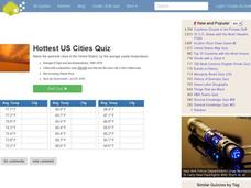
In this online interactive geography quiz instructional activity, students respond to 20 identification questions about the hottest cities in the United States. Students have 4 minutes to finish the timed quiz.
Curated OER
Coldest US Cities Quiz
For this online interactive geography quiz worksheet, students respond to 20 identification questions about the coldest cities in the United States. Students have 4 minutes to complete the quiz.
Curated OER
Map Skills
In this map skills instructional activity, students research and label the states in Australia and add in the major cities, oceans and seas.
