Curated OER
Saskatchewan's Population Distribution
Students explore landforms, vegetation, climate and population distribution in Saskatchewan. After discussing an atlas of Saskatchewan, students create their own relief map and climagraphs of Saskathewan. Using specified websistes,...
Curated OER
Oink, Moo, Peep What Is A Farm?
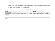
Young scholars explore the workings of a farm. After reading "Charlotte's Web," students visit a farm. They discuss their observations of the real farm to the one described in the book. Young scholars create a map of the farm they...
Curated OER
Where In The World?
Learners identify the goods and services from the United States and Mexico. Using postage stamps, they describe the various images they see and place them into categories. They use those categories to determine what is important in...
Curated OER
Australia
Sixth graders study the continent of Australia. In this Geography lesson plan, 6th graders create an Australian city using their knowledge of Australian cities. Students participate in a game about the continent.
Curated OER
Wanted: Texas Workers
Students discover industries prevalent in nineteenth-century Texas cities and identify resources required to perform occupations. They examine how geographic areas contribute to the development of industries and write a letter applying...
Curated OER
Can You Name that Town
Students, after becoming familiar with different names of towns in Arkansas, practice using a map grid and map index.
Curated OER
Boilermaker Geography
Fifth graders investigate the geography of central Indiana with an emphasis upon finding the location of Purdue. They make a connection to literature with the reading of a newspaper article to create the context for the lesson while...
Curated OER
Spring Harvest
Students engage in a activity that is interested in the foods related to the season of Spring. They conduct research using a variety of resources while creating menus to match the regions of The United States. Students create food items...
Curated OER
Weather Or Not
Students use the internet to find pen pals to share in their weather experiment. Individually, they research the high and low temperatures for cities within the United States and email the results to their pen pal. They also develop a...
Curated OER
Land Grant Colleges
Students are introduced to the concept of land grant colleges which allowed agriculture to be brought into education. As a class, they create a timeline and compare and contrast the land grant colleges of 1890 and 1892. They use maps...
Curated OER
Interpreting Aerial Photographs
Students interpret aerial photographs. They view aerial photographs or satellite-produced images to locate and identify physical and human features. They study satellite images and label their images for bodies of water, clouds,...
Curated OER
How We Get From Here to There
Young scholars recognize various types of movement people rely on to get from one place to another, locate the forms of movement on a map and choose one form of movement and research its path.
Curated OER
What Causes Irregular Temperature Patterns?
Young scholars examine common trends in climate across the U.S. They identify the anomalies in hot-cold temperature differences in the U.S and locate them on the map using latitude and longitude coordinates.
Curated OER
Site vs. Situation: Location! Location! Location!
Learners examine places with a similar latitude to Alabama, and discuss the importance of a location's site versus its situation. They analyze maps, create a chart, and write a paragraph on the difference between site and situation.
Curated OER
Arkansas Counties
Students discuss what counties are and state facts about the county students live in. They research and report on one of the counties of Arkansas.
Curated OER
IDP Introduction
Fourth graders examine the three regions of North Carolina through class discussion of favorite places in the state and a review game based on the game of twister. The different colors on the twister sheet represent the different...
Curated OER
Where in My World Am I?
Students determine exactly where they are in the world by using a local map to write accurate directions to local eating establishments. They write precise directions from the school to their home which the teacher simulates driving to...
Curated OER
The Debate Over North Shore Road
Young scholars examine the impact of the North Shore Road Project in North Carolina. For this environmental science lesson, students share their views regarding this environmental issue. They compare and contrast the map of the Great...
Curated OER
The English Settle America
Sixth graders compare immigration today with that of the colonial period. They locate colonies on a map and describe reasons their families immigrated to the United States.
Curated OER
Columbus Park
Students complete activities that go along with the study of and possible fieldtrip to Columbus Park in Chicago, IL. They discover how urban conditions influenced the creation of city parks. They examine the preservation of historic...
Curated OER
Shore is Windy!
Students consider what a hurricane is and how it impacts both land and people, explore the speculations surrounding Hurricane Isabel, research potential target sites and create maps illustrating how Isabel may affect them.
Curated OER
Immigration in the Late 1800's
Seventh graders explore the progression of immigration patterns in the United States. They examine how immigrants perceived and adapted to the United States culture. Students discuss how immigrants were able to perserve their culture in...
Curated OER
Mills of New Hampshire
Students locate mill sites on a New Hampshire map. They describe who worked in the mills and their working conditions. They examine the environmental impact of the mills and work together to find out more information about mills.
Curated OER
Geometry: Classifying Angles
Students measure, construct, and classify angles as acute, right, straight, and obtuse. Once they have completed an angle worksheet, students use a map of South Carolina to locate cities by constructing the aforementioned angles.


