Delegation of the European Union to the United States
The Geography of Europe
What is the European Union? Where is it? Why is it? To begin a study of the EU, class members examine the physical geography of Europe and the size and population density of 28-member countries in comparison to non-member countries...
Curated OER
How Big is Big?
Geography learners compare and contrast population densities throughout the world. Using maps, they estimate the relative size of the world's regions and populations. They develop analogies to discover the world they live in and...
Curated OER
Comparative Geography I
Students use population density and other statistics to compare countries. They find the population density for the countries listed in the table. Students compare findings with a partner, and then share with the class.
Curated OER
Size It Up: Map Skills
Compare information from a US population cartogram and a standard US map. Learners draw conclusions about population density by analyzing census data a population distribution. They discover that census data is used to apportion seats in...
Curated OER
Elbow Room - Exploring Population Density
In this population learning exercise, learners click on the links and research the internet about population, land, and government. Students answer 16 short answer questions including making spreadsheets.
Curated OER
The Effects of Limited Space on a Culture
Students predict the impact of population density on shelter, transportation, recreation, land use, and social skills and then research that impact on Japan. They write a response about the impact of population density on food...
Curated OER
Comparative Geography II
Students engage in a research question of finding the effect of population density upon the use of land in a physical area. They also find the effect of how this can effect the lifestyles of the people who live there.
Curated OER
East Asia: Population Facts and Figures
Students examine population information from East Asian countries. Using a specified website, pupils explore the population of China, Japan, North Korea and South Korea. Classmates examine the population density compared to the world's...
Curated OER
Living in an "Olympic" Country
Learners research countries participating in the Olympic Games. They create a database which includes graphs for comparing population density, the number of athletes, per capita income, etc. for each country. This project is completed...
Curated OER
Mapping Counties
Students practice reading a map. In this mapping lesson, students illustrate a map and compare and contrast the counties based on their population. Students also explore what a census is and read census data on a map. A student...
Curated OER
People, Goods, and Railroads
Young scholars compare population distribution and density railroad network in 1878, identify areas of expanding population density, and evaluate geographical and economic factors that influenced railroad expansion in late 19th century...
Curated OER
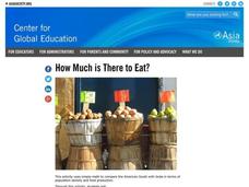
How Much is There to Eat?
Students examine food production related to population density. In this interdisciplinary lesson, students gather data regarding food production in the American South and in India. Students follow the outlined steps to calculate the...
Curated OER
Historical Indian Treaties and Aboriginal Population
Sixth graders navigate an online atlas of Canada and compare the land area of of historical Aboriginal peoples in Manitoba to present-day figures.
Curated OER
Continents Game
Students study geography. In this geographic terms lessons, students compare the continents based on their different features. They work as a class to put the continents in order from least to greatest based on the different geographic...
Curated OER
Learning and Population Information - Where I Live
Students study their county populations in a multimedia presentation format. In this populations lesson, students work in groups of 3 to research the county populations in their state. Students chart their results in an Excel document...
Curated OER
Mapping Districts
Students use maps to learn about the U.S. Census. In this 2010 Census lesson plan, students visualize census data on maps, use map keys to read population maps, and explore the concept of population density.
Curated OER
Lesson 2: Mapping Sub-districts
Learners learn more about the census. For this mapping sub-districts lesson plan, students visualize census data on a map, use a map key to read a population map, and better understand the concept of population density.
Curated OER
Postcards from California: A Unit on Geography, Social Studies, History and California's Resources
Fourth graders examine patterns that influence population density in the various regions of California. The unit's three lessons utilize graphic organizers for the interpretation and presentation of data.
Curated OER
Exploring the USA and the World with Cartograms
Learners investigate cartograms in order to explore the different countries on Earth. In this world geography lesson, students use the Internet to analyze data on different cartograms. Learners compare data, such as population density,...
Curated OER
Cities as Transportation Centers
Middle schoolers work in small groups to identify some of the major transportation centers, recommending two as possible sites for a national political convention, based on population density and the travel networks available in 1835.
Curated OER
Weather and its Effect on the Environment and Settlement
Students, after choosing two diverse cities, collect data on weather for a month and construct a graph on temperature and precipitation. After collecting population data of said cities, and graphing it, they plot population on a large...
Curated OER
A Contouring We Go
Students examine the built environment and infrastructures of their community by constructing contour equipment, using the equipment, and comparing their results to current topographical maps of the same area
Curated OER
Internal Spatial Structure of Cities
Students examine the internal spatial structure of cities. In groups, they analyze patterns of functions, structure and characteristics of settlement patterns. They also identify the population densities of land value of business...
Curated OER
The Continent Game
Young scholars order the continents in terms of area, population and other geographic terms.


