Curated OER
Chinese Inventions A Selected History of Science and Invention in China
Young scholars study the history of Chinese technology by identifying when and where items were invented or discovered.
Curated OER
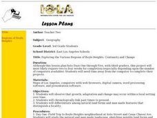
Exploring the Various Regions of Boyle Heights: Continuity and Change
Student study the local landscape of Boyle Heights, California and draw a sketch of the area. Students use map making skills in this activity. Studient make a portfolio of information and photographs they accumulate over time on the area.
Curated OER
Make Your Own "Weather" Map
Students create their own "weather" map using data from x-ray sources. They analyze and discuss why it is important to organize data in a fashion in which is easy to read. They compare and contrast different x-ray sources using a stellar...
Curated OER
Math: a World of Symmetry
Students expand their knowledge of quadrilaterals and identify basic symmetrical forms. Over three weeks, they explore the math, application, and discussion of symmetry. After conducting Internet research, students create symmetrical...
Curated OER
Making a Region Map of a State
Fourth graders create salt maps of a state and indicate its regions. They include topographical elements including mountains, valleys, lowlands and major water bodies and a compass rose.
Curated OER
Draw A Coastline
Students identify, locate and draw at least ten different geographical features on a map. Using the map, they must make it to scale and include their own legend and compass rose. They share their map with the class and answer questions.
Curated OER
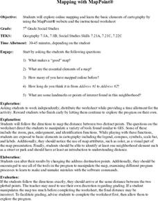
Mapping With MapPoint
The class is engaged through a discussion of mapping. They determine what they believe makes a good map and what the essential elements of a map are. Students work independently to complete a worksheet on mapping. They follow clear...
Curated OER
Navigating Your Community
Students draw a map from memory describing the route between their classroom and the gym including a legend, a compass rose, a map scale, symbols, and a landmark at every change of direction. They then retrace their steps in their maps...
Curated OER
Outdoor Education
Students participate in various outdoor activities to teach them about the environment. In this outdoor education lesson plan, students participate in activities such as compass direction, conservation, forestry, wildlife, and...
Curated OER
Weather Conditions During the Spring Monarch Migration
High schoolers keep a detailed record of weather patterns during the spring migration of the monarch butterfly. The use of weather reports is used to form a class data sheet. This lesson connects to the skills of graphing and critical...
Curated OER
Student Weather Journal
Students recognize different types of cloud patterns and associate these patterns with certain types of weather. They predict the weather for the next 6 to 24 hours. They then improve their observation skills as they check on the weather...
Curated OER
Exploration Activities
Students examine the stages in finding, removing, and processing mineral resources. They participate in the "Exploration Hunt" and "Leasing Mineral Rights" activities to better get a handle on their studying.
Curated OER
The Importance of Trade Routes
In this cultural diffusion study guide worksheet, students read a brief overview pertaining to the significance of trade routes and then respond to a reflection question.
Curated OER
Wilderness Training
Students explore how to prepare for a wilderness journey. In this wilderness survival lesson, students construct a compass from a magnet and a sewing needle.
Curated OER
Cartography
Students research about cartography and how to be a cartographer. In this math lesson, students draw a map of their classroom. They use a robot to explore navigation using a compass rose.
Curated OER
Chart Interpretation
Learners study the use of a nautical chart and how to obtain information from it. They describe and differentiate the basic topographic characteristics of a chart and demonstrate the use of nautical tools used to plot fixed points on a...
Curated OER
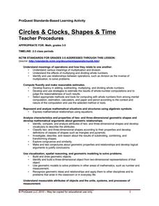
Circles and Clocks, Shapes and Time
Students work in groups to research clocks and practice telling time. In this telling time instructional activity, students use the computer program ProQuest to study circles, including radius and diameter, and practice drawing circles...
Curated OER
Orientation of the Earth in Space
Students hypothesize the location of the sun in the sky at diferent times of day and at different latitudes. They perform several experiments to provide evidence for their hypothesis. Experiments including observing the sun's position at...
Curated OER
Pharaoh Mountain Hike: Investigating Adirondack Life Zones
Students hike a local mountain and examine its life zones. They measure various components at each zone and collect leaf litter at the sites. At the mountain top, students make descriptive observations and complete a handout about the...
EngageNY
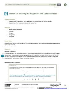
Dividing the King’s Foot into 12 Equal Pieces
Apply, apply, apply! A measurement lesson applies a number of concepts to help learn a new construction. Scholars learn to divide a segment into n equal parts using a method that uses the Side Splitter Theorem and a method that...
EngageNY
Points of Concurrencies
You say that perpendicular bisectors intersect at a point? I concur! Learners investigate points of concurrencies, specifically, circumcenters and incenters, by constructing perpendicular and angle bisectors of various triangles.
Curated OER
Understanding Symmetry Through Visual Art
Have your class explore symmetry, radial balance and fractional parts in natural and man-made objects in their environment. Learners list examples and identify symmetrical and asymmetrical designs. Pupils are given a box of crayons and...
Curated OER
Exploring Geometric Figures
Tenth graders explore mathematics by participating in hands-on daily activities. Learners identify a list of different shapes and classify them by shape, size, sides and vertices. They utilize tangrams and geometric pieces to gain...
Texas State University
Earth: Deposition and Lithification
Geology geniuses analyze sediment samples with a hand lens and sort according to physical characteristics. They also learn about the processes of cementation, compaction, and lithification within the rock cycle. The lesson plan is...
Other popular searches
- Compass Skills Worksheets
- Compass Skills 3rd Grade
- Compass Skills First Grade
- Compass Skills Elementary
- Map and Compass Skills
- Compass Skills Lesson Plans
- Map Compass Skills
- Math Compass Skills
- Tecahing Compass Skills
- Decaying Compass Skills
- Compass Skills Yr 10
- Math Compass Skills Triangle


