DocsTeach
Analyzing a Map of the Louisiana Purchase
With the stroke of a pen, Thomas Jefferson roughly doubled the size of the United States. The Louisiana Purchase not only grew the new country, but also it gave rise to the legends surrounding westward expansion and accelerated the...
Curated OER
Me on the Map Lesson 1
Students use maps, globes, geographic information systems and other
sources of information to analyze the nature of places at a variety of scales. They identify on a map and determine the population
of the city, county, state, country...
Curated OER
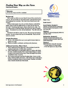
Finding Your Way on the Farm
Third graders make a grid map. For this directionality lesson, 3rd graders review how to use a grid to locate objects or places on a map. Students draw a grid map of the classroom and locate seating assignments. Students create a grid of...
Advocates for Human Rights
A Global Perspective on Immigration
To gain a global perspective on immigration, groups investigate and create a map of the migration patterns in Africa, Asia, Europe, Latin America, and the Middle East. Class members then examine the background, immigration history, and...
NASA
Outline Maps
Don't miss this gold mine of blank maps for your next geography lesson! Regions include traditional continents such as Asia, Europe, and Africa, as well as other major world areas such as the Pacific Rim and the Middle East.
Curated OER
Cities and Countries Around the World
Briefly introduce your young Spanish speakers to different cities around the world. Identify the country they are located in, what the people are called from those countries, and the country's location on a class map. Make sure to use...
Curated OER
Finding Your Spot in The World; Geography, Maps, Multi-Culturalism
Students use a variety of maps to locate their home, their school and the origin of their ancestors.
Freecloud Design
Stack the Countries™
This resource does an excellent job of engaging and educating people on world geography. It includes informational flashcards as well as games. Though the graphics are designed for elementary players, people of all ages will have fun...
Curated OER
Basic Mapping Skills
Establish and study the parts of a map with your class and, then they will work in small groups to create their own detailed map, including a legend. There are specific instructions to follow on what needs to be included.
Civil War Trust
Map the Civil War
Mapmaking was a very important element in successfully planning attacks on enemies during the Civil War. Guide pupils through the process of pacing to find the average length of their steps, measure the distance between one object to the...
Curated OER
If You Were a Pioneer on the Oregon Trail
Students examine what it was like to travel west on the Oregon Trail. They develop a list of questions about the trip, explore various websites, and create a story about the experiences of a 19th century family travelling on the Oregon...
CK-12 Foundation
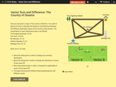
Vector Sum and Difference: The Country of Dreams
Find your way around using vectors. Scholars use an interactive to learn about vector addition. They answer a set of questions about modeling a route on a map using vectors.
Curated OER
Music to Learn Countries and Capitals Around the World: Learning Countries and Capitals in Asia
Students use musicto explore the countries and capitals of Asia.
Curated OER
Put the Mountains on the Map
Pupils discuss what they know about the regions where snow leopards live. They observe the worksheets to see if they can identify any of the mountain ranges and then use atlases to check and complete the country identification worksheet.
Curated OER
Orienteering - Lesson 1 - Maps & Map Scales
Lesson 1 of 10 lessons in this orienteering unit is about maps and map scales. After all, orienteering is all about maps, compasses, and finding ones' way around. It is imperative to be able to read maps and understand the relevance of...
Curated OER
Just Draw Me a Map!!!!
Middle schoolers draw a map to give directions to someone rather then give them too many relative locations.
Curated OER
Countries of the World
Students identify countries on a world map. In this map skills lesson, students define the word "country" and use post-it notes to locate several countries on a world map.
Curated OER
Comparing Countries
Students compare facts about different countries. For this comparing lesson, students collect information about the US and another country and compare them. Students locate countries on the map and make a hypothesis about the lives of...
Curated OER
Map the Civil War
Students explore the Civil War through original maps. In this mapping lesson, students calculate distance and show it on an original map. Students examine the type of landscape and its landmarks and draw symbols on the map.
Curated OER
Map Quiz 1
In this map quiz 1 worksheet, students answer questions relating to geography, not interactively, then scroll down to see the answers.
MENSA Education & Research Foundation
Connecting Africa: A Project-Based Learning Adventure
Mission Possible: Your task is to design a new highway route from Tunis, Tunisia to Cape Town, South Africa. If you accept the challenge, you must create a small map of the route that has already been rejected, a rationale for rejection...
Curated OER
Identifying, Mapping, and Personifying Countries Involved in WWII
Get artsy with this WWII group activity, starting with a whole-class assignment. Create a map of Europe, Northern Africa, and the Pacific using geometric shapes cut from construction paper and placed on the floor. Consider splitting the...
Curated OER
Geographic Regions and Backyard Geology with the USGS Tapestry Map
A beautiful tapestry map of North America is examined by geology masters. The map incorporates the topography and geology of different regions. You can purchase printed copies or a large poster of the map, or if you have a computer lab...
Curated OER
East Asia Country Project
Get your young historians thinking about East Asian culture and history during this partner research project, in which they analyze a variety of East Asian aspects to prepare for a presentation. After an initial "what do we already know"...


